2002 Sierra Hikes
Taboose Pass to Bench Lake, July
Sierra High Route then Muro Blanco, Sept-Oct
This is a work in progress
Two Sierra Hikes in 2002
Taboose Pass to Bench Lake, July 2002
Loop through Cartridge Pass, Sept-Oct 2002
Taboose Pass to Bench Lake, July 2002
It is a five hour trip from home to the Lone Pine Ranger Station. I stopped by the Sawmill Pass trailhead to see if a loop would be possible. But, it is a ten mile hike back to Taboose; and it would be hot. Drove up to the Taboose trailhead in my Honda CRX. The road was designed for a car with more clearance; but it made it ok.
I hiked from about 1:30 to 6 PM then set my tent up in a flat area near a huge red cedar. There was thunder and lightning, and some rain, so I went down the hill a bit, not wishing to be close to the high point in the area. A bit later, a boy and his father (Peter and Randy) joined me in camp. He was an inspiration to me to take my grandkids hiking..which I did when they all turned seven years old.
In our conversation about the weather I mentioned that the thunderclap travels a mile in five seconds. Randy said he only remembered 330 m/sec. Now, as an undergraduate Physics major, I heard the speed expressed in metric units in the US ONLY in Physics class. "Wow", I said, "You must be a Physicist." He paused. Then said "I am."
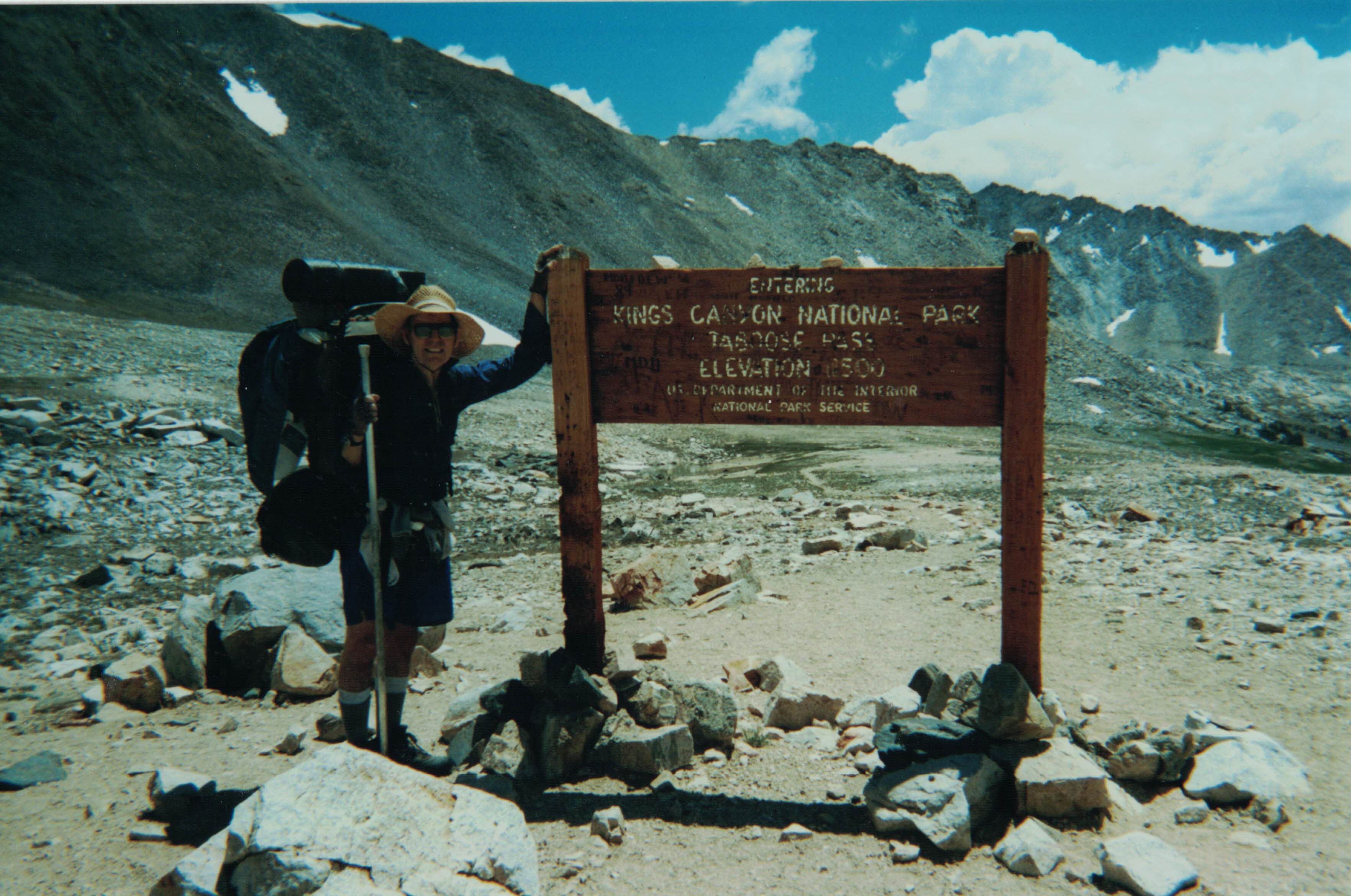
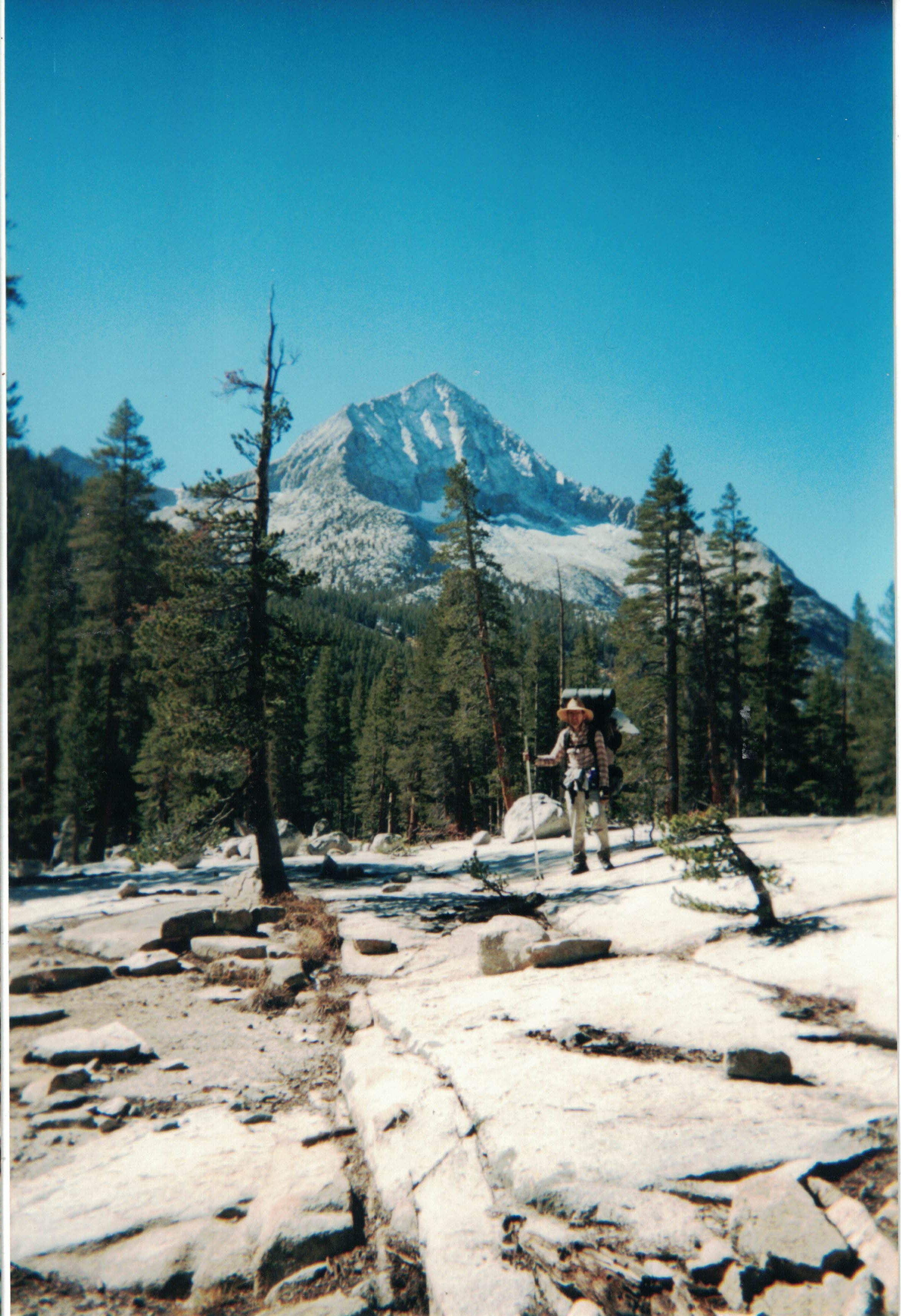
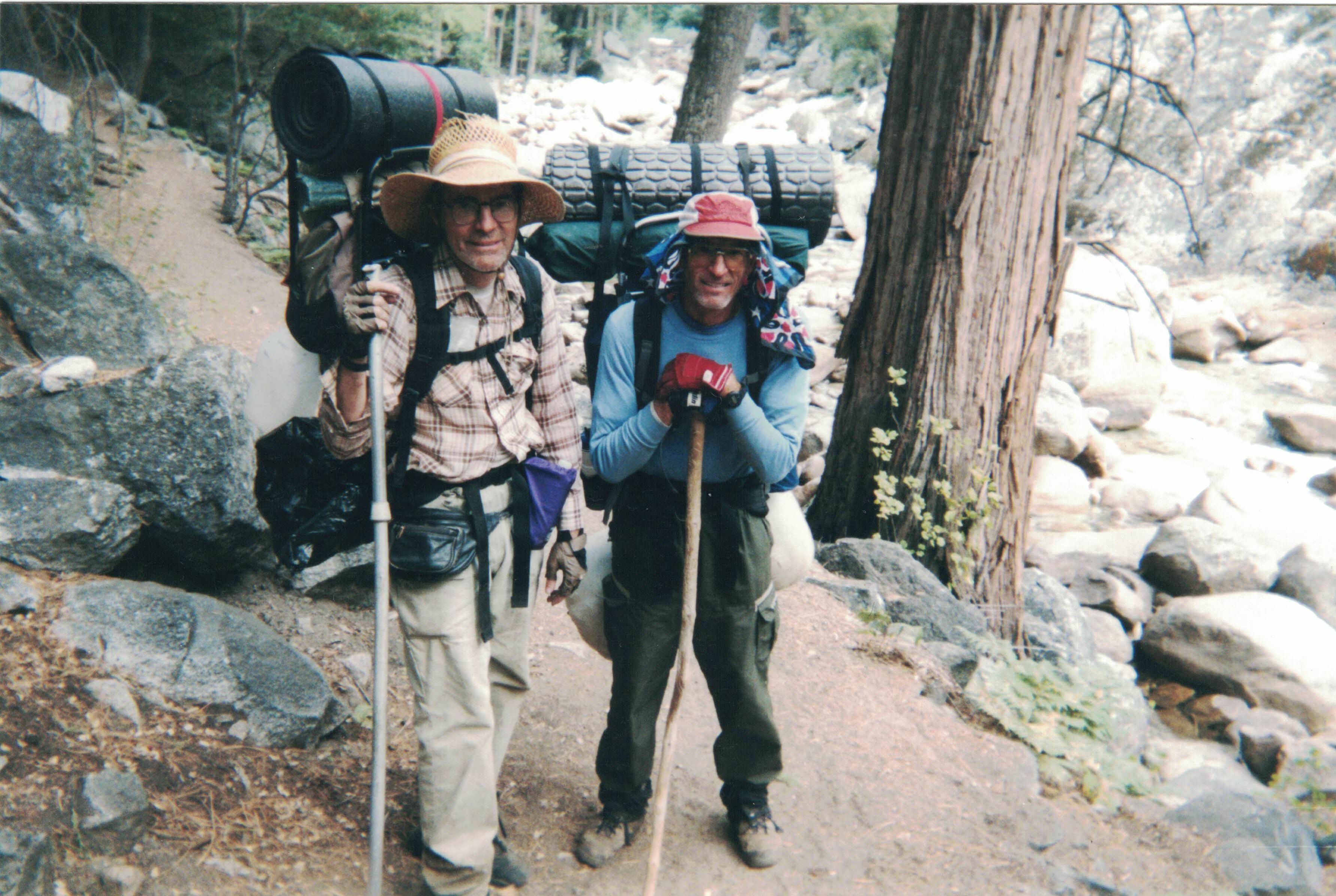
I started off at about 8:30AM and got to the pass at about 1:30. Peter and Randy had passed me on the way up, and they were starting back just as I crested. They were kind enough to walk back 50m to snap my picture (above) next to the sign
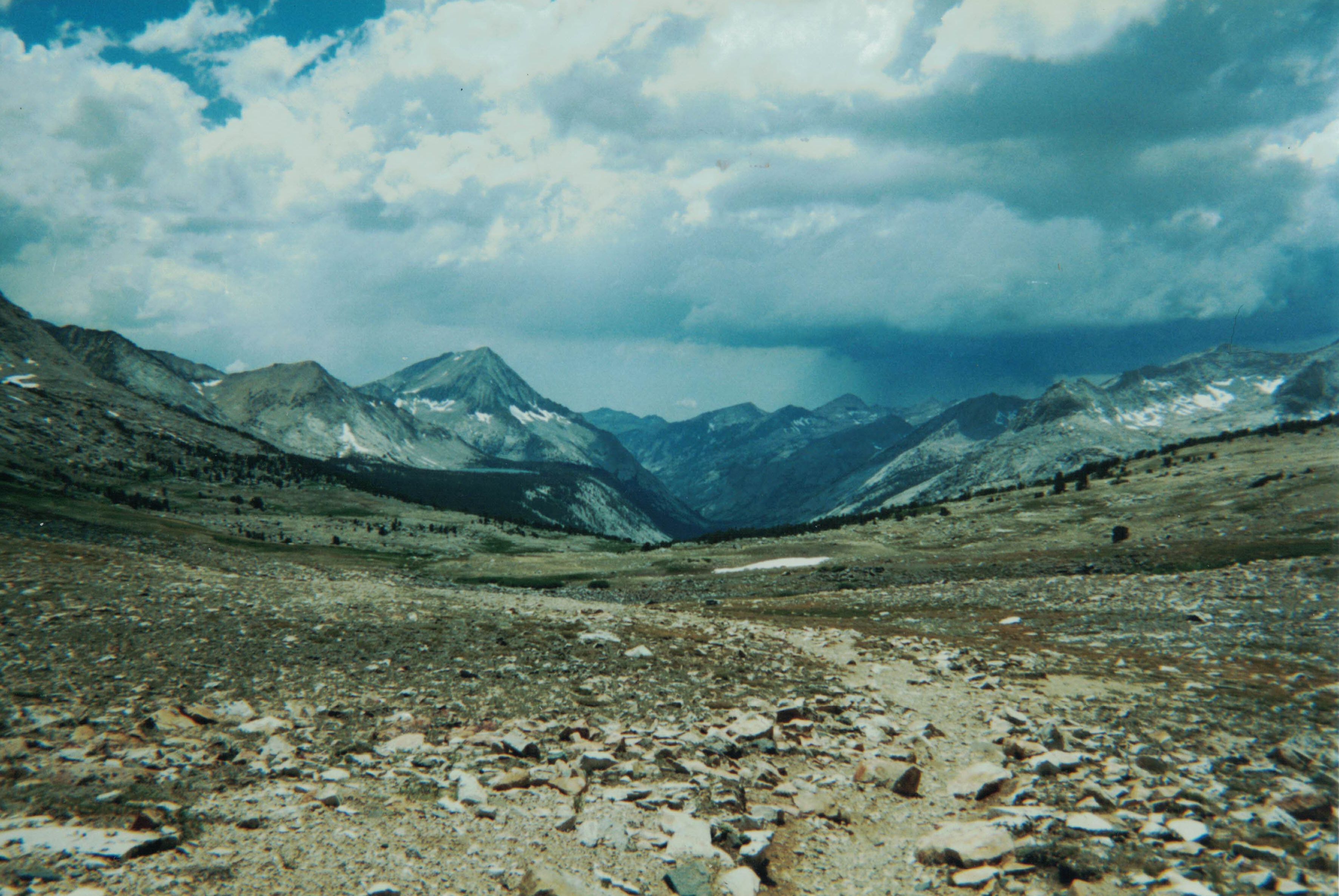
Just a bit down from the pass a remarkable view opens up. I didn't know it at the time but a few months later I would be hiking down the valley straight ahead.
As I continued on to Bench Lake the density of mosquitoes increased dramatically. There were so many mosquitoes that I rushed to put up my tent when I got to my campsite and jumped inside. Every time I went out, I let in three or four mosquitoes. I laid down and watched them till they landed on the sides of the tent, then squished them. A couple squirted blood (guess who's).
I started back at about 6 AM. I covered up as much as I could for mosquito protection. Got to the pass at about 9 AM, and down the mountain before 5 PM. Got home about 11PM. Hard to keep awake last two hours. Showered and in bed. AAhh
Bring soap, sunscreen, and DEET!
I had some difficulty getting water on my previous hike, so this time I brought along an empty half-gallon (~2l) milk jug. I have been carrying a gallon Water jug ever since.
Loop through Cartridge Pass, Sept-Oct 2002
I thought a lot about this trip before finally deciding on an introduction to Roper's Sierra High Route. A loop up to the Lake Basin and back would put us in the back country for most of the trip. Since it was late in the year, I had worries about the weather. I figgured that the absolute worst thing that could happen was for it to snow when we entered the Lake Basin. It could potentially block the passes, and was the point in our hike that was furthest from civilization. Well, it did snow. But it was light enough that we could easily get over Cartridge Pass. It made it exciting.
Got up early and drove up to Cedar Grove with Dale, arriving at about 12:30. We ate lunch and were on the Copper Creek trail at about 2 PM. With steady climbing we attained Lower Tent Meadow, our first campsite, at 5:30 PM.
So far we were on all trail. Even so, we saw only one group of trail workers. The park visitors thin out after Labor Day. These were the last people we would see for a week.
Started out at about 8:30 and got up to Upper Tent Meadow at about 11 AM. The views back are quite impressive from here. I spent some time picking out landmarks from our trip last year. We got to Grouse Lake just past noon. Heated up some lunch. I was still learning the daily process. Cooking mid-day slows one down, so in the future I turned to Hand Snacks for mid-day meals.
We restarted about 1:30 and were near the saddle between Grouse Lake and Granite Lake at about 2:30. Contouring from the saddle down over boulders was slow and hard. We were resting in the valley at about 3:30 and then at Goat Pass by 4:30. After a rest, we were down by Glacier Lake by 5:30 PM.
We were tired. This day turned out to be the one that had the most climbing, over 4000 feet. We found a sandy area near the lake to put up the tent.
This is the day I ran into some minor problems with navigation. I had brought a 1:100000 map instead of the 1:25000 topo maps. So, I missed some of the detail. The evening's campsite turned out to be a shallow mud hole with huge bugs swimming around in it. We boiled and boiled it. Yet only 600 meters away over clear level terrain was a beautiful clean blue lake. It didn't show up on the low res map. I started bringing topos with me after that.
We started out about 8:30. We were down in Glacier Valley by 10. The grass there is a sea of waving yellow this time of year. I also did not miss the mosquitoes. At the end of the valley we found a campsite that was well stocked with firewood. I think mule pack trains use it. We made State Lakes by 11:30 and left Horseshoe Lake at about 1:15 PM.
My compass navagation worked great. But the low resolution map again made it difficult to match my estimated position with the map. I had to pull out my GPS to get a fix. We arrived at the muddy tarn at the foot of the Windy Ridge peninsula at about 3 PM.
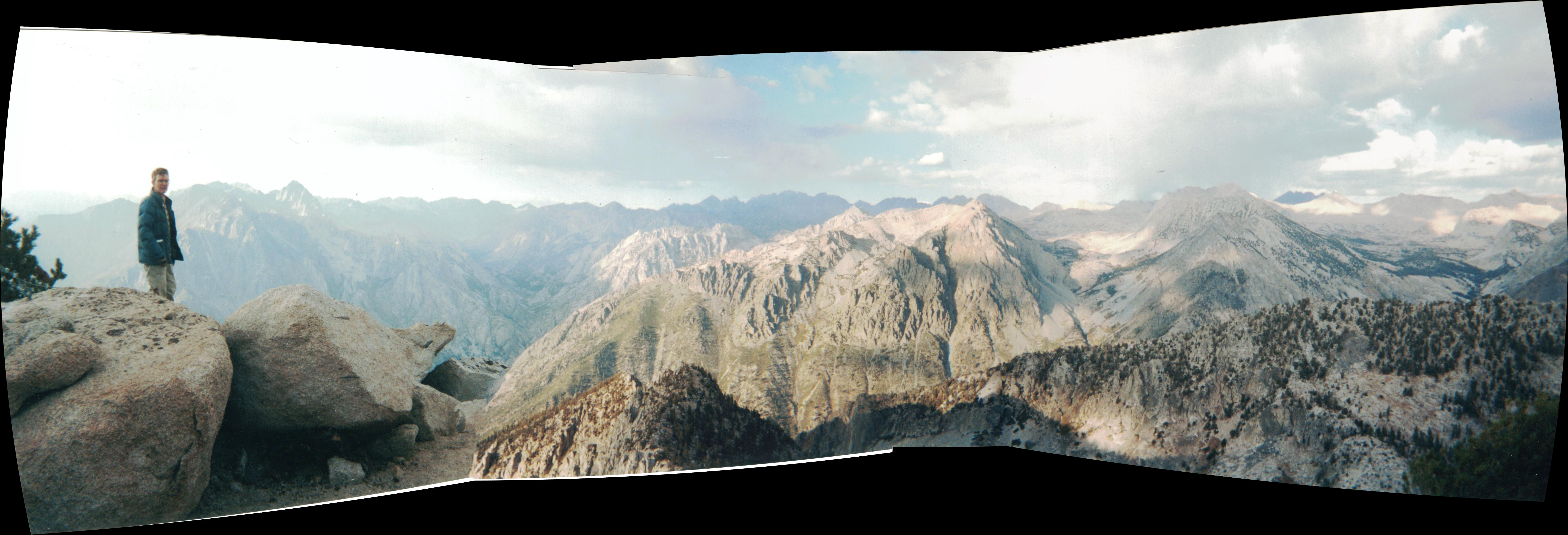
We had time for an excursion out on the ridge. It was Well worth it: the views were fantastic.
This day we went over three passes: Gray Pass, White Pass, and Red Pass, all named for the rock color. The water in the tarn froze overnight. Crunchy Ice in the mud near the lake. It froze in inch long pilars so when you stepped on them your foot fell to the side as the pilars toppled. Waited awhile for Dale to warm up. Had a candy bar for breakfast; did not want any more of that smelly brown water than I had to.
Started out just after 9 AM. We arrived high up one side of Gray Pass. It looked too steep to descend so I had to go up and down a bit to find the correct path. On the way down Dale found a Timex Expedition Watch with a broken wrist strap. It was still functional.
I was at White Pass at about 1:30 PM. It was getting cool and there were clouds on the horizon. Dale is a stronger hiker, so he was waiting for me for quite a while in the chilly breeze while I was working my way up. He needed to get going to warm up. Left about 2:00.
It was somewhat after 3 when we got to Red Pass. The sky was getting darker. At about 4:30 we were at the plateau above Marion Lake facing the prospect of going down the "Impossible" Chute. I had seen pictures of this chute in trip reports. It was verrrry steep. Dale let me go first. Scary, but it worked out just fine. I recall 'surfing' down one steep part squatting down on one foot while my other leg was straight out ahead.
Got down to the lake just before 5PM. It was a relief. Dale didn't want to do that again. Clouds started rolling in, and it was hailing when we got to a campsite near the outlet. Put up the tent and threw my pack in. I was a bit anxious, not ever having been out backpacking in real weather before. I was afraid of rain. It actually wasn't that bad. Dale was more nonchalant.
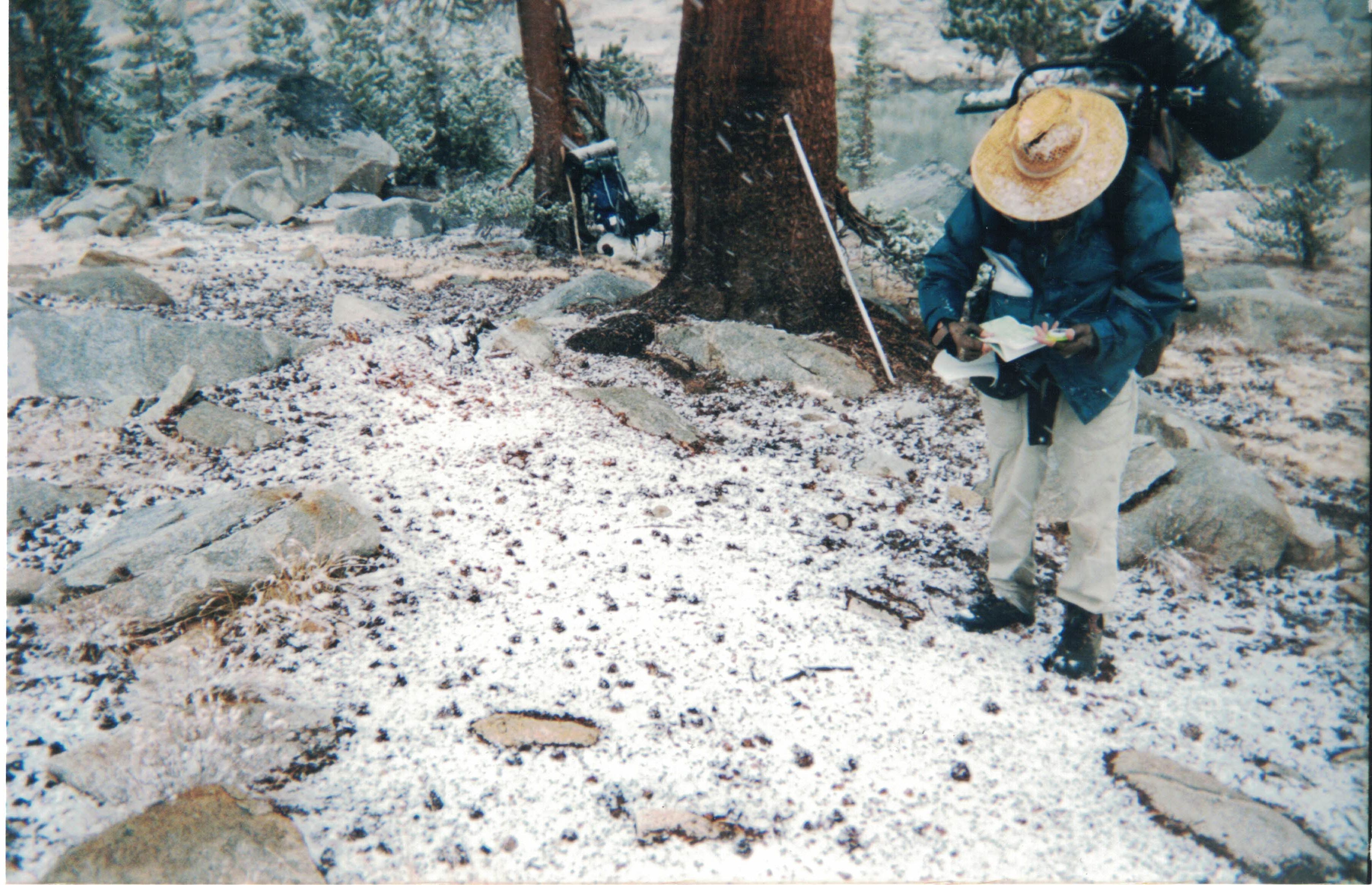
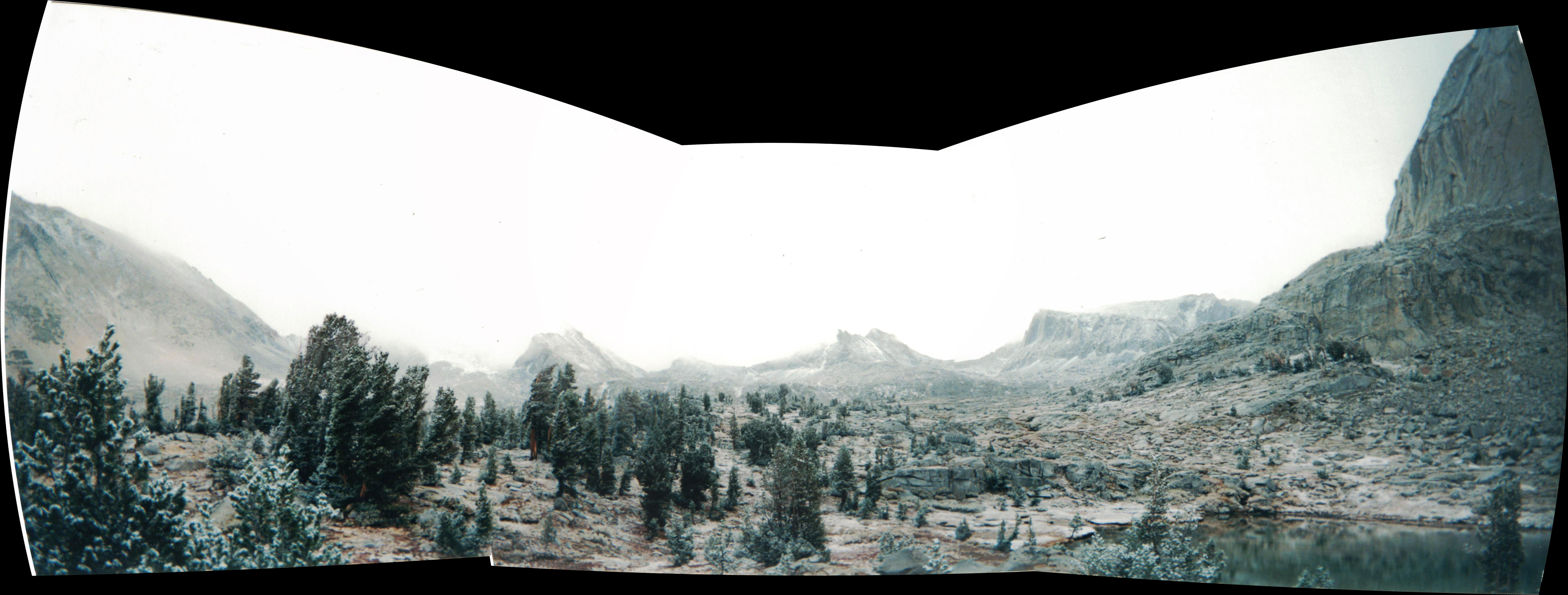
There was some rain at night, and snow clouds started coming in. We left at 8:30, navigating by compass through the fog. GPS didn't seem to work while it was snowing. Every once in a while we could see large dark mountain ghosts appearing through thinning fog. They were all around and featureless so they were difficult to distinguish one from the other. I relied on the compass. I was able to split the two small lakes about 2000 feet north east of Marion Lake. Kept going. Ran into lake 10592. There was a cliff all around it, so we weren't going to continue on that track. I posed for a picture in the falling snow with map and compass (see top).
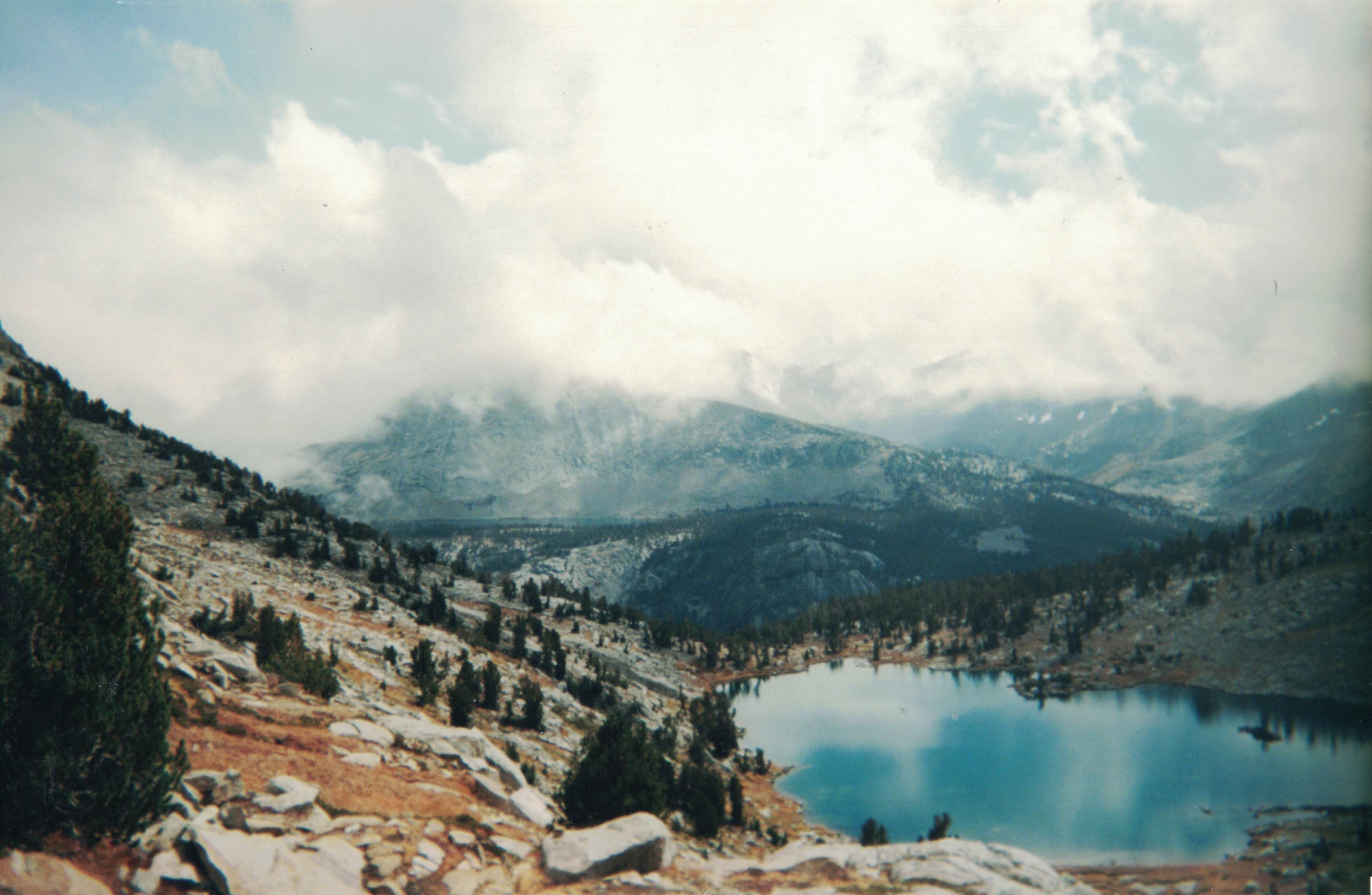
Dale suggested we try to follow the creek, so we did a 90 degree turn and ran into the thumb of 'L' lake (lake 10632). It was recognizable on the map so I pretty much knew the way from there. The fog started lifting, the snow stopped falling, and we could view the magnificent Lake Basin below.
There were two ways to go up: take the faint trail on the right, which is what Dale did, or go up the rock chute to the left, which is what I did. Dale made the better choice. Some of the boulders in the chute rocked as I stepped on them. I got out of the chute about 2/3 the way up.
Got to the pass at 12:45 after an hour of climbing. Dale was waiting for me for about 10 minutes. It was sunny when he got there, but began to cloud up, then snow. Started getting cold fast. Snowflakes were zipping by horizontally when we started down. Followed the trail, it goes off to the right, climbs just slightly before going down. At 1:50 we rested at the lowest lake.
Started down. It is a very steep 1400 foot (425m) drop to the river. Dale flew down; it was hard on my knees trying to keep up. Glad to get down at about 3:00 PM. Wandered a bit, found a campsite near the water. Adjusted the stones for cooking. Warm fire, but it snowed that night. We tried to arrange coals, wood and rocks to last through the night; but no luck.
Tent sides were frozen in the morning from the condensation. Couldn't start the fire; wood was too damp; so I waited for Dale to get up to try. The top of my Bear Barrel was frozen. I scraped off the ice with my knife, then heated the lid over the propane burner. The scraping left a scratch on the lid which serves as a reminder to turn the Bear Barrel on its side overnight so any rain water runs off.
Birthday Party
Got out balloons, ribbon, candle, and cake. Sang happy birthday to Dale. Toasted his birthday with a sip of Tequilla each. Not enough alcohol to help start the fire. Lit the burner in the tent for a few minutes. Nice, but I melted the back of my coat, so feathers started coming out. Dale burnt my sox trying to dry them near the fire. Something to tease him about for the next year.Spent a lot of time drying out in the morning so we got a late 10:45 start. Going up by Arrow Peak seemed too ambitious so we decided to go down Muro Blanco.
Then the progress got verrry difficult. We would find a trail only to have it peeter out after 100 feet. The twisty aspens were designed to trip you. The talus is slow going. Sometimes along the river you could make better time because the rocks were smaller. But I stepped in a lot of water, my feet seemed always wet. Could feel the squish within my boots. At about 4 Dale suggest that we stop for the night. He had found a miserable campsite; might have been able to fit the tent on it. I could see down the valley to where it flattened out a bit, so I suggested we pushed on. We did, and at 4:45 we had several good campsites to choose from at 8300 feet (half way between the 8400 and 8200 contours on the topo). It was a bit windy, but the dry cedar flakes made good kindling. Dale built a fine furnace. Viewed some stars with my star chart, but the canyon was too narrow, and it was too cold to stay away from the fire for very long. I pointed out the Summer Triangle: Cross, Vega, and Altair ( Virgin at the altar with a crucifix ). We huddled by the fire. I think it was 10 when we went to bed. Late. The wind helped dry our stuff out. I got dry sox for the first time in 2 days.
Dry! 9:50 start. More bushwacking, boulder hopping. It may have taken as much energy; but mentally it was easier. We were going downhill, no frozen passes to worry about, and any reasonable effort would get us back to civilization.
At about 3 PM we suddenly burst out upon a campsite with a bear box! What luxury. At that time there was no bridge across the river, so both Dale and I ventured across the wooden log bridge. A bridge was later built...only to be washed away. It lasted about fifteen years. Found out we were in Upper Paradise Valley campsite. 6 sites. I was expecting to see other hikers; but we were alone. Some of the fire pits had lots of needles: hadn't been used for awhile. Pretty to wander through. And there were trails! No more bushwhacking. 10 miles to the trailhead. Stayed up late.
We started hiking about 8:30, didn't have to wait for our stuff to dry out. At about 9:20 we got to Middle Paradise Valley campsites, with Toiletts! At about 11 AM, just after passing Mist Falls, we met a couple, the first people we had seen in a week. We had them take our picture.
We got to Road's End at noon. Everything was closed for the season in Cedar Grove, but we did manage to wash up in an open restroom. There was a light snow and I was a bit worried about getting stuck in the park without chains. We drove down to Orange Cove and got a Burrito and coke from a small Mexican eatery. Didn't want to go through Los Angeles durring rush hour, so we stopped in Bakersfield for dinner. Home about 9 PM.
Afterthoughts
The primary goal was to hike in the backcountry where people didnt go much. Secondarily: to do something hard so we could brag about it. Complete success on those two points. Saw no-one for a week. Far beyond my expectations. In planning for this route, I estimated the most we could do in a day, but expected to do less. The first four campsites were all at the limit of my expectations. So it made coming back easier ( less stressful ). I had 1.5 days of food left. Total Miles is about 49.2 including side trip to Windy Ridge. Ok, 50 miles.
We both lost about 4-5 pounds (2kg). But, we weren't hungry. We could have used the hi-rez topos. They would have quickly resolved some trail questions.
Re-reading my trail notes I found this warning:
I emphasized part of the above because 17 years later I did have a hike-stopping event at that very place.
© 2020 Tom Judd.
www.juddzone.com
Carlsbad, CA
USA