2003 Sierra Hikes
Bishop Pass, Muir Hut, Black Giant, Sept
Shepherd Pass, Mt. Tyndall, Oct
Two Sierra Hikes in 2003
Bishop Pass, Black Giant, Sept 2003
Bishop Pass, Black Giant,Sept 2003
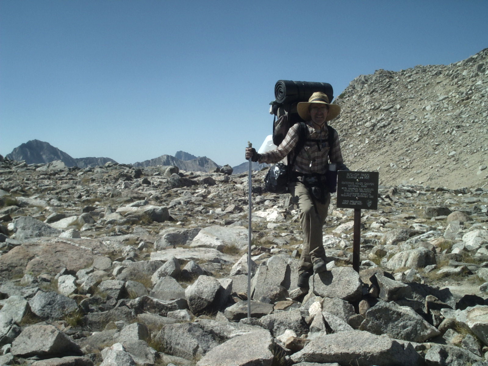
6-Sept-2003 Saturday
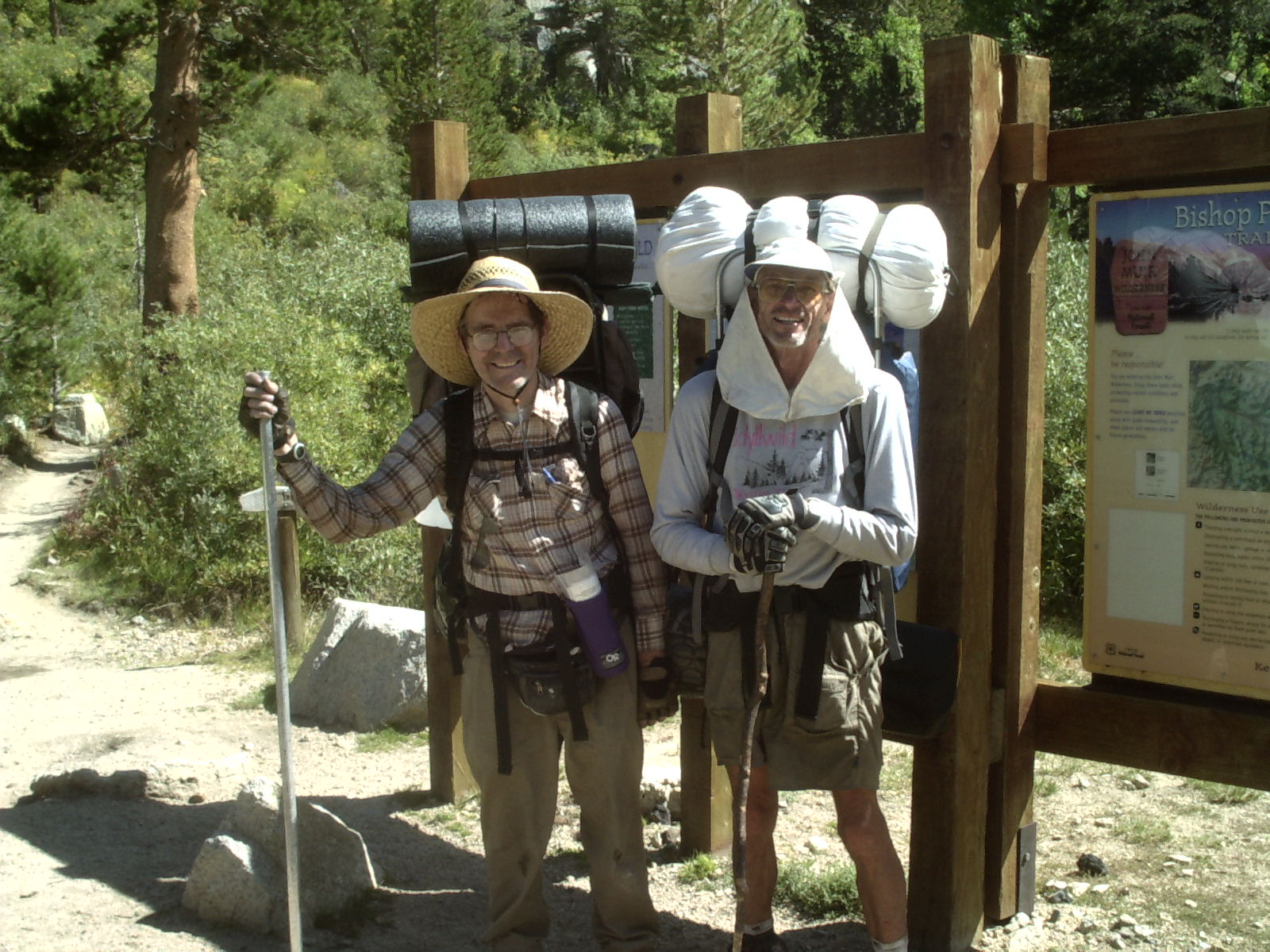
I wanted to hike in the full moon, this week was it. Going Saturday to the next Sunday meant I could get by with taking only a week off work and still get in a good hike. Left home with Dale about 5 AM, got permit in Lone Pine and started out from the South Lake trailhead at about 12:30 after a pizza lunch.
Able to get over Bishop Pass, stopped at the first good campsite about 6PM. I was exhausted. We were boiling our water, so I was able to tuck a warm bottle under my coat as I snuggled in my sleeping bag. I needed it.
7-Sept-2003 Sunday
Super tired from yesterday's hike, my legs didn't have any oomph. Started off about 9 AM and were by the stock fence near the bottom around 1 PM talking to Ranger Bob. We told him we had planned to go down the Enchanted Gorge. "Why would you want to go THERE ??!!." He was not encouraging. He told Dale there was a man-eating 'Man-za-neeta' there; which made Dale's eyes widen as big as saucers. Dale suggested that it couldn't be as bad as Muro Blanco. We had struggled down Muro Blanco last year. At that point, Ranger Bob administered the coop di grace: "Muro Blanco was a cakewalk!" We decided not to go down the EG.
We struggled uphill for a bit then stopped early in Big Pete Meadow. In bed by 6:30 and slept the night.
8-Sept-2003 Monday
Up at 6, left about 8:45 AM. Hiked. About 2 PM we were in the gorge just below Lake Helen when we met a mule train. Let it go by. It was followed by a trio, two of whom were a couple in their eighties. The woman was slightly stooped, perhaps with osteoperosis. He was carrying a walkie-talkie. I wish I had taken their picture. I hope I can hike in the Sierras when I am 80.
We found a small secluded lake to the south east of lake Helen at about 2:40. We were planning a hike up Black Giant tomorrow, so this was a good spot to stop for the night.
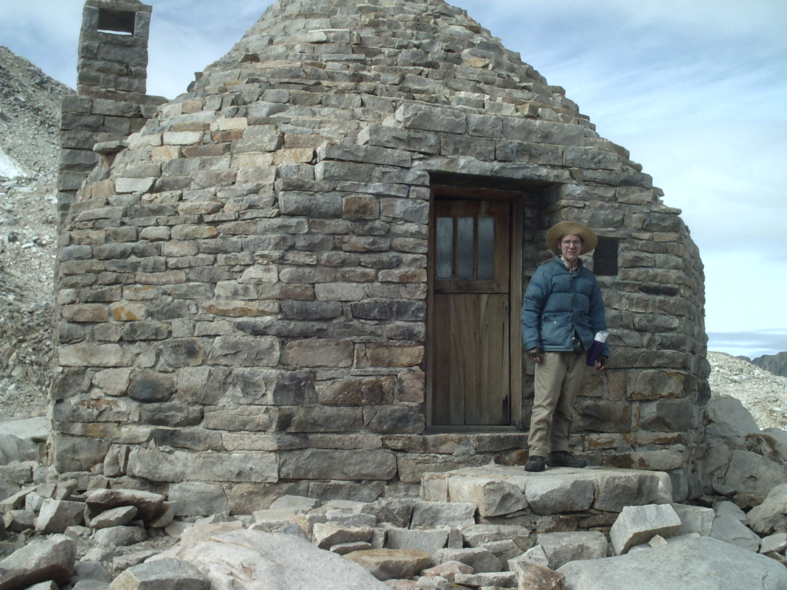
Muir Hut & Black Giant
9-Sept-2003 Tuesday
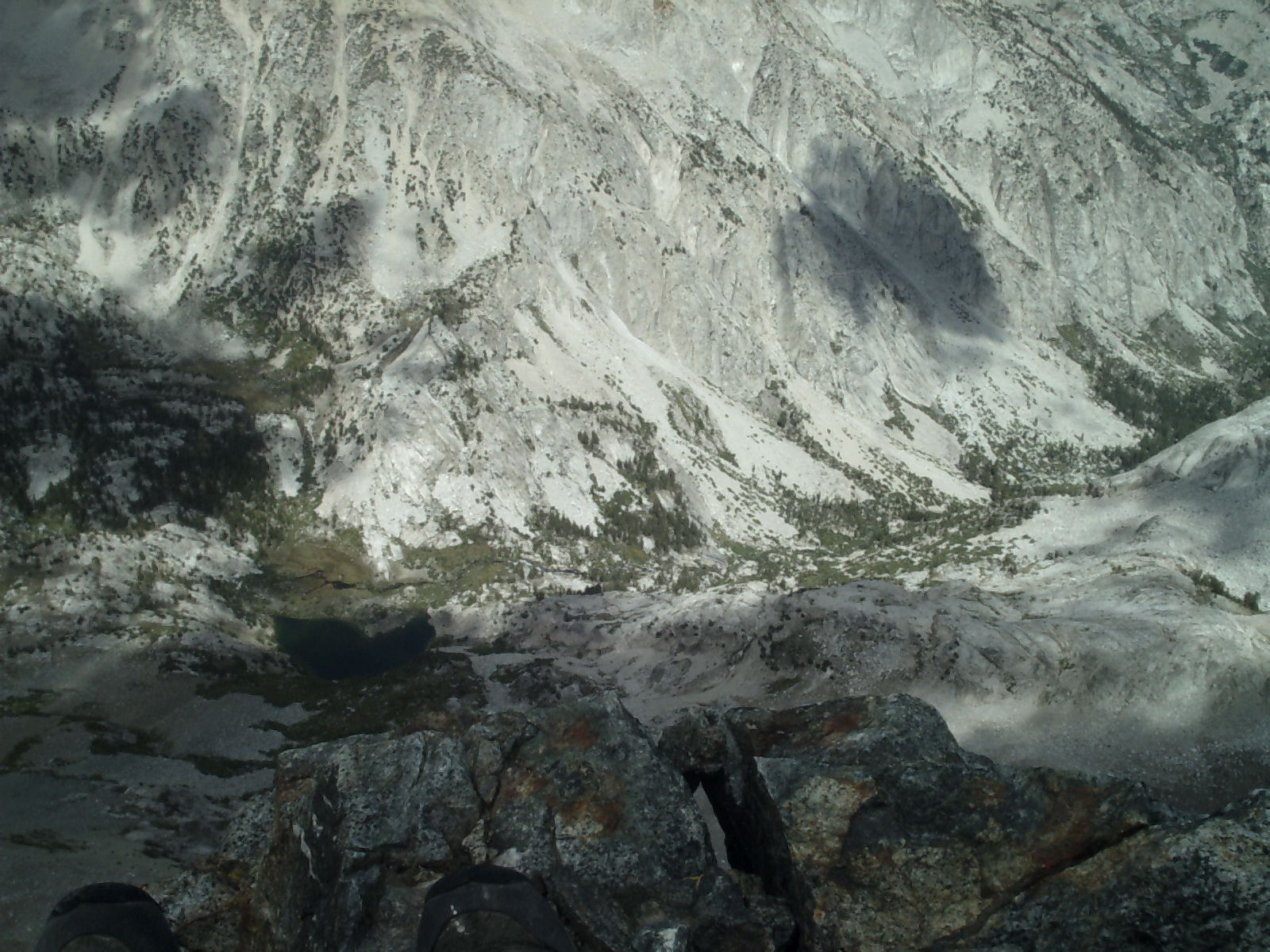
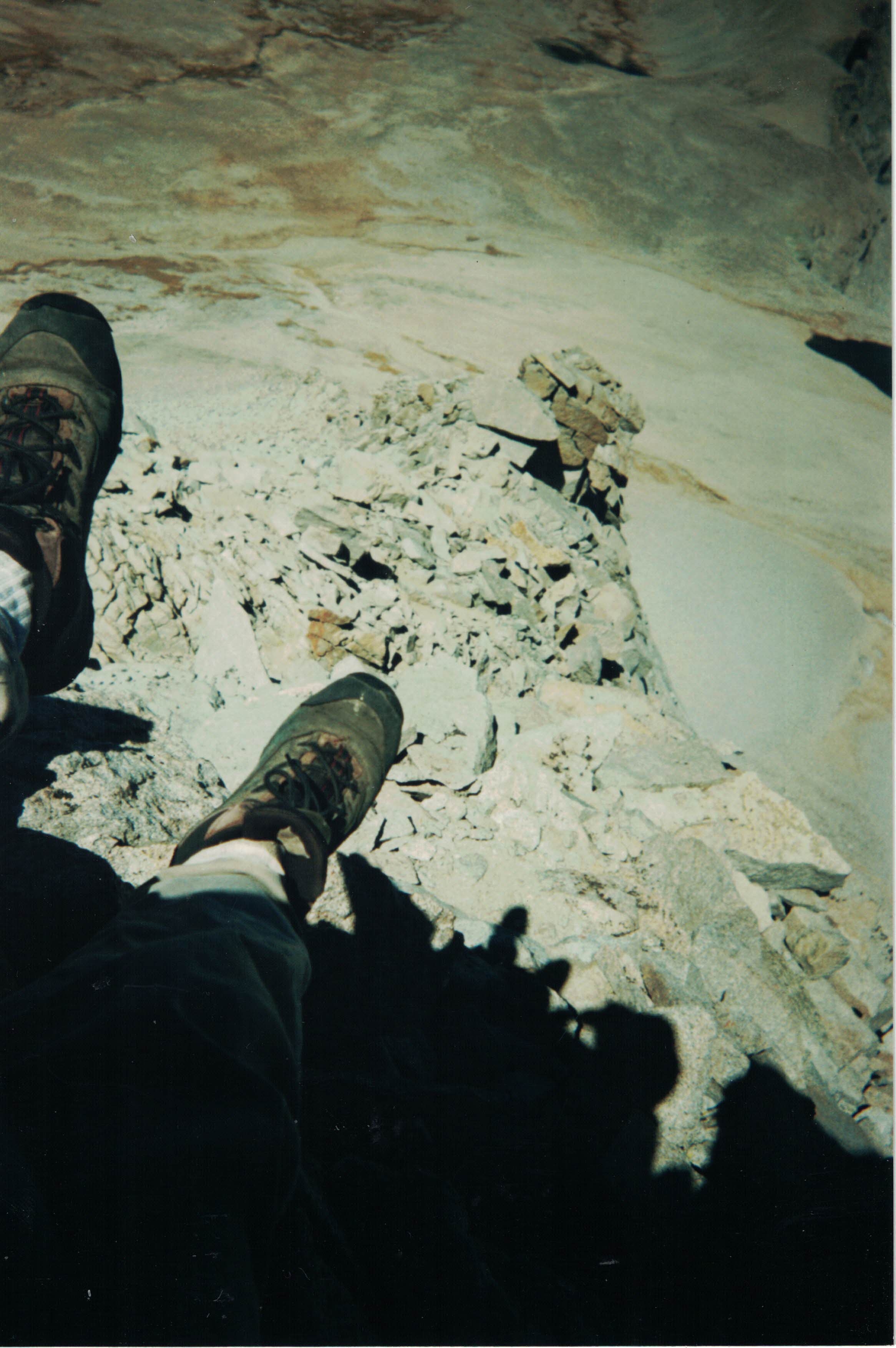
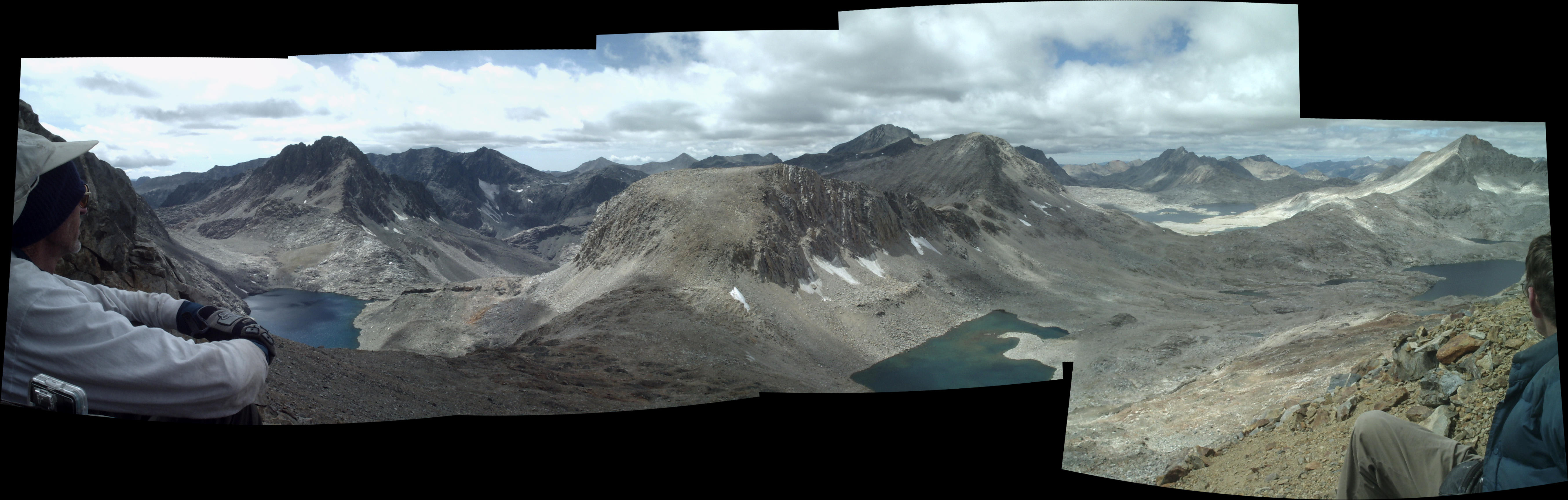
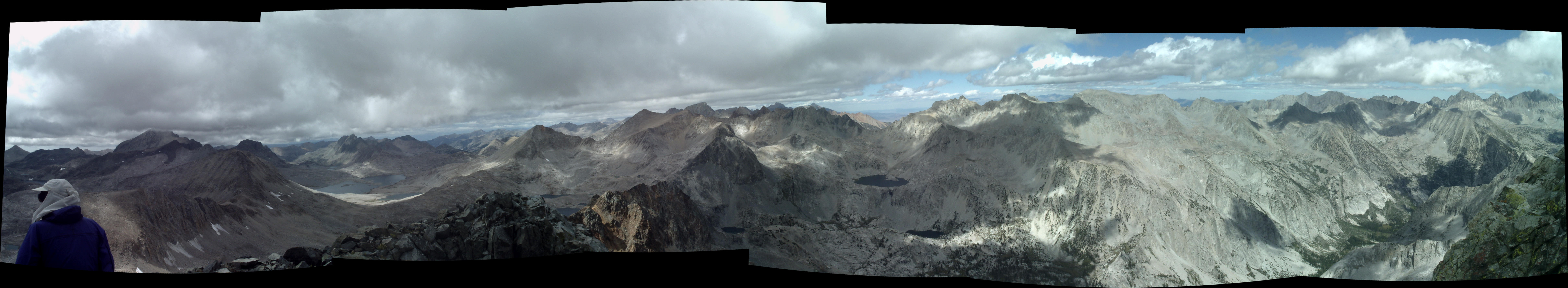
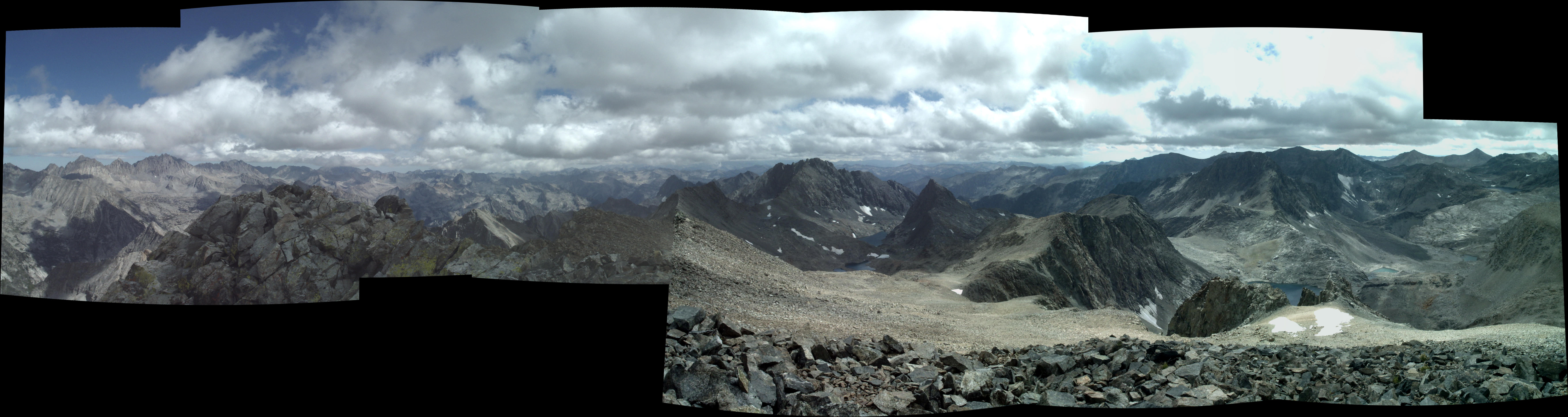
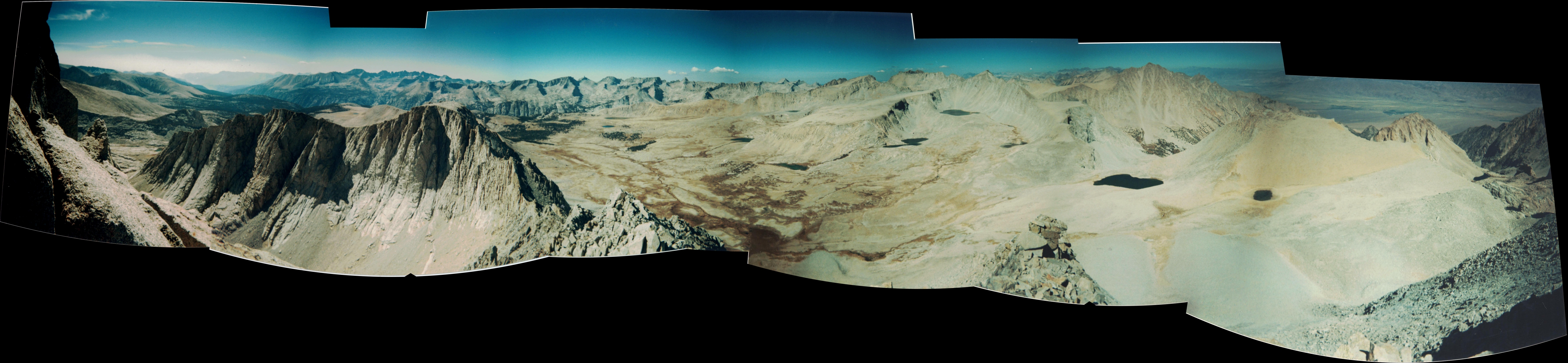
Next day we hiked up first to the Muir Hut, a landmark on the PCT. Got there about 10 AM. It is a busy place. Dale enjoyed talking to all the passing hikers. We left before 11, were down at our camp and started up Black Giant about 11:30. Got to the top about 2 PM. The views were wonderful. The first panorama below is looking north, the second south.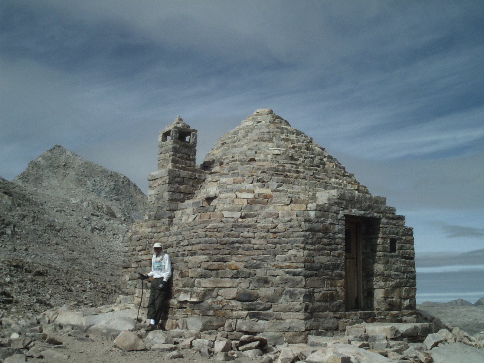
Tuesday Evening Sky Show
It was a very satisfying climb. Got back to the tent a little after four in the afternoon. It had started sprinkling briefly, and I got a bit worried. But nothing came of it. The wind and cold were a bit much for me; so I rested in the tent while Dale cooked noodles for dinner. He used lighter fluid to start his solid fuel and some got on my sleeping pad he was using for a wind screen. It melted some in the flame. Recall he burnt my sox last year. He was gaining a reputation.
The sky that night put on a memorable show. The sky was dark, but had enough light to outline Black Giant which was inpenetrably black. First Mars, which was at its nearest for some 60,000 years, peeked over Black Giant. Looked like a jewel. The moon was coming up shortly, but had not yet shown its face. Black giant had some wispy clouds that were boiling over towards us from east to west, but which got blown back over on themselves when they were at the crest. No other clouds were in the sky. They were backlit by the moon. So BG had a halo, a wispy etherial veil with an orange red jewel in it. Looked like a black witch with soft white hair decorated with a magic ruby. A unique and curious sight. Later on, when the moon had risen, ( it was nearly full ) it brightened all the mountains around us. The sky being black, it looked like an Ansel Adams black and white photo.
10-Sept-2003 Wednesday
Going into the Ionian Basin had been crossed off our list. We wanted something easier so we set out for Grouse Meadow, about 10 miles downhill. We had thoughts of going up Glacier Creek and mentioned it to Ranger Bob whom we passed on the way down. He recommended staying to the left. We also met a couple who had just come down Glacier Creek (and injured a knee in the process). Got to Grouse Meadow about 3:30. Nice campsite but about 70 paces to water.
11-Sept-2003 Thursday
This campsite is on the JMT and so gets lots of use. So, it was not surprising that in looking for a private place I uncovered a rock with toilet paper and maggots crawling through sepia fecal matter. I washed my hands long and hard.
We changed plans again, looking for something easier. We decided on a climb up the Ladder Lake drainage. I had a lot of trouble crossing the stream; still learning how to hike. I ended up with squishy boots for the rest of the day. We didn't get all the way up, but it was fun exploring.
Across the stream we were alone. It is so busy on the JMT, so the contrast was noticable. It's like we had one whole side of the river to ourselves. We climbed up aways then dropped our packs and continued on up to the lip. It was quite pleasant sitting in the trees near the creek. Dale amused himself by feeding ants to the fish. I pulled my boots off and looked at my feet. They were all wrinkly from the wet boots. To be safe we decided to end the hike. At the bottom we fixed ourselves some cocoa. Dale found a place to get over the stream. We hiked till we got to the trail up to Dusy Basin. Stayed at the campsite near the start of the climb.
12-Sept-2003 Friday
No rush, we did an easy hike today. Up about 2000 feet to a campsite near Knapsack Pass by 2 PM. Did sightseeing. Hiked over to the pass. Maybe some day... Mars and Stars and a Meteor at night.
13-Sept-2003 Saturday
Ready to go home. Hiking by 9, up to the pass just after 11.
We had some cocoa at the pass then hurried down. Passed a dead mule on the switchbacks. It was on its back with its feet in the air. I had seen some small splotch of blood, then a bigger splotch on the trail above the carcas. At the trailhead we met a group of people as we came out. They were in awe of us: real mountain men! We gave them glowing accounts of our travels, their eyes widened. Dale is good at that. I'm sure our grizzled look helped with the aura. Had one of them take our picture.
Traded off driving on the way back. Got home late. In bed by midnight. Day of rest before return to work on Monday.
AfterThoughts
This was my third year hiking in the sierras and I was still learning. I brought my pulse oximeter with me on this trip and took readings every night. In subsequent trips I would take them morning and evening. Morning readings seem to be more reliable. I brought a pound of butter along, and ate all of it. My food thoughts have evolved but the basics have been remarkably consistent through the years.
This is the first year that I observed a curious phenomenon with my weight. I noticed that I would still be close to my starting weight at the end of the hike. I would stay the same or lose just a little. But if I weighed myself a few days later I would be three or four pounds lighter. It turns out that this is a known phenomenon. See my comments on High Altitude Water Retention
Shepherd Pass, Mt. Tyndall, Oct 2003
I had originally planned to do Sierra hikes in August and September. But work got a bit hectic, so I delayed this one until October. It is colder in October, so I bought a bivy sack to add an extra sleeping layer. I also experimented with some aluminum foil. I was going to try to line the tent/bivy with it in hopes that it would help reflect back heat. It didn't work out, but I used the foil for the next ten years for a windscreen. I was cooking all my meals and boiling all my water so I took a more than a pound of fuel.
I was a bit rushed, so ended up just throwing the food components into separate bags and planned to mix them up on the trail. I brought cooking oil instead of butter on this trip. Didn't use it, it made me nauseous. At the last minute I added a paper towel for each day. I remembered how tough it was to keep things clean last month. I continue to bring paper towels on hikes for general purpose cleaning and as a toilet paper replacement.
I started hiking at about 1 PM on October 5; made it half way up to Shepherd Pass. The next day I made it over the pass and looped around to the small lake above Shepherd Lake. The altitude was about 12.4K feet, the highest I had camped. I woke up in the middle of the night worried about my heart rate. But, I had my pulse oximeter with me; and after taking a reading I found the heart rate in the expected range. You worry a bit more when hiking alone.
The third day, Oct 7, 2003, Tuesday, I climbed Mt. Tyndall. It was magnificent as suggested by the above panorama. I should mention that I did not get all the way to the top. The mountain has a flat ridge at the top; I got to the lower end of the ridge, 13.8 K feet. The other end is 200 feet higher. But, being alone, I was being cautious.
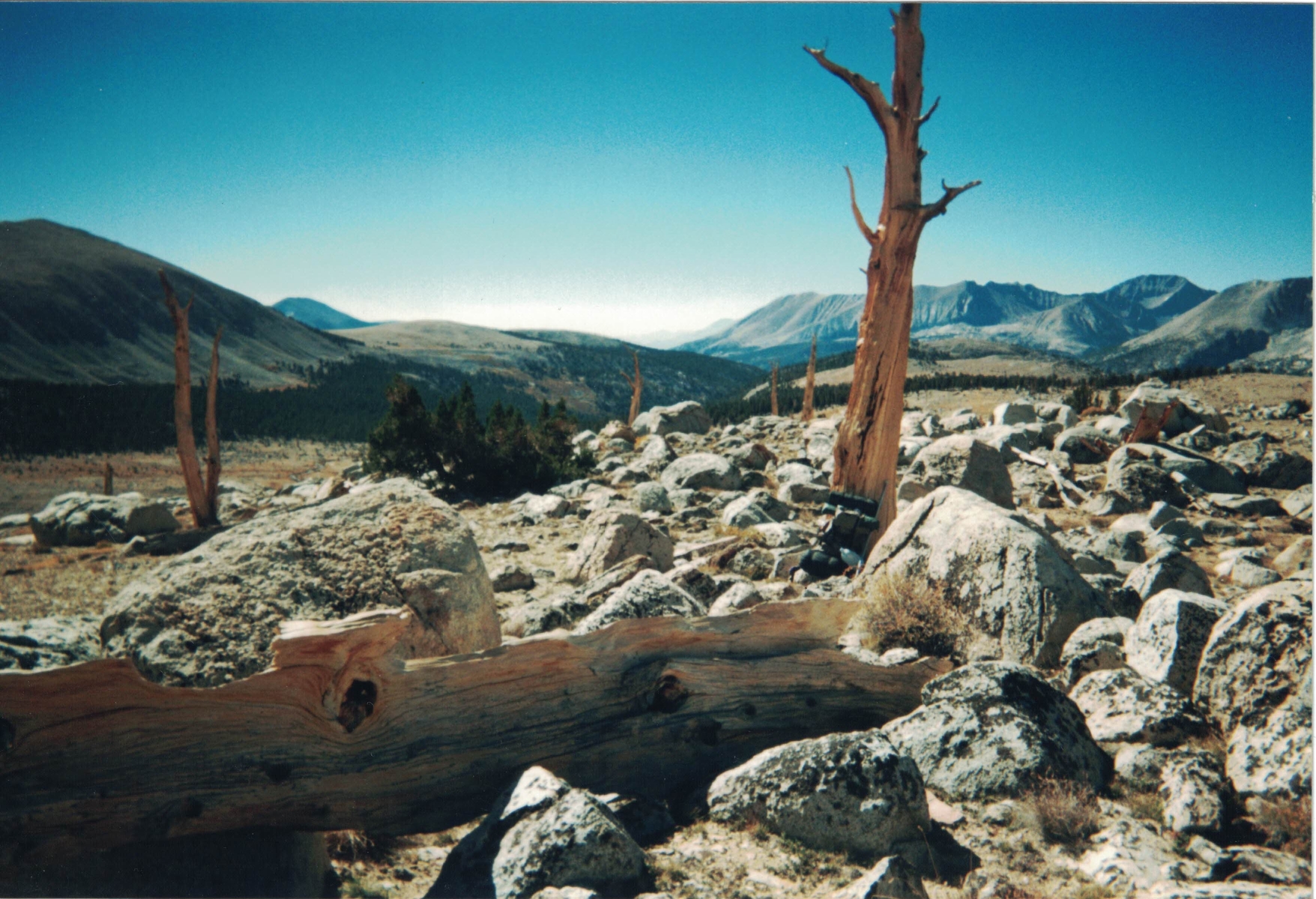
I had feet problems on this trip, so I again exercised some caution in reducing some of the more ambitious portions of this hike. I originally wanted to go over Harrison Pass, but settled for wandering on this side of the divide. I spent a second night at my high camp near Shepherd lake, then the next day, explored on the other side of the PCT. I was intrigued by the sight of a line of dead trees running south, parallel to the PCT. Made me think of telephone poles. I climbed the pass going to Lake South America, then went back down to settle into a campsite overlooking the view south. That night I was startled by a searchlight coming from between some peaks to the south east. In time, the light rose to become the liquid silver moon. The sky was so clear that there was no tinge of yellow on the face of the full moon.
The next day I went back over Shepherd pass and made my way to an abandoned campsite below Junction Peak. It was large enough to hold a boy scout convention. This used to be part of the PCT before the trail over Forester Pass was built. All the trails are now overgrown. There are still a scattering of fire rings that have been unused for fifty years. Got windy but not cold. Altitude is about 11.2K feet.
On Friday October 10 I took a hike up towards Junction Peak. It was a splendid, glorious day. The trail was old and in disrepair. But, there were a lot of ducks to show the way. Started out at about 9 AM and was at the pass, 13,168 feet, at 12:20. A beautiful day with beautiful views. I could see an eagle soaring below me. Left reluctantly. Made my way down to camp, packed up, and headed down the mountain. The trail down was hard to follow. It is old and not maintained. Branches and trees sprout out from the rocks. Rock slides hide portions of the trail. There are ducks everywhere, and paths criscrossing the whole area. Many paths plunge into brush that appears impassible. Just grit and go, and the branches usually part.
Got to a campsite by a creek, about 8800 feet altitude. Overnighted, then was up early the next day, Saturday October 11. Got to the car by 11 and home by 5PM.
Nice trip.
© 2020 Tom Judd.
www.juddzone.com
Carlsbad, CA
USA