2004 Sierra Hikes
Rowell Meadow with Grandson Jon, Aug
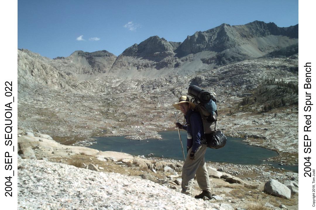
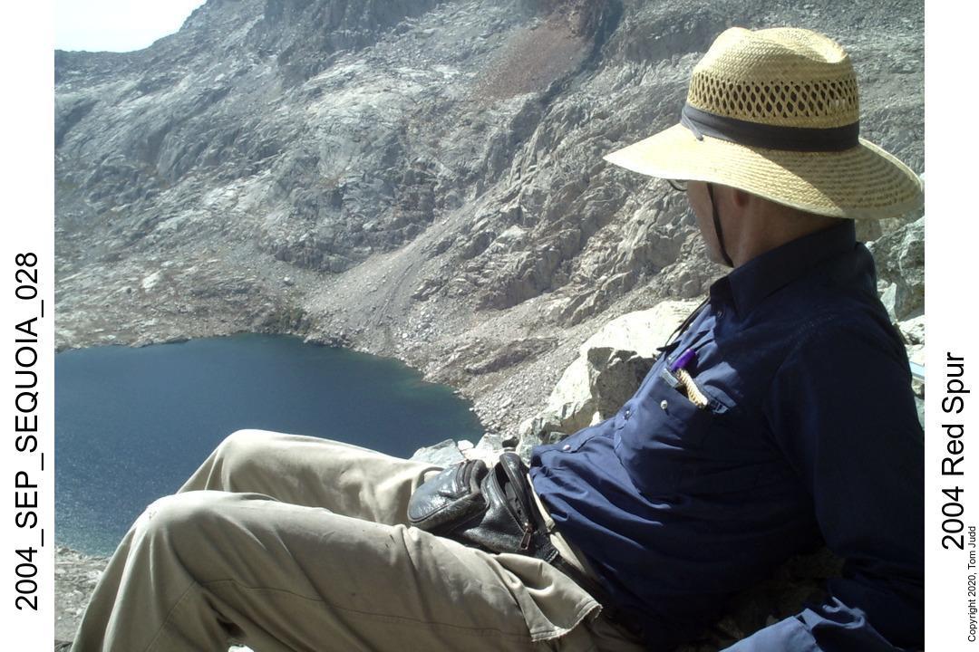
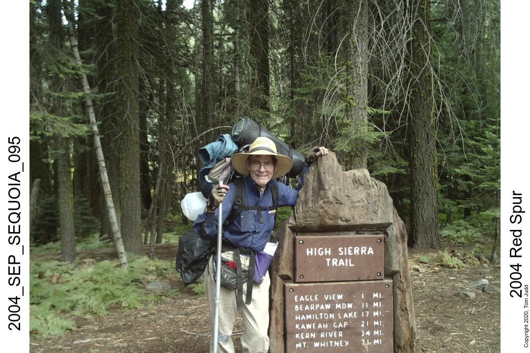
Pants Pass, Kaweah Basin, Red Spur Bench, Sept
Two Sierra Hikes in 2004
Hikes this year are landmarks for a couple of reasons. First, it marked the beginning of my hikes with my grandkids. We have begun a tradition of going out with our grandchildren when they are old enough to carry a backpack, and strong enough to hike in the back country.
This year also marks the first time I hiked alone in the back country for a significant time and distance. It was my first practical chance to test good solo hiking habits. It was also the first time I carried a satellite phone. I have carried a satphone or two-way satellite texting device (Inreach) ever since.
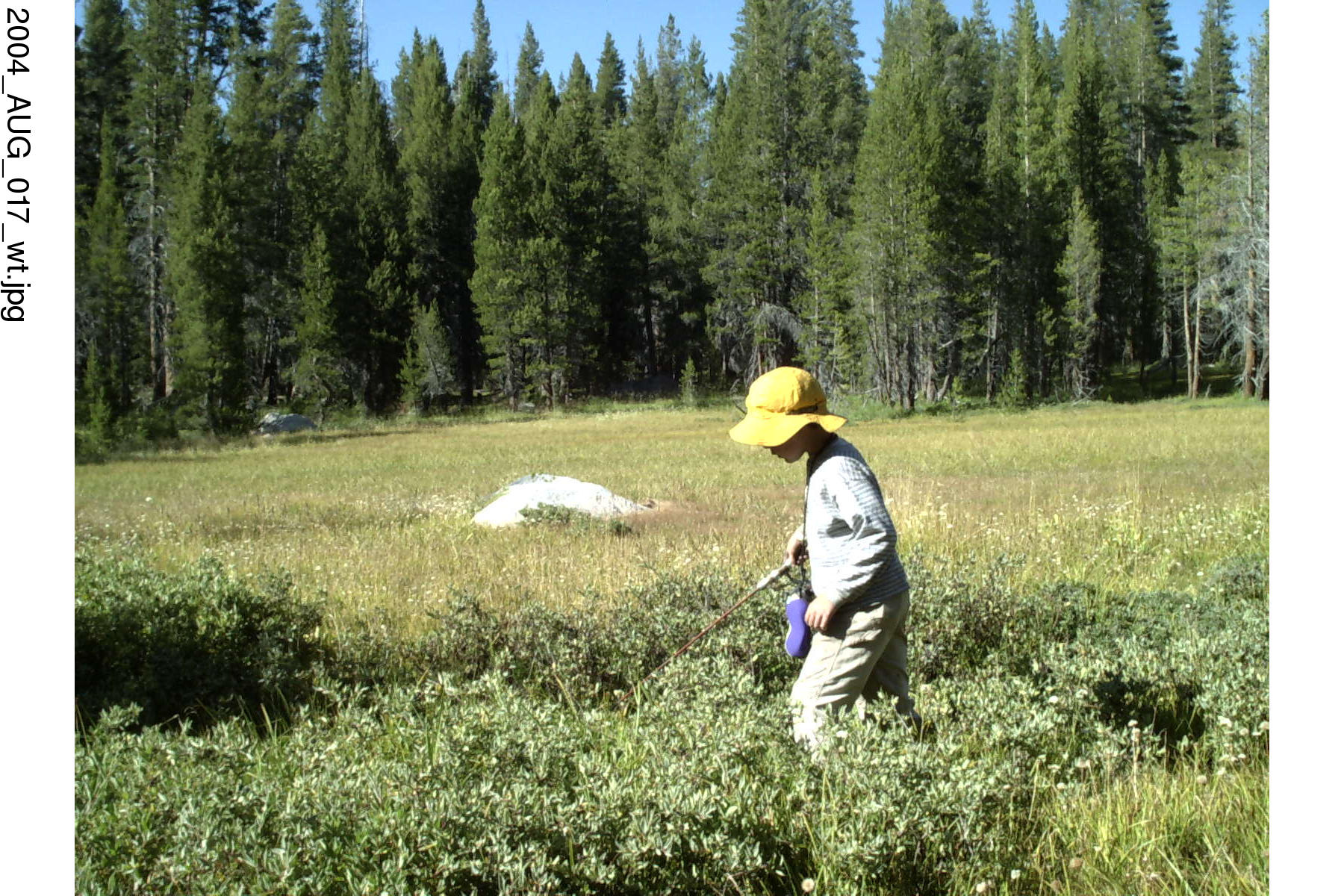
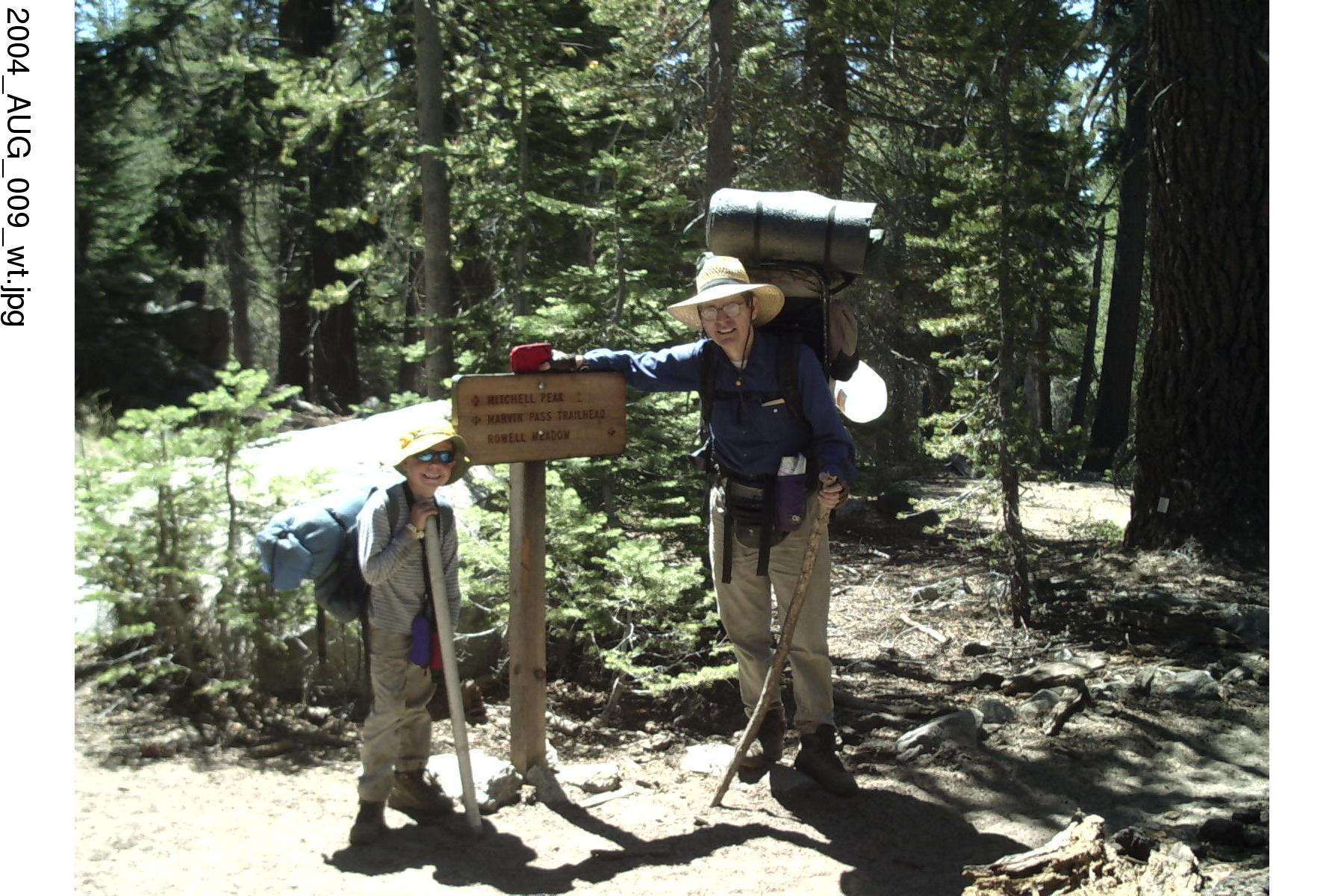
Rowell Meadow with Grandson Jon, Aug 2004
Pants Pass, Kaweah Basin, Red Spur Bench, Sept 2004
Rowell Meadow, Grandpa, Grandad and Jon, Aug 2004
Intro
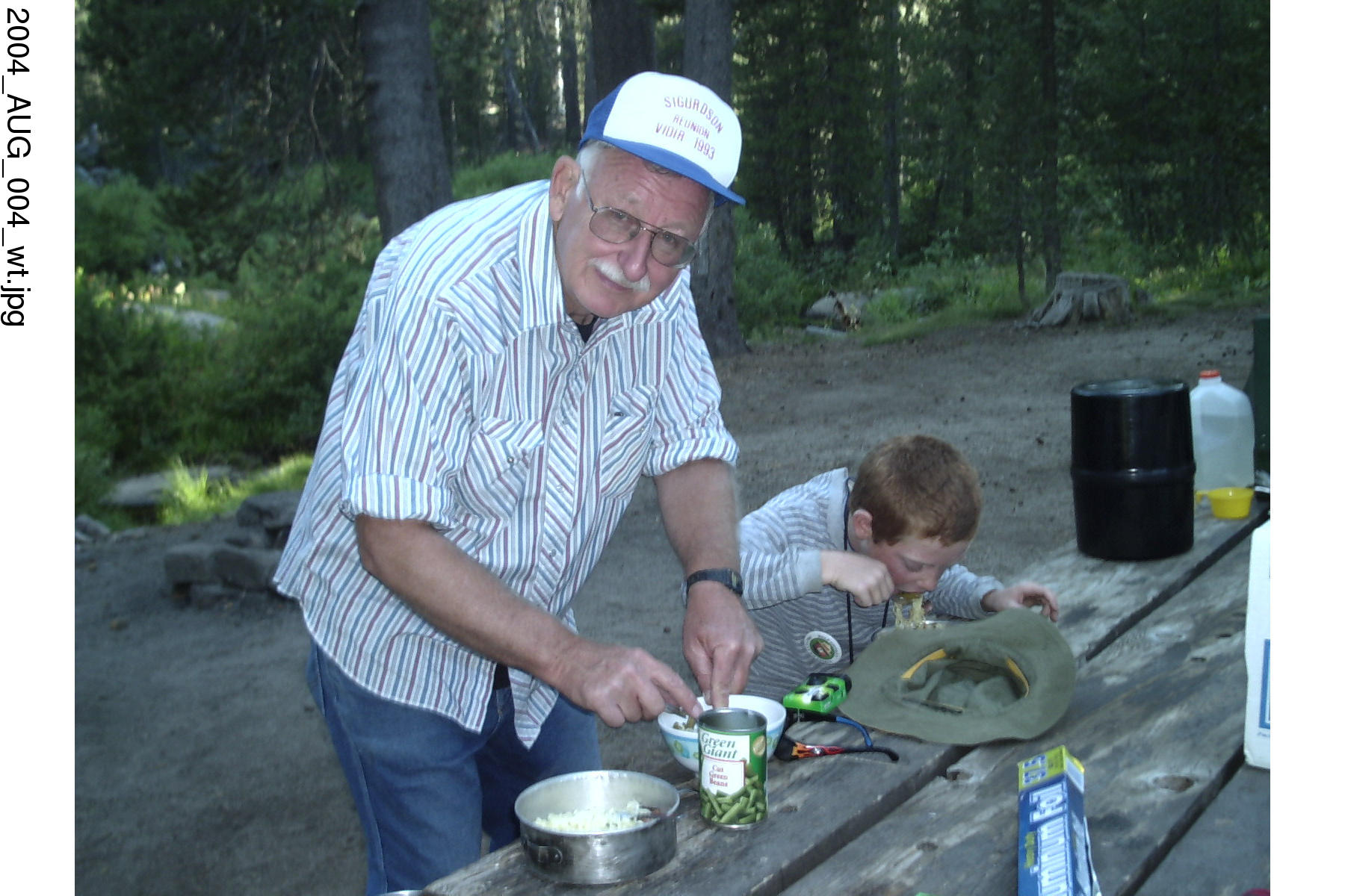
I thought it was time for the wise elder grandparents to shepherd their grandchildren through a rite of passage. And so it came to pass that Grampa and Grandad laid hands on their first born grandchild and led him up the mountain to the secret ritual site in the High Sierras. We both had taught college undergraduates before. We again took the opportunity to guide an awed pupil, this time in camping and cooking, in s'mores and steaks, in fishing and hiking, and in campfire stories and poetry.
I had wanted to go on a hike that was suitable for a seven year old. I picked a hike to Rowell Meadow. I had never been there before, but it turned out to be a good choice. You get to it from the Big Meadows road, half way between Lodgepole and Cedar Grove.
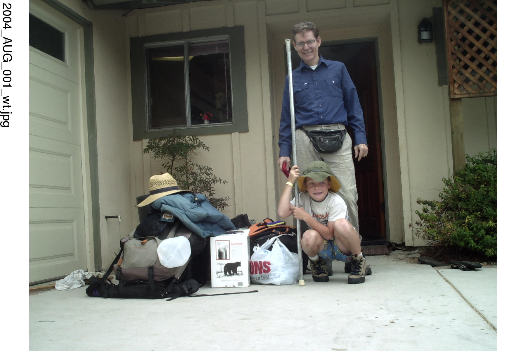
4-Aug-2004 Wednesday
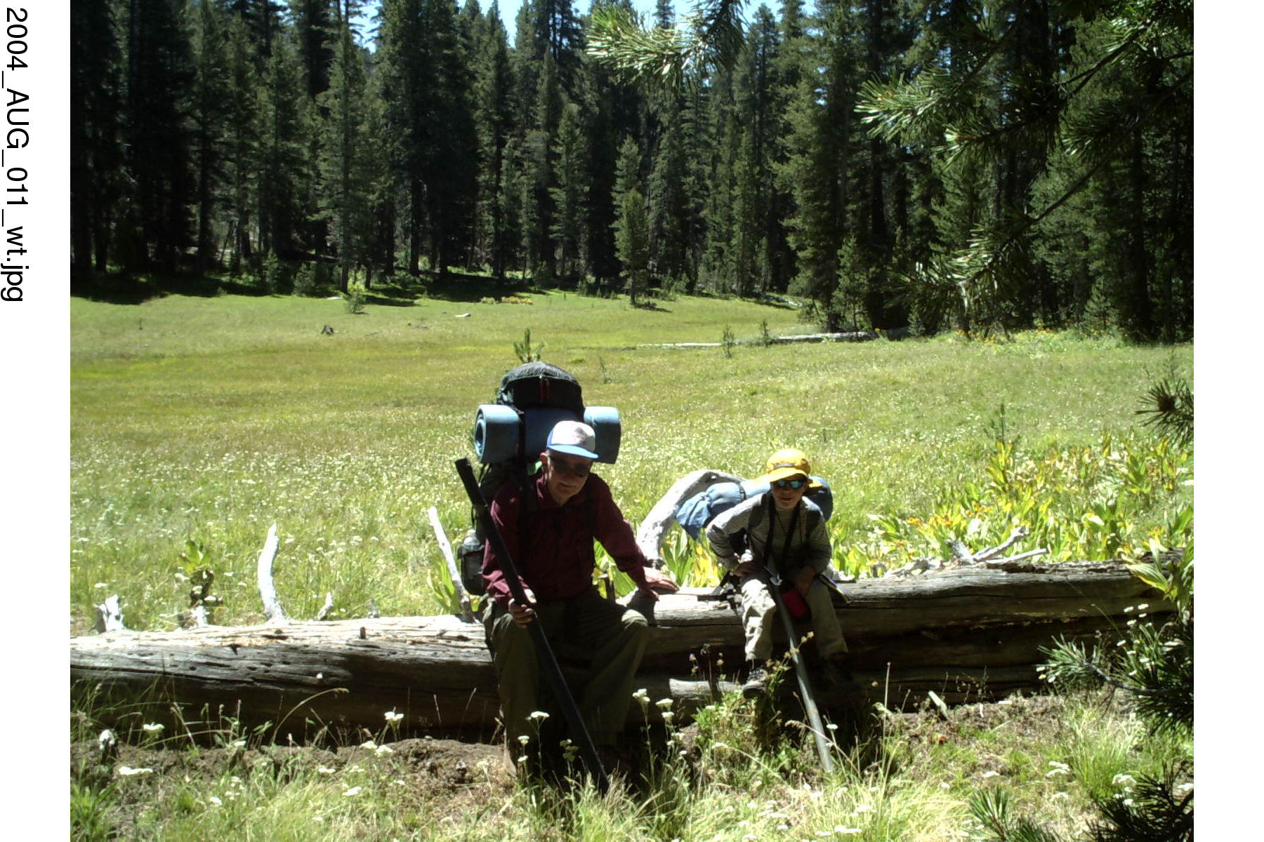
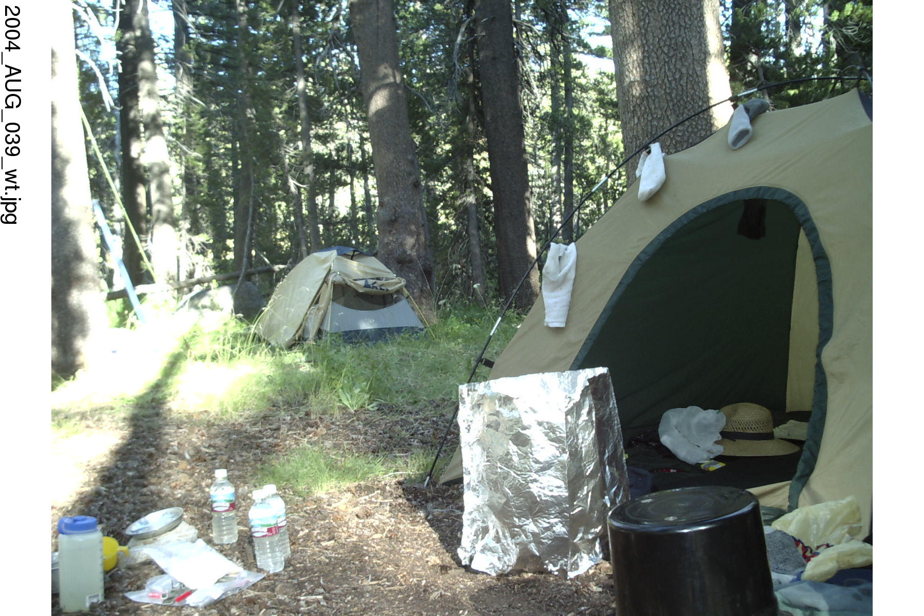
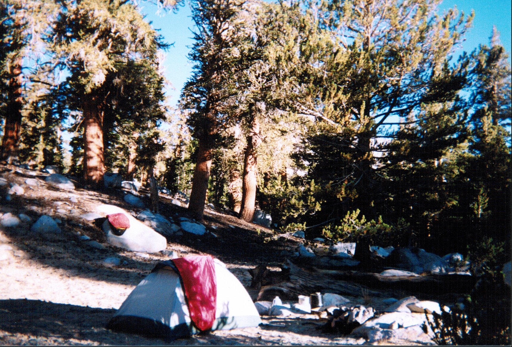
Grandad Jon and I drove up from Santa Barbara starting at about 10 and had our tents up by about 4PM. We were camping in the Sequoia National Forest (not Park). We had steaks for dinner and s'mores for dessert. Since his parents were not around we could allow Jon a half of a chocolate bar for each s'more. We played fish (the card game) in the evening and were snuggled for the night in our sleeping bags by 9PM.
Aug 5,6 2004, Thursday & Friday
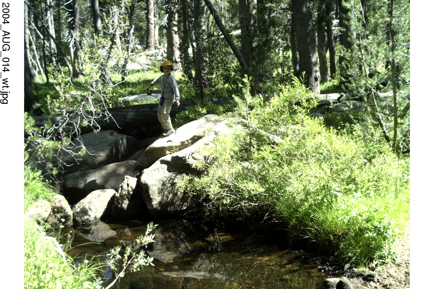
Hiked up over Marvin Pass in the morning. Once we got over to Rowell Meadow we headed cross country directly south. We hit Gannon Creek, but it was dry. We followed it down (west) until it started filling up. Found a nice campsite where it intersected with Rowell creek. Most of our fishing was in Gannon Creek. Spent the rest of the day with camp chores, fishing and hiking. At night we played fish (card game).
Next day we went hiking to the north. Stumled across a pair of hikers that had plopped down in the middle of the night near the trail. They mentioned going over Pants Pass. Since I was intending on going over the pass next month I quizzed them on it. They said it was steep and slick, but you could crawl up on the rocks to the left to avoid the chute, then safely work your way down. It was good advice.
After the hike there was more fishing, and in the evening we recited poetry: '..the silken sad uncertain rustling of each purple curtain..'. Grandad did an excellent job with the cremation of Sam McGee. Jon was particularly impressed with my rendition of the charge ofthe light brigade. '..Sabering the gunners there!..' I wonder if he knows what a league is?
Aug 7 2004, Saturday
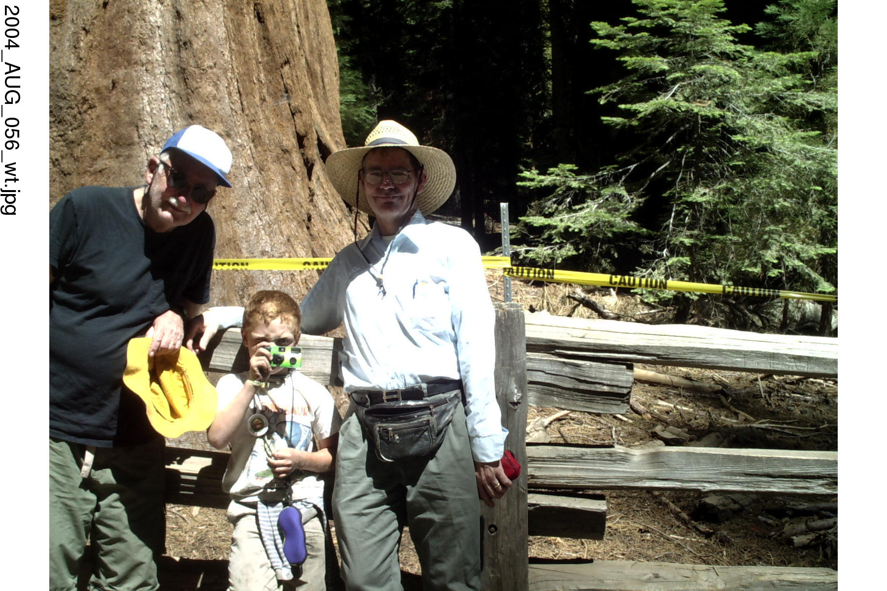
Packed up after breakfast and hiked back over Marvin pass. Stopped at Lodgepole visitor center to clean up. Bought some topo maps. Continued on down to the Sherman Tree where we found the last free parking space. They have since eliminated the parking lot so you have to take a shuttle. Afterwards we took a trip to Crescent meadow through a stand of Giant sequoias. Very impressive.
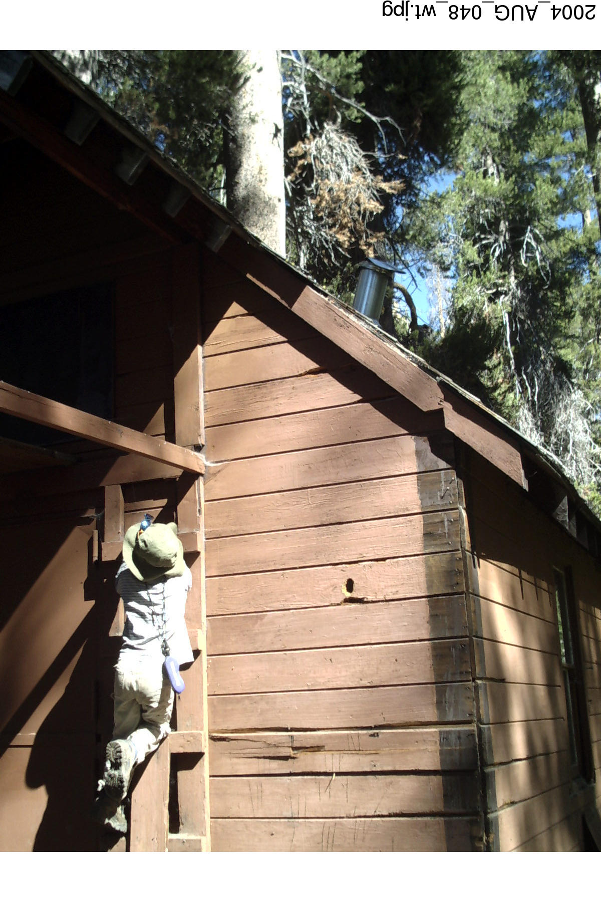
Ranger Hut
Sherman Tree
Crescent Meadow sign
2004 Sierra Hike to Kaweah Basin
Pants Pass, Kaweah Basin, Red Spur Bench, Chagoopa Plateau
I loved this trip. It was exciting, had its scary moments; but also had a lot of interesting moments. This was the first time I had used a satellite phone. I needed one since I was going solo for an extended period of time. It gave my wife some assurance. The main source of backcountry information for the offtrail portions of the hike was Bill Finch's web page. Before Google Earth, photo information was harder to get. I was able to get black and white images of the area around Pants Pass and Lawson Pass through Terraserver.
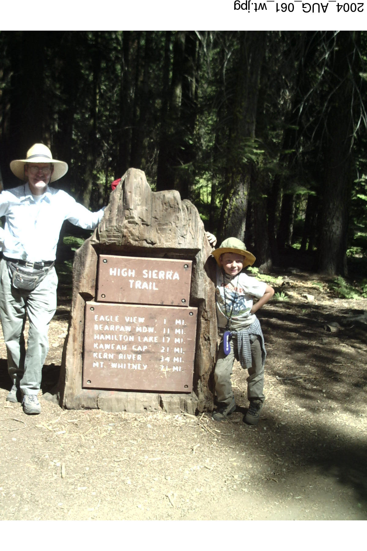
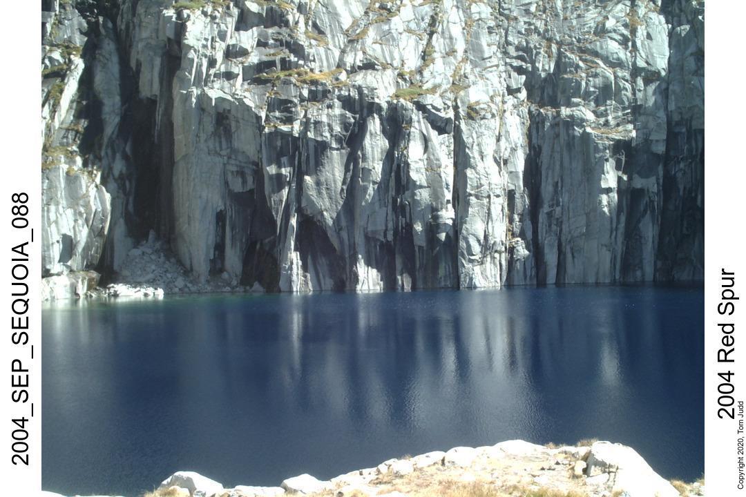
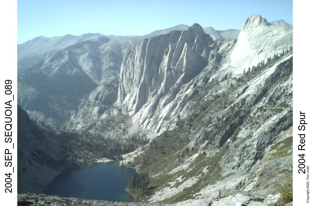
I drove up from Southern California, so I did not get started on the High Sierra Trail until about noon. It was my first time on the High Sierra Trail. The trail up from Crescent Meadow was beautiful. But, I couldn't help being a bit frustrated with the gnats that clouded around my face. More than once did I breath one in. I made note of all the creeks that trickled and gushed down on the left. And, of course, the views to the right were impressive. I got as far as Nine-Mile Creek until I pooped out. Next day I climbed up as far as Lower Precipice Lake. Near the tunnel above Hamilton Lake I saw a father and daughter pair that were returning from a long hike. They would be the last people I would see for a week. My campsite was in one of the flat spots not far from the trail. I was feeling the altitude. A short trip to the lake seemed strenuous even without a backpack.
10-Sept-2004 FridayThe first two days were the hardest. The backpack was heaviest, and the climbs were longer than on the rest of the trip. Besides, things got more interesting since I was beginning my off-trail portion of the hike. Right after Kaweah Gap (10.7K feet) I veered off towards Pants Pass.
The climb up the scree over the pass was laborious. It was very loose. Hiking with a partner would be problematic here because of all the debris that would rain on the one below. I climbed up to the top of the scree and then worked my way across to the solid rock at the pass. I spoke to some hikers in August who had been over the pass. They recommended starting down on the rocks to the left. Looking down the slippery chute I agreed with them.
The trip down was interesting. Yes, I got an embarrassing rip on the seat of my pants. It was so steep that I tried skiing on one foot with the other extended straight out. Worked somewhat, but my sleeping bag would drag. At times I found myself in a bathtub of fist-sized rocks, all moving down the slope together.
At this point in the hike I had not solidified my plans. I looked to the right at Lawson Pass as it came into view. 'Piece of Cake' I said out loud to no one but myself.
Got to the big lake about 5:30 and found a flat camping area down a bit. Lights out about two hours later.
11-Sept-2004 SaturdayI was quite proud of myself since I was now about a day ahead of schedule. I had originally thought of going down the Kern-Kaweah River Drainage to the left then hopping over one of the passes in the Picket range. But Lawson Pass to the right looked doable, so I gave it a try.
It took about four hours to get to the pass. I had stopped midway to boil water. Near the end was a wall of steep fresh grey talus. But it was stable. The rocks scraped together as I climbed them and made noises like cinder blocks rubbing together. The last part was surprisingly easy: a stretch of 'sidewalk' granite that I just walked up.
Views all around from the pass were fantastic, but especially down Picket Creek. Mount Whitney was centered dramatically in the view which was framed right and left with the mountains that line the creek.
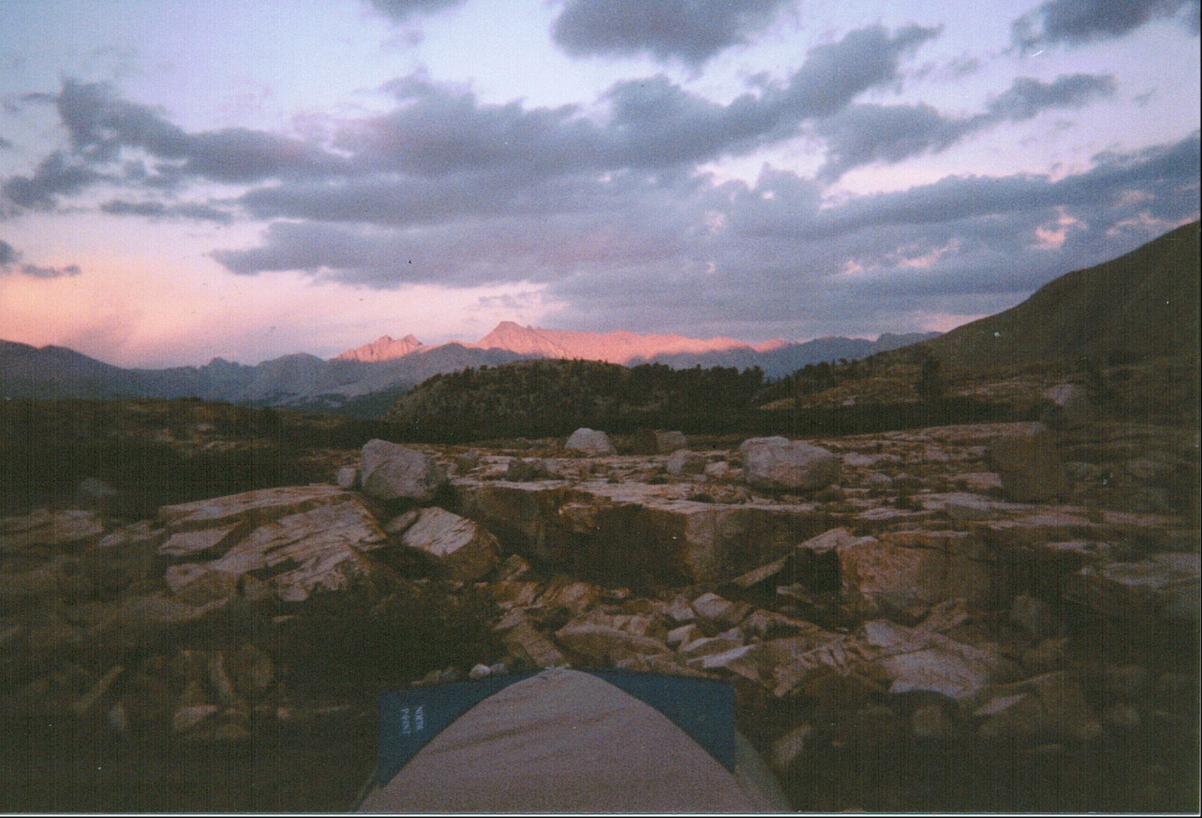
The view down was a relief; I saw no cliffs that would block my descent. Topo's don't show ten foot cliffs and topo's were what I used to pick my route. I made my way down to the big lake just below, then after a rest, proceeded down the valley. The path looked easy on the topo, but there were a lot of rocks to step over. Progress was slower than I had expected. I stopped to make camp just a little before 5PM. I had noticed some rain showers over by Whitney and thought it best to put up the tent just in case they blew this way.
I was becoming less anxious over the unknowns on this trip since now I was a day and a half ahead of schedule. It was colder this morning, my sleeping bag froze to the side of the tent. Sounded like velcro as I pulled it away. This campsite is just a bit under 11K feet.
I had been checking in with Kay on the sat-phone; this time I called my mother. She was thrilled to hear from me. But she was a bit chatty for the $1/minute charges.
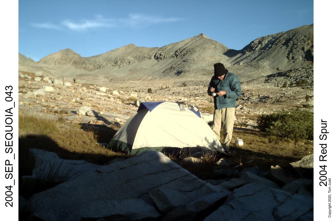
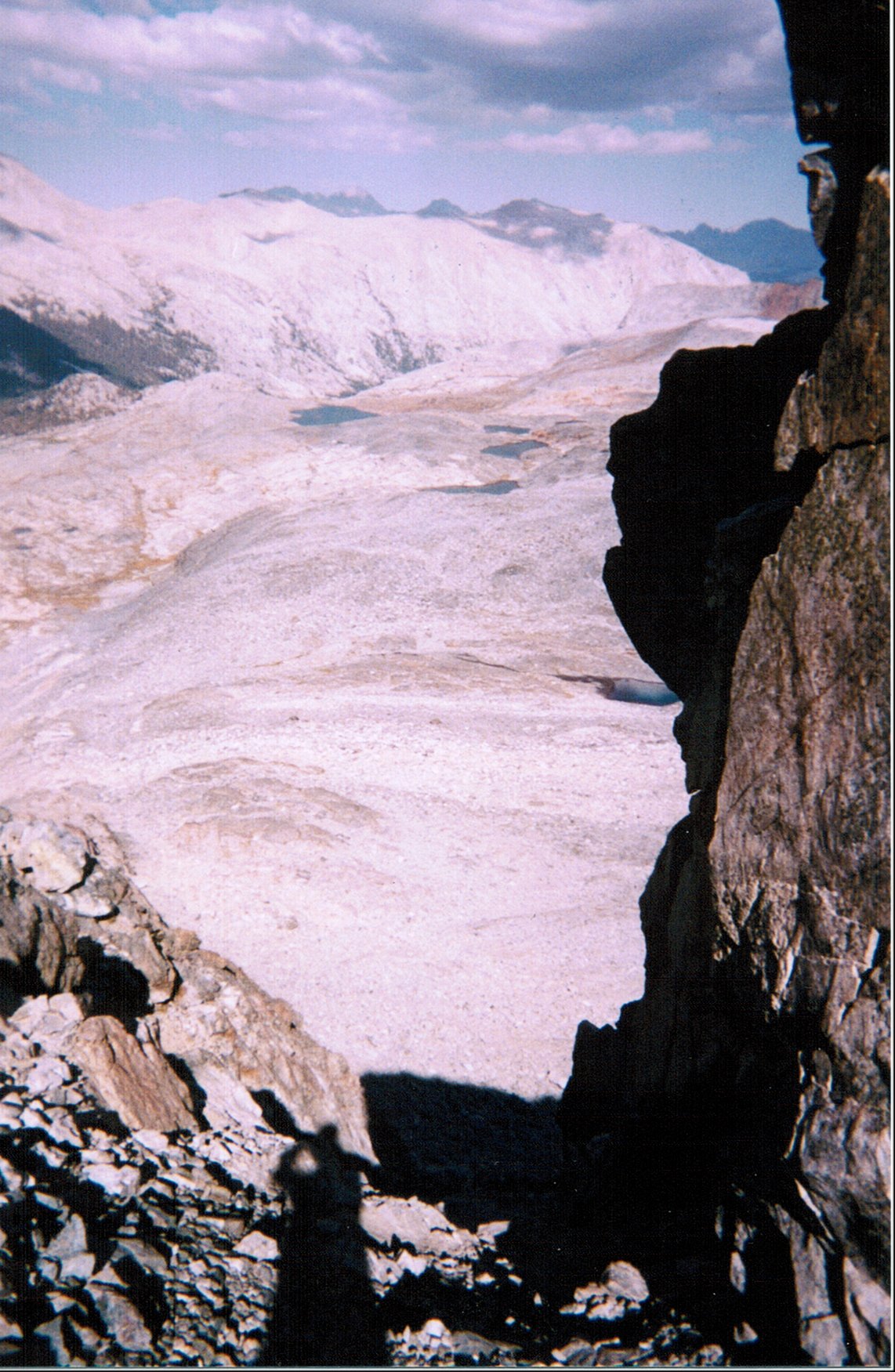
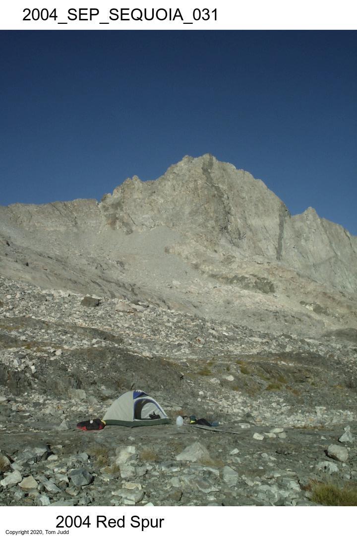
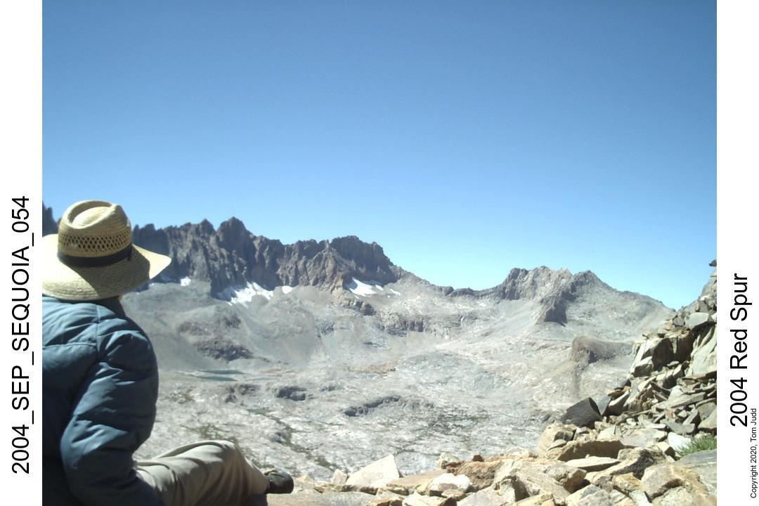
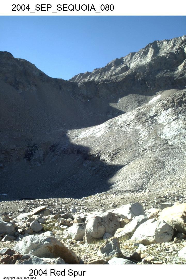
My destination for the day was the plateau on the east side of the Red Spur: Red Spur Bench. I started off for the Pickett-Kaweah Pass at about 9. This is a mild saddle between Pickett Creek and the Kaweah Basin. Took about half an hour. Downhill to the Kaweah Basin was steeper and at the bottom there was a big ravine blocking my direct path. I had to circle around. The knoll blocking the way to the bench was steep but short. I arrived at the first big lake on the bench (10935 feet, 3300m) at about 2PM .
It was a beautiful spot. I got to the campsite early so I wanted to explore down towards the point so I could peer over and down into the Kern valley. But it was tough going. It was the worst boulder field I had ever encountered. I did pass through some beautiful red and white marble. One white rock had a large red swirling star in it. After hiking for an hour I found an appropriate spot to bury my medallion--a quarter engraved with my name and date. (I returned in 2015 to unbury it 36.565348,-118.432832). It took another hour, slightly uphill, to return to camp.
The night sky was brilliant with a host of stars. One curiosity was an arrangement of stars I saw when I awoke at midnight. In the clear air you could see right down to the horizon. And there I saw three stars standing like a telephone pole straight up on the horizon. The earth turned, the stars rose, and I could see that the telephone pole was made up of stars in Orion's belt. Later I looked at my circular star chart and realized that only at that time on that date at that latitude could I have seen that arrangement.
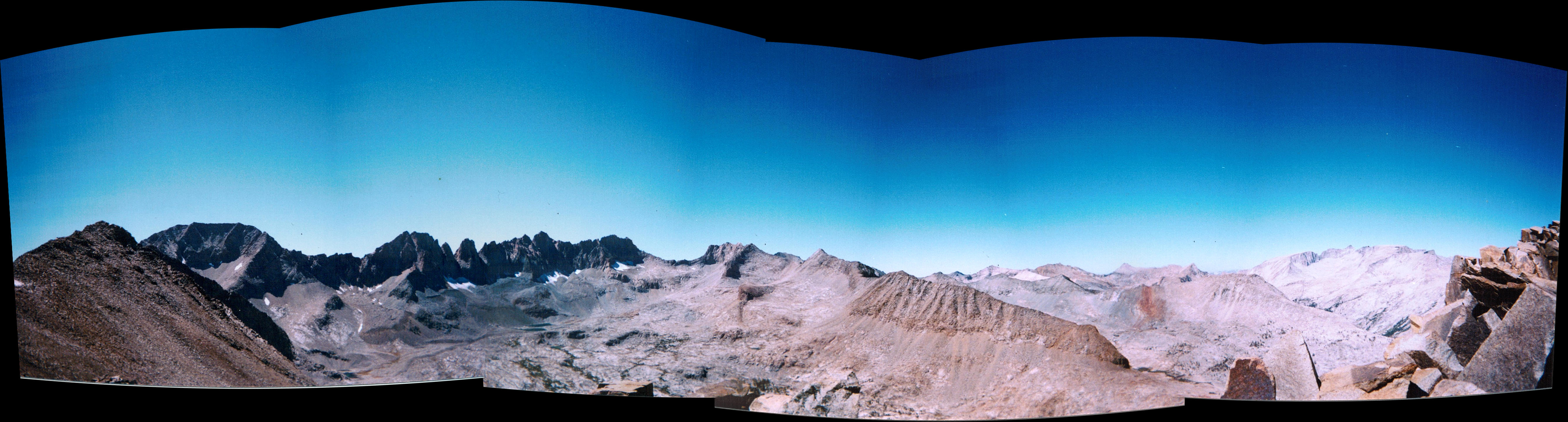
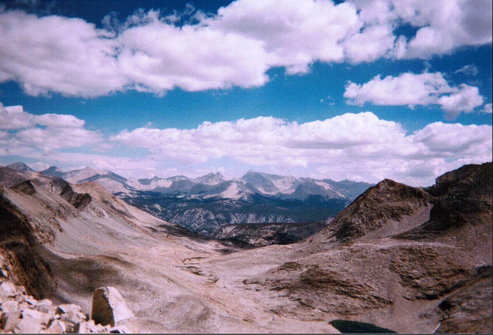
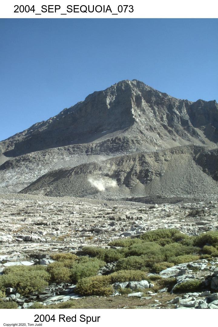
This was Explore Day. I had some thoughts of hiking over Red Spur, but I considered it too risky. I set off to the south thinking that I might just do a day hike up the spur; but the sight of all the talus turned my attention southwest. I climbed up to the 12.3K foot saddle southwest of my campsite. The views were fantastic. The panorama picture at the top of this report is an example: the entire Kaweah range setting out there almost close enough to touch. Views to the east were just as enchanting. I climbed up to the nearest peak on the ridge, about 12.4K feet, then turned around.
I was super pleased with myself. I had attained all my objectives of the hike; it turned out better than expected. I said out loud in a satisfied voice to anyone within earshot: It's time to go home.
Left saddle about 2PM back at the campsite by 4:30. I decided to try to repair my pants. The seat, and both knees had rips; they were getting bigger. So I used my aluminum wire and made staples. Punched holes in the fabric with my corkscrew on my knife. Four staples, two on each end of each knee. It did not take long for them to rip out. Patched them up again with duct tape. That lasted through the end of the trip.
A coyote yelped a ways off. Being alone, it affected me more than it should have. I gathered a few stones and kept my hiking stick close to the tent for the night.
Took a half bath. Immersed legs and seat. Clean shorts. Felt good,fresh.
My plan is to go over Kaweah Pass; it is less risky, and I am anxious to get home: my pants are falling apart, and I noticed that the stitching is beginning to come out of my left boot, there are holes in the toes. The sooner I get on the other side of the Kaweah's the better.
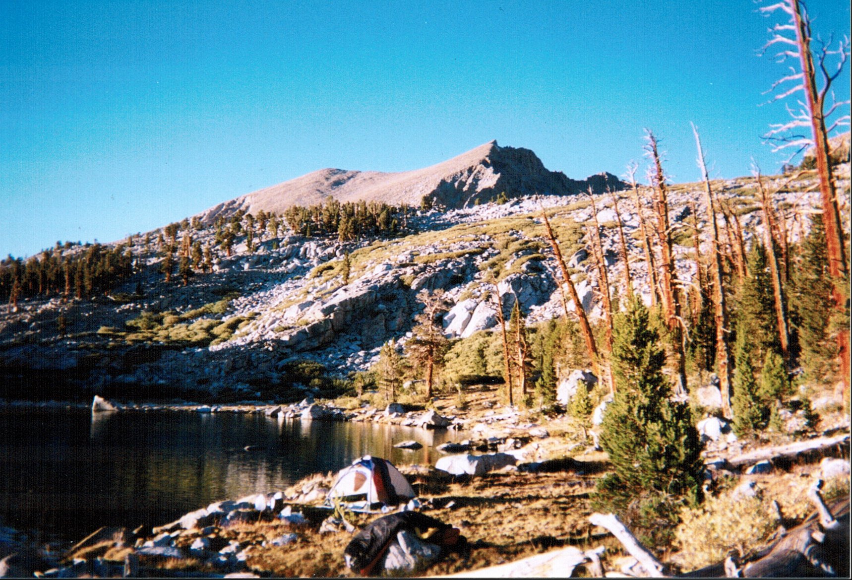
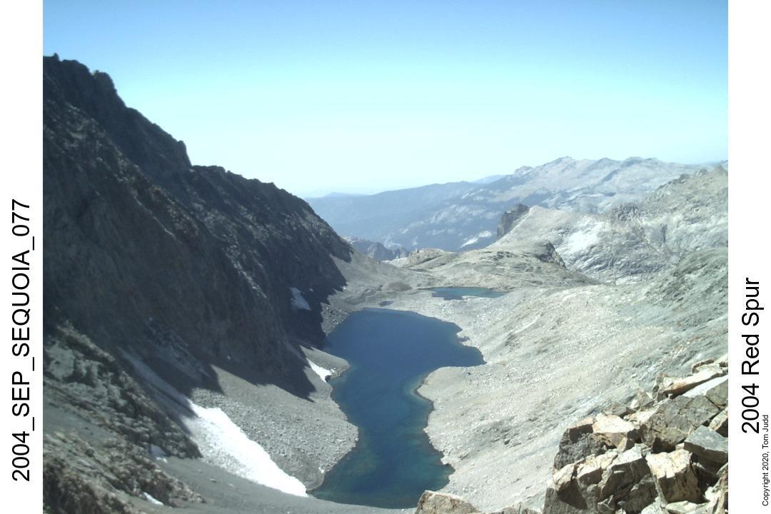
Left the bench about 9AM and got up near Kaweah Pass around 2PM. There was some yuckie water there so I decided to go over to Pyra-Queen Col since I had seen really clear water over there. It was a quick trip across the basin to a small lake where I set up camp.
It was early so I decided to take a walk up the hill to see the two large lakes and to scout out my path for tomorrow. Suddenly I heard a jet tearing the air. Then I realized that it was not a jet but an rock avalanche. I was able to pull out my camera and snap the picture of the dust cloud before it drifted away.
This turned out to be a rather interesting day. I planned to climb over Pyra Queen Col. I started out about a quarter to nine in the morning and was up in the red rocks below the prominent notch by 1PM. I was up at the saddle in 45 minutes. At the top was a small carin (pile of stones) with a rusty old bandaid box tucked inside. I opened it up and found a short pencil, and a spiral notebook, brown, 10 cents. From the price I knew it was old. The first entry was from 1967!: Bill Schuler, Andy Smatko, Ellen Siegal, and Frank Yates. Bill Finch was also there in '84 among other times. There were very few entries, considering the age; but curiously, the one just before mine was Hal and (Al?) in August '04, just the month before. They were there because they took the wrong pass.
(Note: Secor comments (p108) that peak 4033(m) was first climbed by Andy Smatko, Bill Schuler, and Ellen Siegal July 2, 1967. This was probably the same trip.).
I packed everything up, and assessed the descent.
Here I experienced true fear.
Two hundred feet straight down, and I couldnt get far enough over the edge to see where my first foothold should go. I tried. After about a minute of manuevering I realized the danger was too great. I would have to commit to going over before I found my first foothold.
I couldn't get over the pass. Now what? I would have to go over Kaweah Pass. (Turns out there is an easier way over the pass about 100 yards south. I went over that pass in 2015)
I would have to hike back down and push over Kaweah Pass the next day. I started saving a bit of food out of my meals and hoped that the weather would hold for the hike out.
Started back about 2:30 PM and was back near my last camp by about 5:30.
Checked the sky as soon as I awoke. Clear! Ready to go by 8:30, made it up to the pass by noon! Downhill or trail the rest of the way to the car.
What a relief. The climb up was slippery but it was much easier than Pants pass. I felt at this point that there were no more technical difficulties; just a question of where I would camp, and how far I would get each day. The thrill of the moment was tempered by the view of the lake. There was a small but significant snow bank along the west side, the longer side. I decided on the east side. It was steep, and the rock was the most fragile I had encountered, It would slide, large bolders would slide down at the gentelest of touches. It was steep, and there were a lot of rocks. It was a difficult trek.
Once past the lake there was talus as far as I could see. I worked my way down, heading for what I thought might be a pretty little lake. I found it a little after 5PM. Scum Lake. A big disappointment. I turned southwest and soon encountered the perfect campsite. Lots of level sand, trees, and a creek running close by.
All the anxiety of getting over the pass was gone. I had plenty of food for the rest of the trip. I didn't know where I would stop. A two day hike would be challenging, since I would have to drive home afterwards. If I got to the trailhead by 3-4 then I could get home before midnight; done it before. We'll see.
17-Sept-2004 FridayStarted off about 8:30. Five hundred paces later (half mile) I burst out of the trees within view of the High Sierra Trail! I was up to Kaweah Gap at 2PM and down at Hamilton Lake by 5PM.
At Hamilton lake I met Bill. He had been yelling friendly greetings up to me as I was coming down the switchbacks -- or so I thought. He was actually yelling at a bear. He showed me.
Just over the rock, between us and the lake was a beautiful bear, long hair, auburn. I asked if it was ok if I camped nearby. YES! He bedded about 10 feet away. This was the only time on the trip that I had a campsite with someone else around. Never saw the bear again.
On the trail by quarter to eight. At the trailhead at 4:15 PM. Cleaned up and left Crescent Mdw about 5PM. Home at 11:15 PM. Showered! stayed up and talked.
It was a very satisfying trip.
© 2020 Tom Judd.
www.juddzone.com
Carlsbad, CA
USA