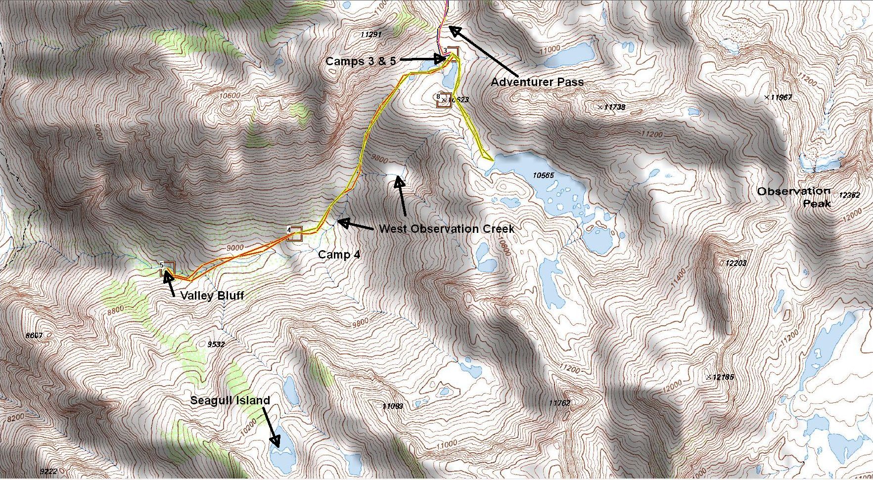
Observation Creek Drainage via Bishop Pass and Adventurer Pass.
This is a work in progress
Intro
I drew up the trek down West Observation Creek in 2008. Last year I tried climbing up from
the Middle Fork of the Kings River. Too steep. This time I would try going down from the top.
This was an 'extra' hike. I had retired in July, so I got a chance to squeeze this one in before my long
hike to the Kaweah basin in September.
Sunday 2015.08.09
Pack weight with water was 52 pounds (23.5kg).
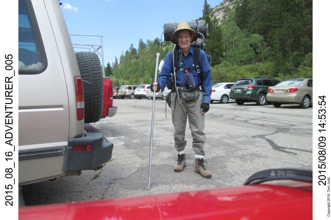
Started driving around 7:30 AM, got my permit in Bishop six hours later. Started on the
trailhead at South Lake just before 3PM.
South Lake trailhead parking lot. Notice the white cord hanging down over my right sholder.
I lost it on this trip, but found it again the next year. I hiked another four hours till I was
completely exhausted. Camped near Bishop Lake.
Monday 2015.08.10
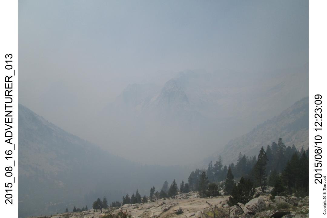
The next day I continued on over Bishop Pass. The Rough Fire was burning that month. I met and talked to
Ranger Dena Paolilli. She indicated that my planned route would not be affected.
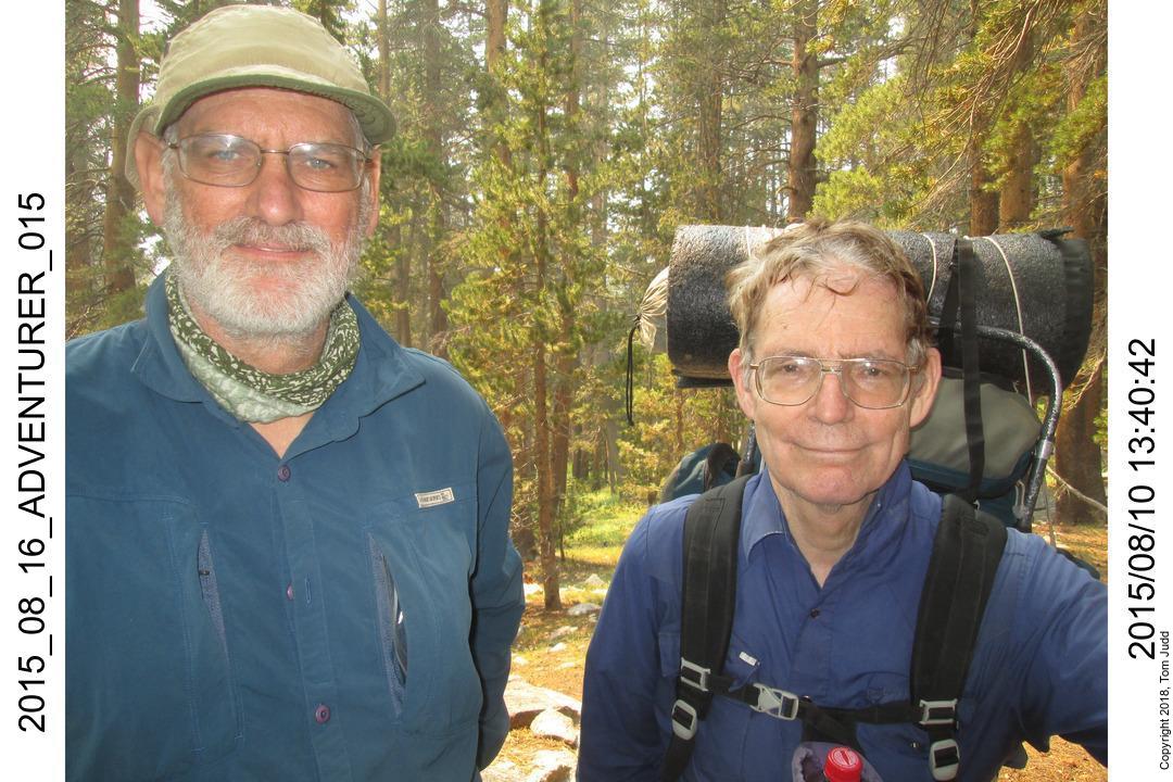
Coming down from Dusy Basin I paused in the campsite near 9500 feet to check it out for future stays.
I talked to a pair of hikers. One mentioned his first name. In a moment of inspiration I realized:
I just met Charles Hayden!
I had been following his Sierra trip reports for years. I still go back and read them when preparing for
similar hikes. I was pleased to finally meet him. Afterwards, I continued on down and camped near the
junction of Palisades Creek and the Middle Fork of the Kings River.
Tuesday 2015.08.11
I was up early, started about 7:30 south on the JMT along Palisades Creek.
After about an hour and a half I came to a stock fence. Just past it was
a trail down to Palisades Creek. This was the way up to Adventurer Pass.
I crossed on some logs. Found an old campsite. I rested there while sterilizing
water. I didn't want to be caught short. Last year I couldn't find water, so refrained from hiking up. Started up about
9:30. At a rest stop around 11:00 I heard a very faint creek. It could have been wind in the trees so I walked on over
to see. Water! There were a couple of campsites on the way up. At the half way point there was a broad lush level area.
No problem finding a campsite here.
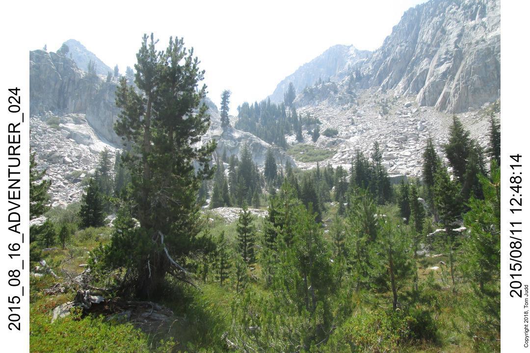
I continued up the steep slope past the level area. Went near the trees on the right then cut over to two grassy
patches on the left. After that it was slow hiking through the 'Boulder Bowl.' I went all the way to the right to
get over the pass. It was quite steep, but doable. It was harder coming back down. In 2016 when I revisited I contoured
from the notch across the face of the bowl. That was easier.
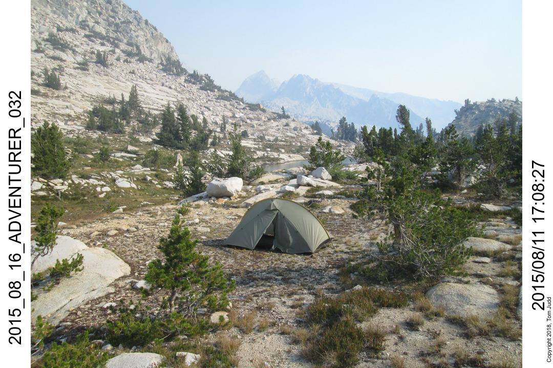
About 100 feet elevation down from the crest was a flat sandy area, suitable for a tent. I got water from a creek that
was trickling into the nearby lake.
West Observation Creek Drainage
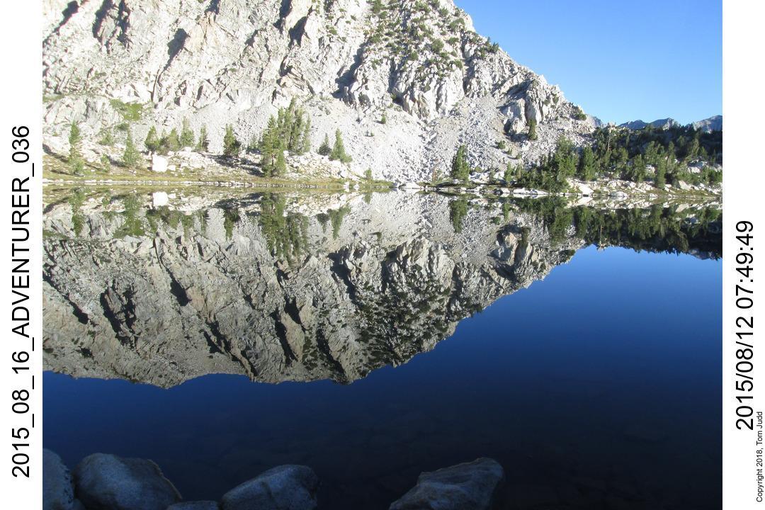
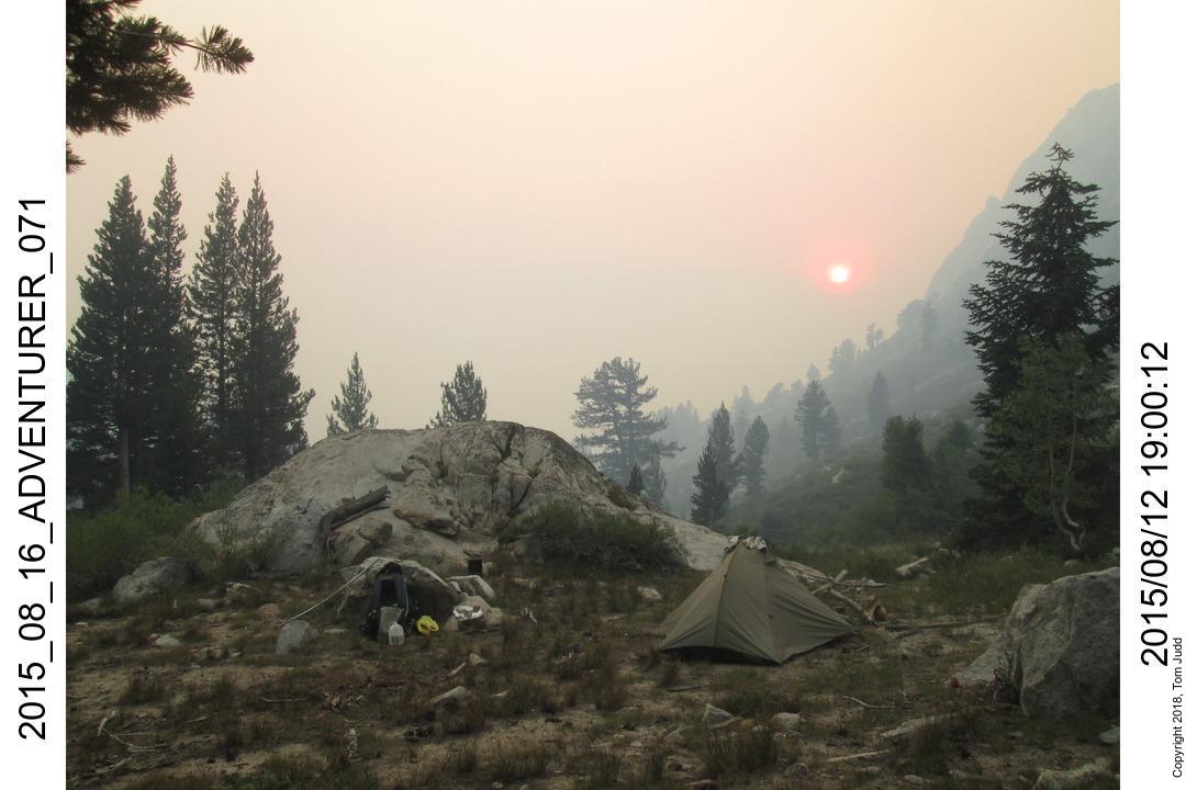
Wednesday 2015.08.12
I was really excited to finally be in the west drainage of Observation and Shakspere Peaks. I had been
looking at this area for quite a while. My intent was to continue on down the valley and
eventually meet the Middle fork of the Kings River. I did not quite make it. See the map above for my
actual path.
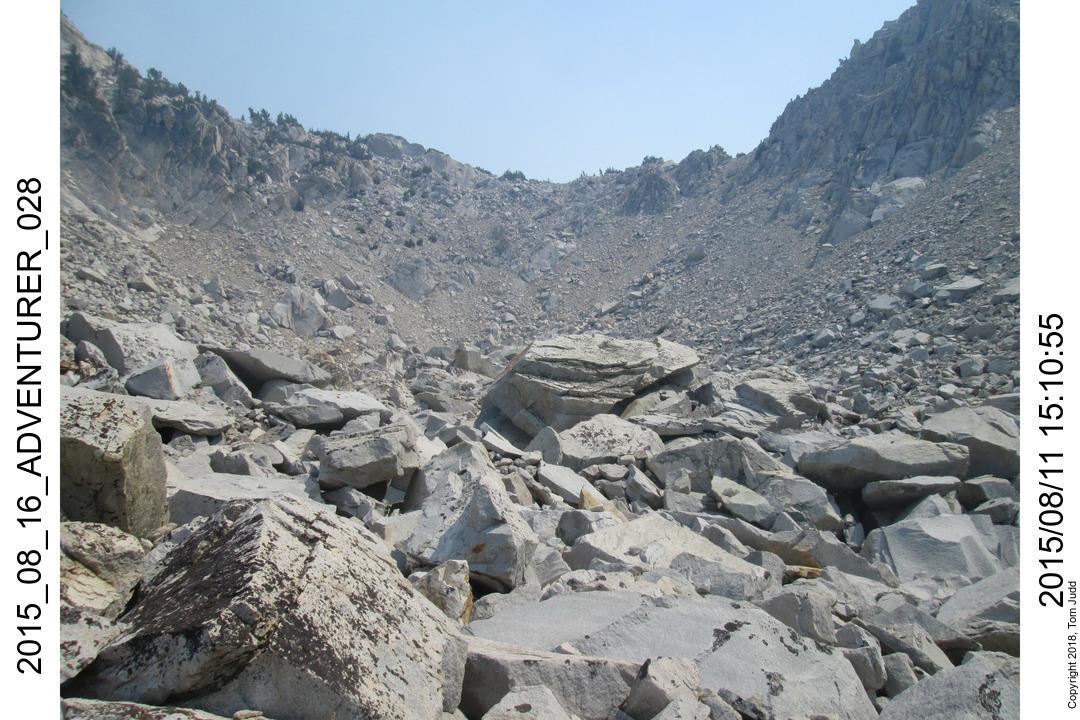
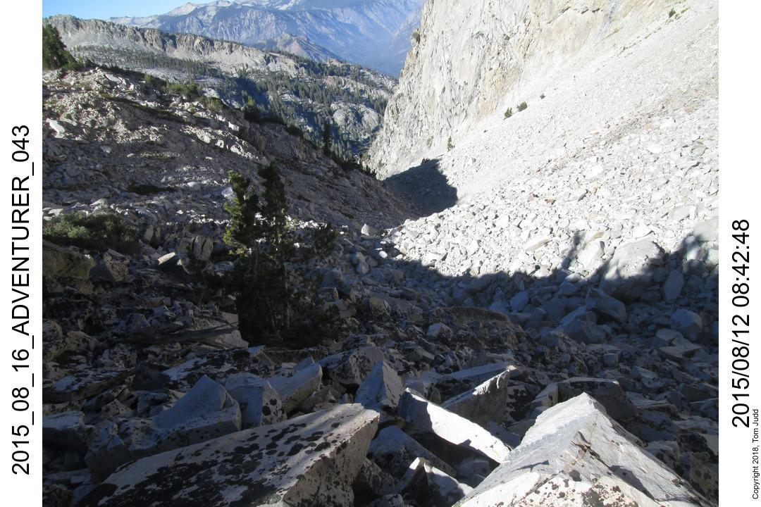
The safest way down looked like the rocky rubbley slot on the right. It is about a 1400 foot (425m) drop down
to a level area away from the rocks. It was slow, took more than three hours. At about 9400 feet (2865m) there is a
pretty tree-covered cliff that would be suitable for camping.
I stopped further down at a rock formation at about 9100 feet
(2775m) elevation ('Valley Rock'). Behind it on the right was a sandy area suitable for a campsite.
I rested for awhile before continuing down the valley.
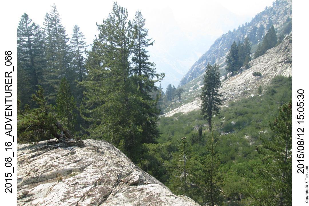
Past the 'Valley Rock' campsite the scenery is quite pleasant: a creek, trees, and a stretch of gentle slope.
However, my time was getting limited. The path down to the Middle fork of the Kings River was quite steep.
There was a good chance that I would not feel comfortable going down; and I didn't want to put myself in
the situation where I was forced by time to take a chance.
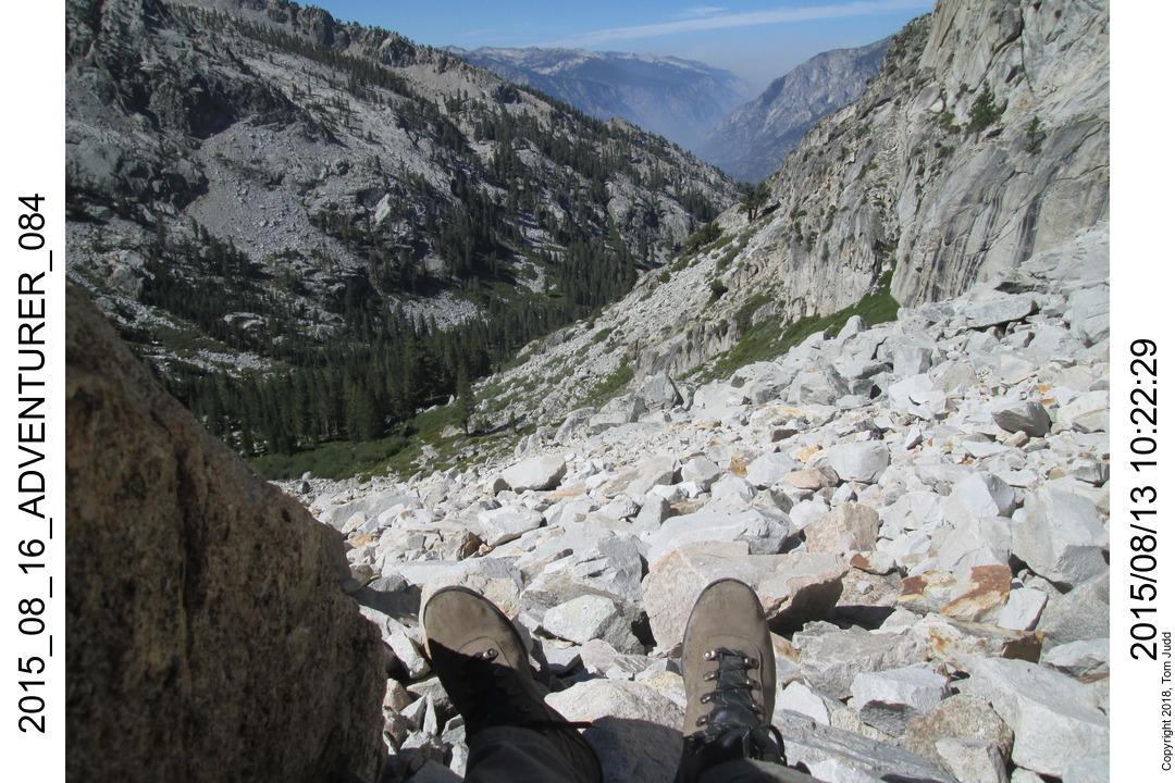
I was slow getting down the valley. It wasn't until 3 that I got to a rock bluff (above picture). The view
of the steep dropoff dissuaded me from continuing on. It looked too steep, and it was already late. I thought it would be
slower going up. So, I decided to turn around and look for a campsite on the way back up.
I got back up to 'Valley Rock' in good time. I set up camp in a nice sandy area. On the way to get water in the creek
I found the remains of a party balloon. I seem to find a lot of these in the backcountry. The evening sunset was made more
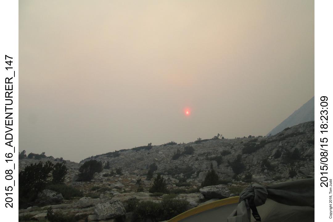
interesting because of the smoke.
Thursday 2015.08.13
I started out in the morning about 8AM. Uphill over rocks was tiring. I got to my previous campsite just below the pass
at about 1PM. That was five hours of climbing. I was tired, set up camp and got my water.
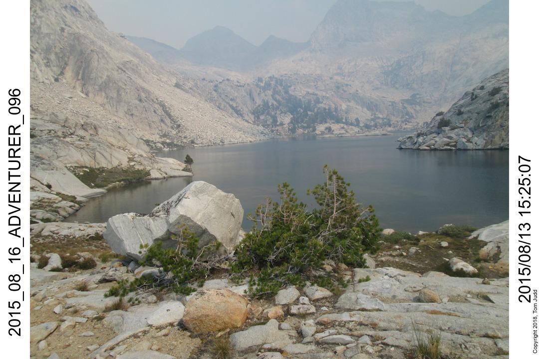
I wanted to explore the area in the direction of lake 10565, since I had some routes planned for the area.
But I was tired. It was difficult going over and getting the water. Such a simple task but it was hard.
I started out on my trek to the lake with no oomph in my step. I started making
excuses for not going to the lake. But I kept reminding myself that I would be sorry later.
At several points I decided to quit, but took one more step and went on. The way looked hard, so that was a disincentive.
After about a half hour my energy picked up. After that it was never an issue. These are all mental struggles; I am glad I
was persistent.
There is a nice flat area suitable for camping just down from the lake. Afterwards, I boiled some water. Most of my
food has been no-cook: just add water and eat. The cup was beginning to get grungy on the outside, so I took the
opportunity to boil the cup in the water. Cleaned everything up.
Friday 2015.08.14
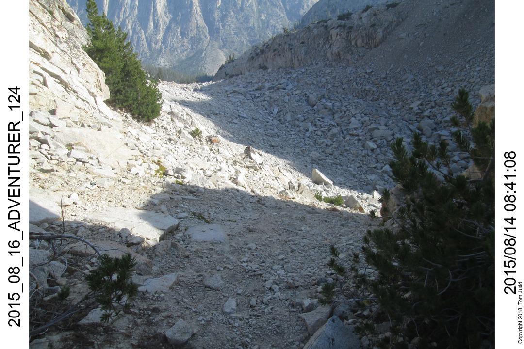
The next morning I climbed up the local hill for a last look back down the valley before heading out to the pass.
The pass was quite steep. It was a tough descent;
I had to think about every step. It took more than an hour to get to the far lip of the 'Boulder Bowl.'
It was about 6 hours from the pass to a campsite on Palisades creek. From camp I could hear voices, hear the
stock gate crash closed, and occasionally glimpse a hiker on the trail across the creek. Civilization was near.
Saturday 2015.08.15
I started off at about 7 the next morning. Got to the trail up to Dusy Basin at about 11. Sterilized some water. It
is a long hot hike up to Bishop Pass. I do not expect to get over the pass today; plan on about 2000-2500 feet (600-760m)
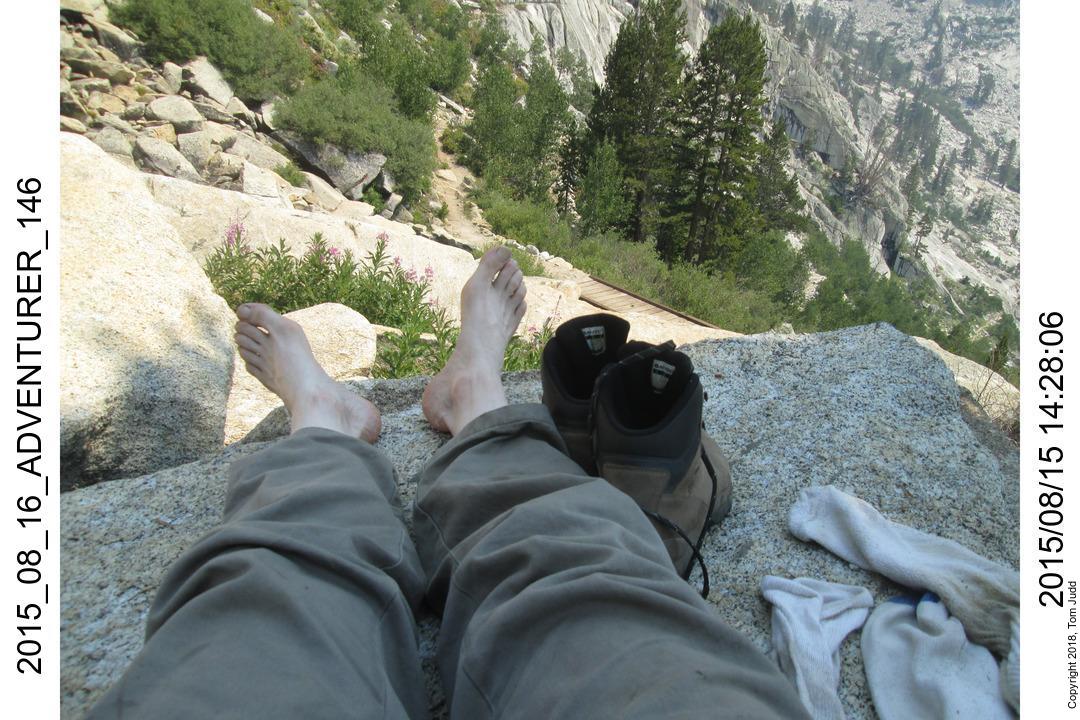
before stopping for the night. I paused at the bridge and took my shoes and sox off in the shade of a nearby tree.
That was fortunate, for it gave me a chance to meet Rick, who came up the trail a few minutes later. We had some common
life experiences: married at 21, undergraduate Physics major, retired. He's a stronger hiker, but still was gracious enough
to include me in future hikes (e.g. Aug 2016)
We hiked up together the rest of the day, stopping at about 11220 feet (3420m) for the night
Sunday 2015.08.16
Next day it was a really fast trip out. We started about 7 and were in the parking lot at 11:30. I drove Rick
to his car, then ate out at his favorite restaurent in Lone Pine. Left Lone Pine about 2:30, home by 8PM