2016 Sept Sierra Hike
Taboose Pass, Bench Lake, Upper Basin Crossing, Amphitheater Lake, Cataract Creek Pass, Observation Peak Pass, Sea Gull Island, Adventurer Pass, Mather Pass
This is a work in progress
Sept 2016 'Grand Taboose' Hike
12.Sept.2016 -- 23.Sept.2016
Intro
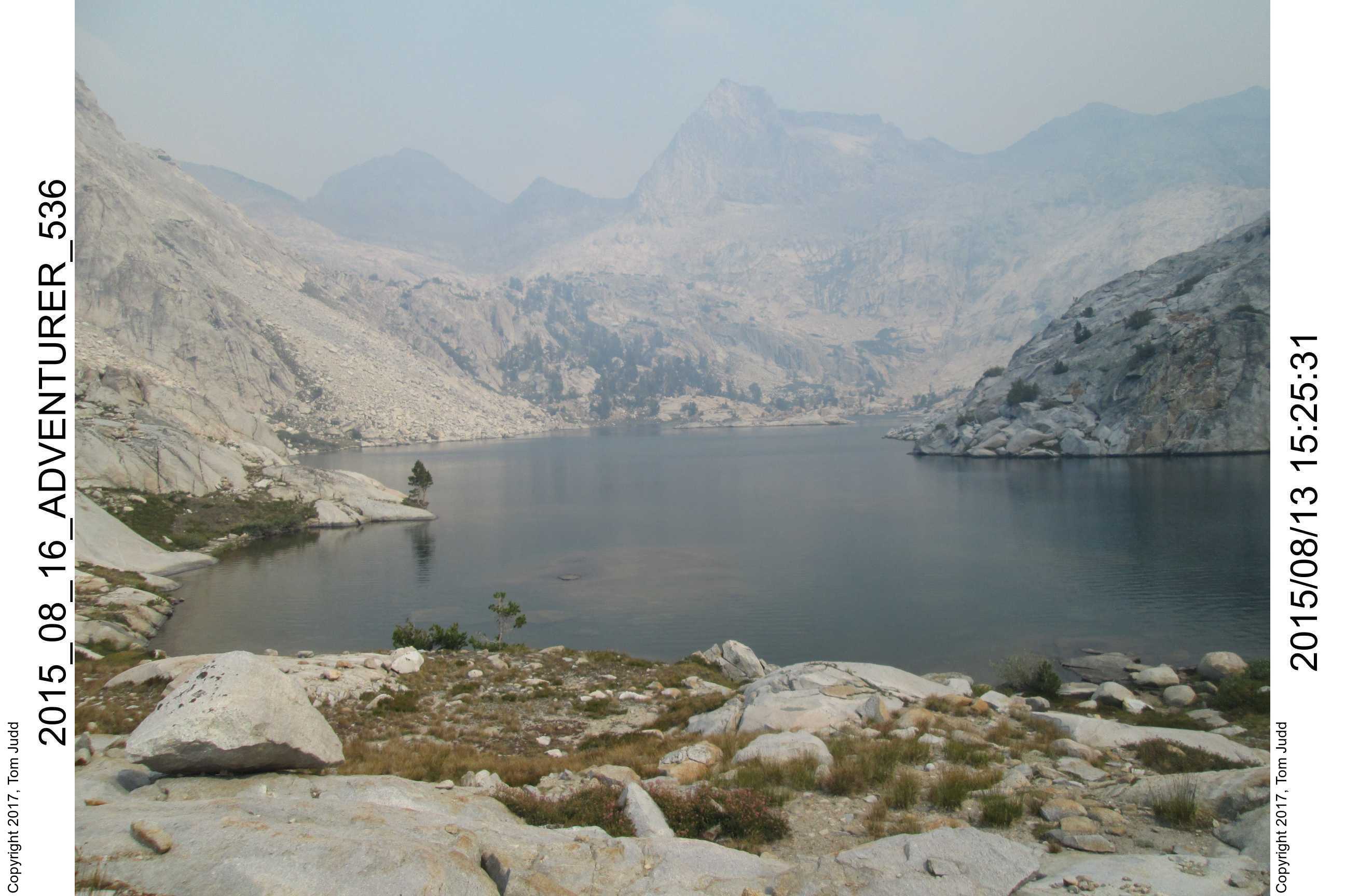
I had looked at this hike in 2008. It originally continued down Observation Creek to the Middle Fork of the Kings River before going north to hit Palisades Creek. On this trip, I abbreviated the loop and went north over Adventurer Pass instead, thinking that the path to the Middle Fork was too steep. It wasn't until 2018 that I was able to go up and down that part of the loop.
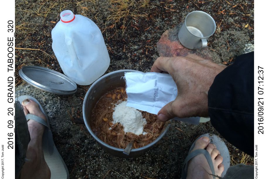
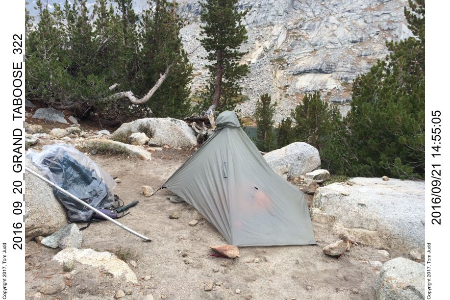
Bishop Pass would be the logical way to access the loop. But, it is easier to get a wilderness permit for Taboose Pass. In addition, it gave me an opportunity to explore three challenging passes that I had not yet visited. I planned for a long hike to give me enough time to exit Adventurer pass should I run into delays. Wally was coming with me for the first two days, so he could carry our food for that period. I carried an additional eleven days of food. I could fit only ten in the bear barrel, so I carried the spagetti outside. Dried spinach and cilantro were outside too. As the food went down, I was able to stuff more in the barrel, so by the time I was at bear elevations, all the food would fit. The food was all no-cook except for the spaghetti. I brought along my pot, butane, and burner mostly for emergencies. (+700 grams). For a tent I used my poncho tent (Six Moons) plus the new bivy. I also brought two cheap plastic raincoats, and lotsa plastic bags. The total weight was under 50 pounds (23 kg) including 2.5L (5 lb.) of water.
One reason for the date of the hike was to get a full moon at the critical part: getting over the Upper Basin Crossing. It would provide light in case I got stuck coming down late, made it feasible to try for the pass on the third day.
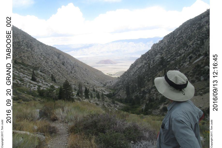
Day 0, Lone Pine
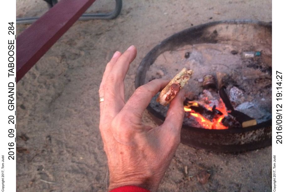
12.Sept.2016. My Official Weight 163.4 pounds (74 kg). I went out to breakfast with Kay at McDonald's. I also ate pancakes in the Lone Pine McDonald's for lunch, and got a McDonald's cheesburger for dinner. It was a McDonald's day. I was in Lone Pine for about an hour before Wally arrived. We then drove up to the Taboose Creek campground and got a campsite. The wood fire was good for roasting marshmallows. The Hershey's had melted. That was good. I found that I could squeeze out the chocolate onto the graham cracker for a perfect s'more. Tasted great. We were in bed by 8 PM
Perfect S'more made with melted chocolate:
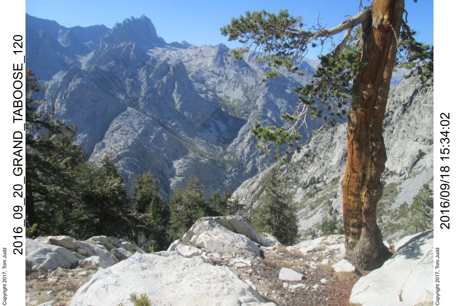
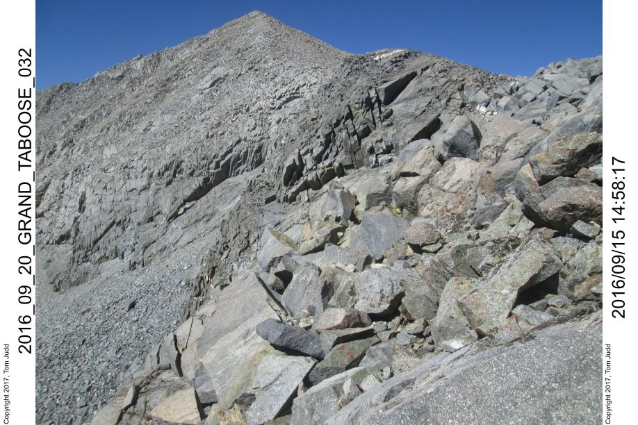
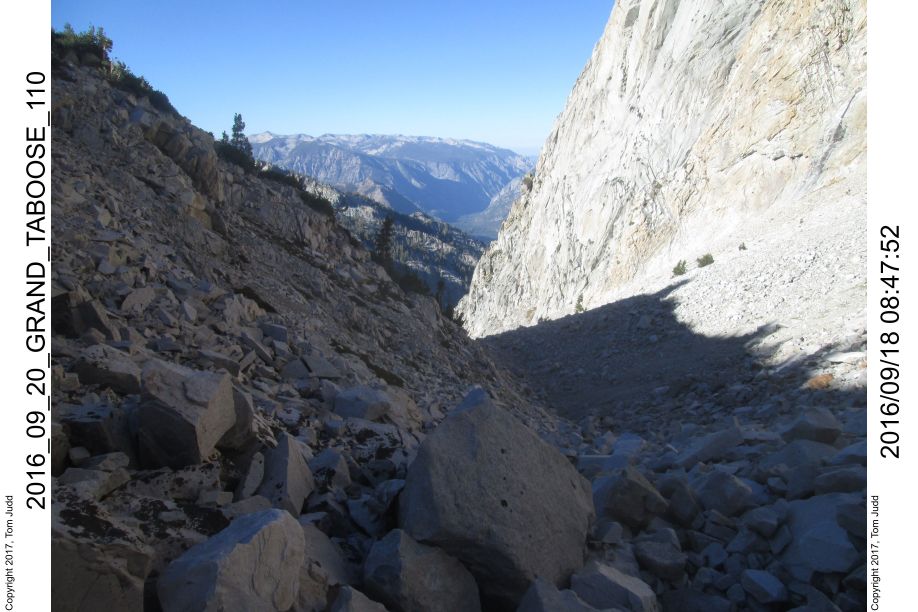
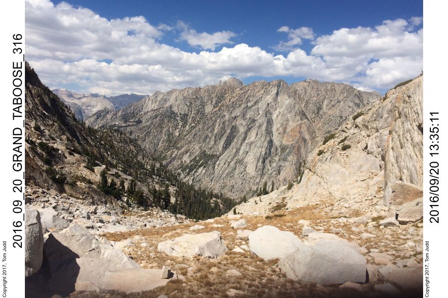
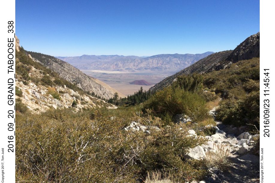
Day 1, Up Taboose Creek
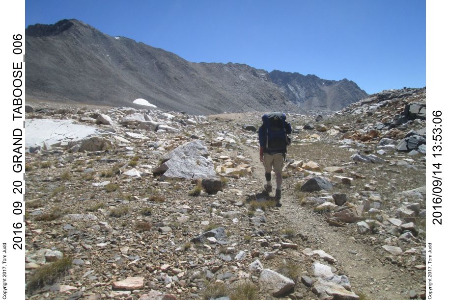
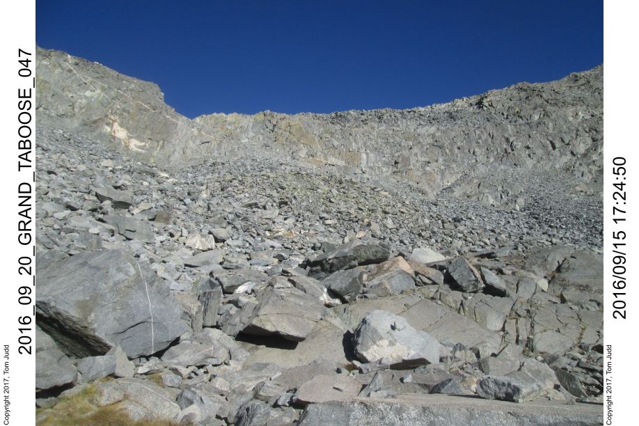
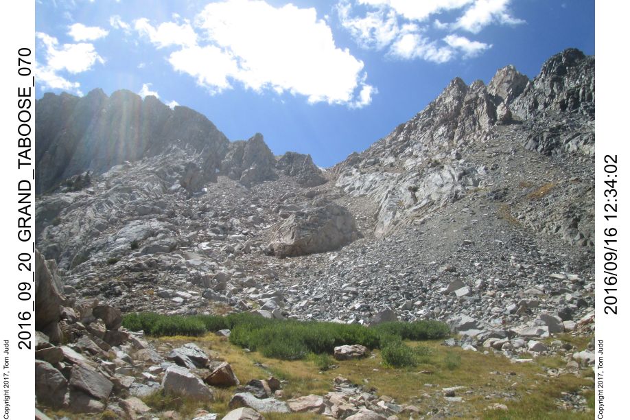
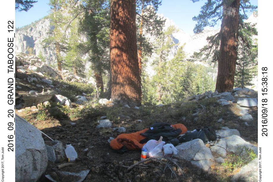
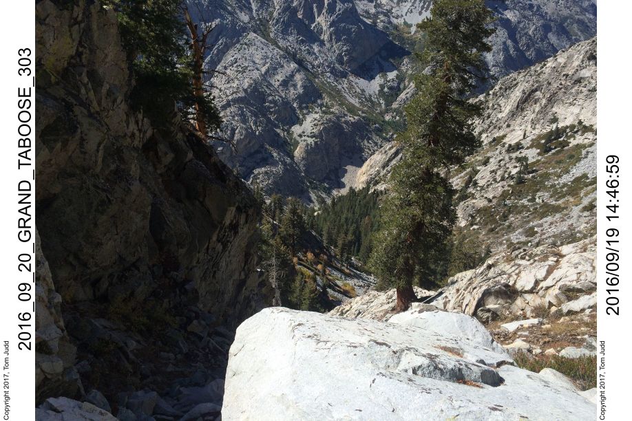
13.Sept.2016. First hiking day. I have been up Taboose Creek several times. Overall, it takes about eleven hours for me to get from the trailhead to the pass. I plan on two days to do the 6000 foot (1830 m) climb. The ride from the campsite to the trailhead is quite rocky and bumpy. It is doable in a small car though. Takes a careful hour. We started out from the trailhead (elevation 5426 feet (1650 m)) at about 8:45. We stopped in a small clearing at 8880 feet (2700 m) elevation to camp at about 3:00. That was just over 6 hours of patient climbing. Nevertheless, I was exhausted. It had snowed/hailed just a trace on the way up, but the sky cleared by the time we had finished dinner. Collapsed in my sleeping bag at 7:00.
Wally looking back down Taboose creek:
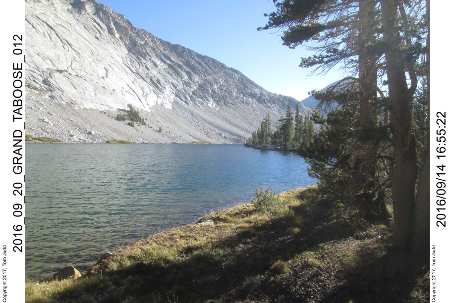
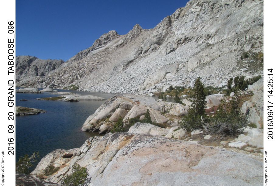
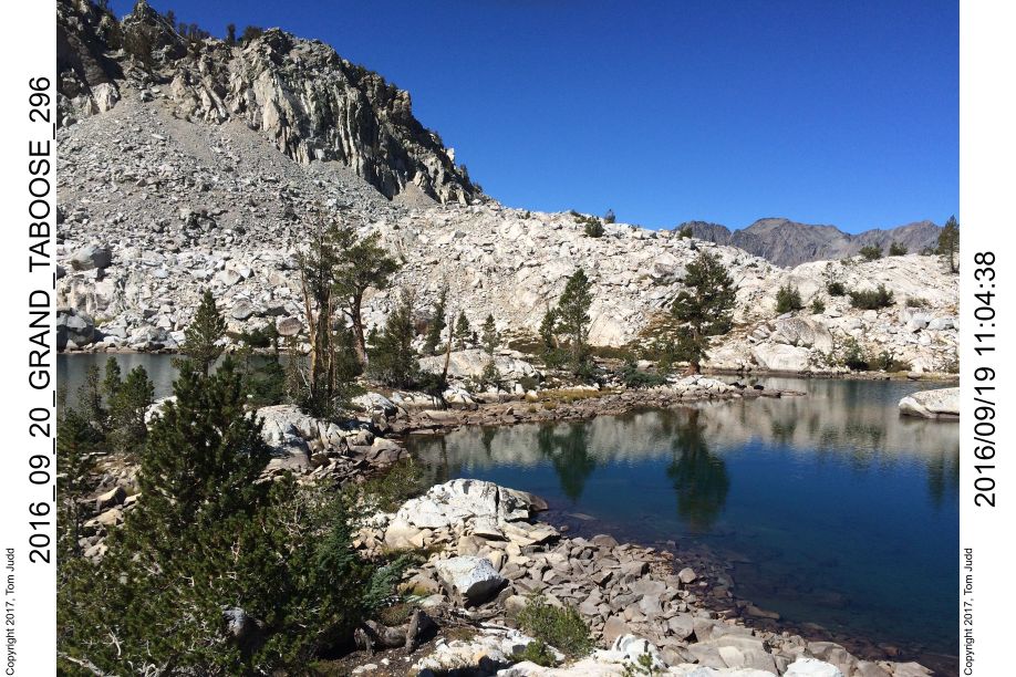
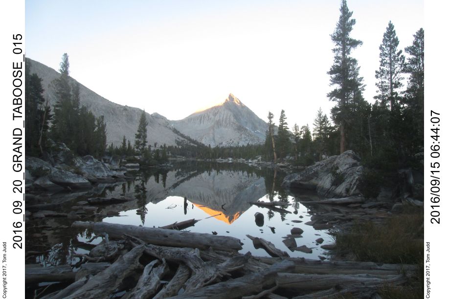
Day 2, Taboose Pass, Bench Lake
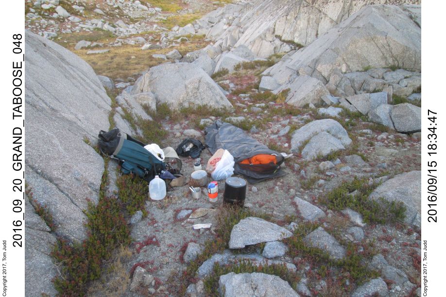
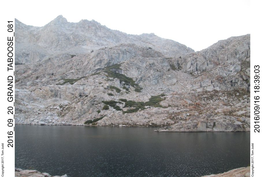
14.Sept.2016. Up at 6:20 started on the trail at 8:20. Got to the pass at 2:00, about a 2400 foot(732 m) climb from Camp 1. Hiked down and lost the trail for a bit. Found the lake at about 5. Dinner was good: polenta, sausage, and onion. In bed at 7:04. We were concerned about Wally getting back down the mountain in one day, so we agreed to start early: try for 5AM rise.
Backcountry Campsites
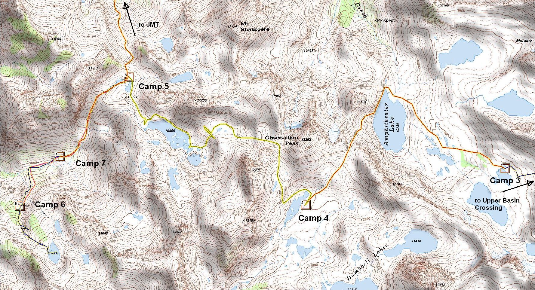
Day 3, Upper Basin Crossing
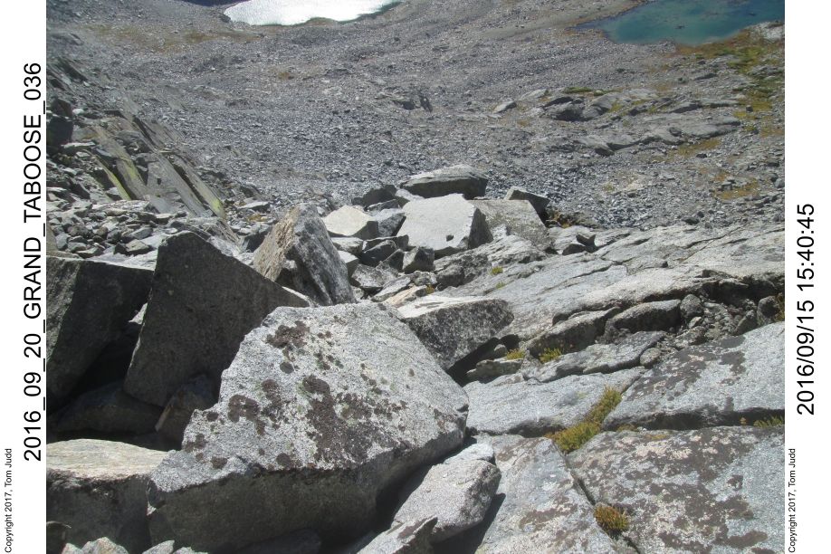
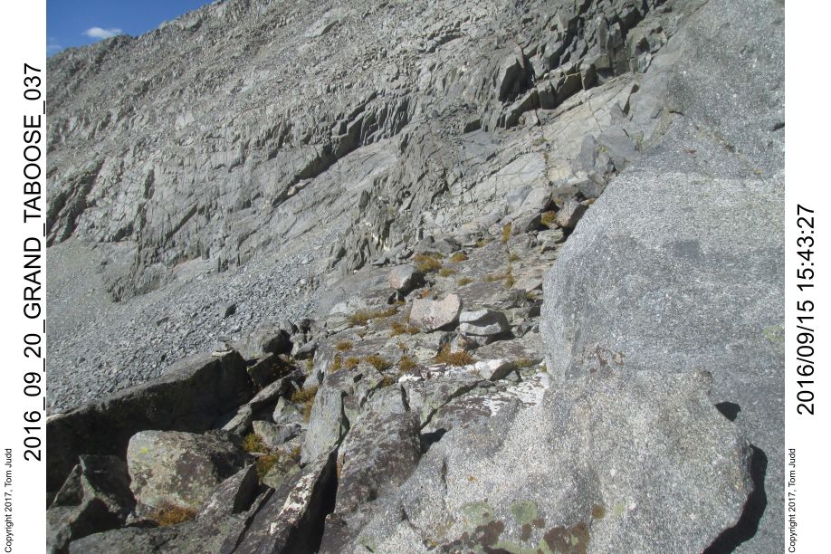
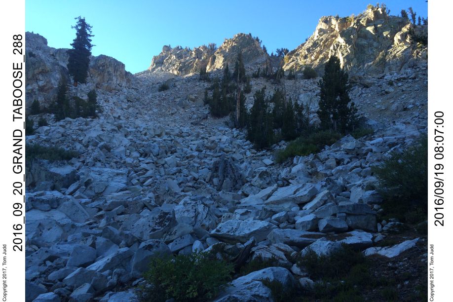
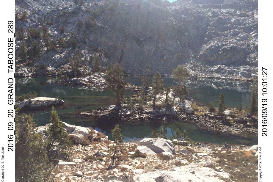
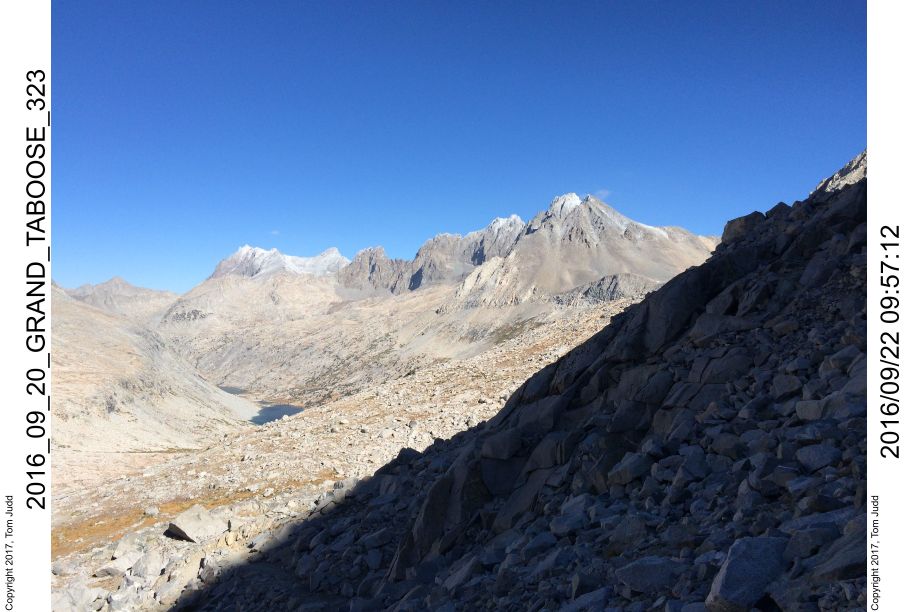
15.Sept.2016. Up at 5, on the trail at 6:40. Water froze a bit in the bottles overnight. It took an hour to get to the JMT where Wally and I parted company. In an hour I was down past Muro Blanco. I veered off the JMT to the left at about 10:50 and started off-trail to the Upper Basin Crossing. I circled around to the left and landed above the big lake at about 1:00. Paused to sterilize some water. I needed water if I was going to chance going over the pass today. I was counting two hours up and three hours down, starting at two PM. That would get me to a campsite before it was too dark. If I got hung up I would need water. I arrived at the pass at about 3 after an uneventful hour and a half climb. I poked around for about 40 minutes looking for the easiest route. Started down the steep face at 3:30 and was on the talus to the right by 4:00. I think it would have taken 5-10 minutes without a pack once you knew the way down. From there it was about an hour and a half to get down off the steep rocks. It was hard and tiring because the rocks were large. It was another half hour of medium steepness before I arrived at the first lake.
A sandy area amongst the rocks at the first lake was campsite number three. I was extremely pleased, since I was a half day ahead of schedule at this point. I called Kay with the satellite phone. Wally had made it down safely and was enjoying a hamburger. His muscles were quite sore.
I was more anxious about this pass than any other on the trip. I was quite relieved to get down. It was about four hours from the lake on the other side to this campsite. I read the description of the descent down the western face of the Upper Basin Crossing (High Sierra Topix cgundersen). I am adding some details below so others may make it faster and with more confidence.
Path down steep western face of the Upper Basin Crossing
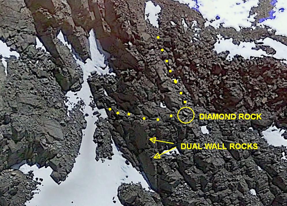
Travel down the gully about 150 feet (45 m) until you get to a pair of diamond shaped rocks that shine brightly with the glint of the afternoon sun. Then turn right (north). See dotted yellow trail in Google-Earth screen shot.
Looking north from Diamond Rocks: Upper flat rock in center dead-ends; skinny ledge on lower left wraps all the way around. It goes along the top of the highest wall rock before turning into the face of the mountain. (Wall rock = Big, flat, and vertical: like a wall)
Looking back. Took half an hour to get here once I got on the slope. Trail slants down to the left from the top of the wall rock in the center.
Looking back. Took 90 minutes to get here after I got off the face and was on the slope. If going up this way, keep the crocodile rock (white figure on the face of the rock) on your left.
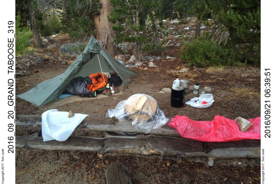
Comfortable camp after a tiring hike. I like to separate my equipment into reusable plastic grocery bags; yellow=cooking, tan=electronics, white=sanitation etc. Unfortunately, the tree-hugging, pot-smoking, moonbeam governed voters of California have made grocery bags illegal.
Day 4, Cataract Creek Pass
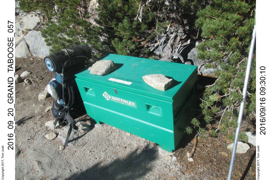
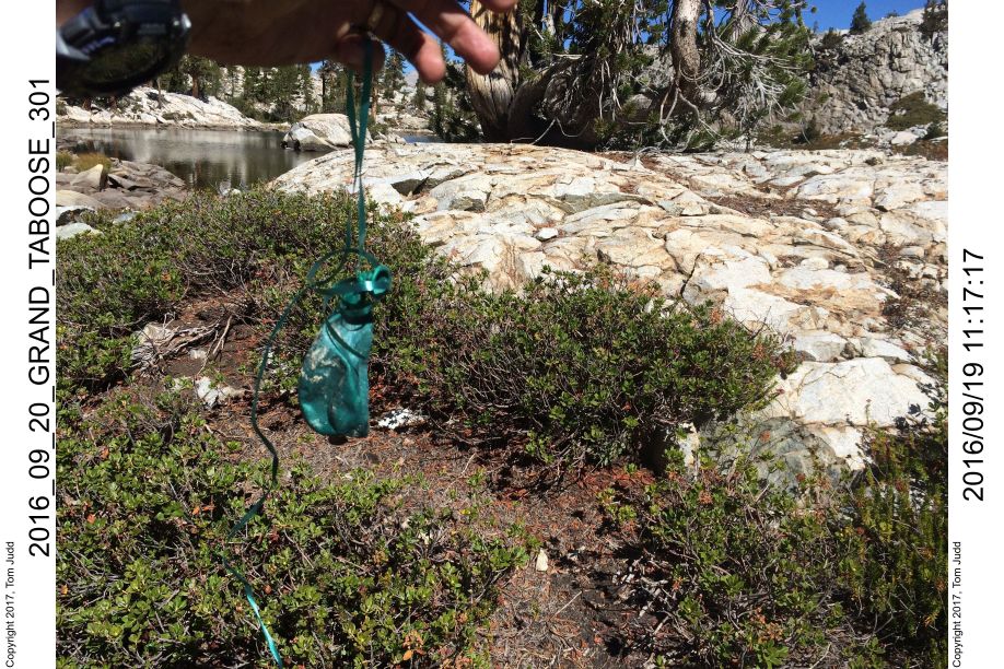
16.Sept.2016. This was a worrysome pass since I had never been over it before. Turns out it was quite easy. I was up at 6:23; Overnight low 28.1 (-2.2C). Breeze makes it cold. Ready to go about 8:00. Hiking for about an hour brought me to a surprise: a big green box setting up on a knoll. Plus, red streamers were tied high on a tree branch to enhance visibility. It was quite a surprise for the wilderness, especially since it is so remote. I would suggest: Leave No Trace. If one must, I recommend dull brown paint next time, and use GPS/map instead of streamers to mark the location.
Day 4, Cataract Creek Pass II
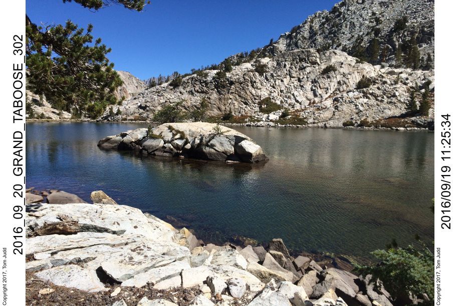
Got to the tip of Amphitheater Lake at about 10:20. This is where I had originally planned for campsite number 4. I was way ahead of schedule. Looked like I could actually get to campsite 5 today, just over the pass. The problem is that it looked like there was a snow cornice blocking the pass. I loaded up on water in case I couldnt get over and had to camp in a dry place. I thought there might be water in the tiny green valley about half way up, but I couldn't be sure. Started the traverse of the far shore at 10:48. Once past the last mound of rocks, the slope was firm, easy to walk up; so I angled up to the valley from there. Easy until I got to the brush, then worked a bit to get by. Arrived at 12:20. It was about 2 hours from where I started at the tip of the lake to the slot.
Day 4, Cataract Creek Pass III
There was a wide slot (tiny valley) sufficient for a campsite just past the brush. There was still water trickling through, even though it has been a dry year. Continued on up to pass at 12:40. Total climb from lake to pass is about 800 feet (250 m). Did the last 400 feet in about an hour. The snow cornice did not extend all the way across. There was a 2-3 foot (1 m) pass with solid stone footing that was easy to climb. From the start at the tip of the lake to the pass was about 3 hours.
Day 4, Cataract Creek Pass IV
I started down from the pass just after 2PM. There were many ways to get down, I just went straight. It was a bit steep in parts, but not difficult. It took a half an hour to get to the lake towards the right that had the shape of a fish. I explored the drainage at the caudal fin, then went along the underbelly side of the lake until I found a wide sandy area suitable for camping. I was early, and had thought of starting the climb up to Observation Peak Pass. But, I did not know if there would be any place to sleep. Nor could I see a clear way up throught the willows on the other side. So I camped at the lake, 10949 feet (3340 m). I had plenty of time. Dinner at about 5. Got a text on the satellite phone from K: "clear, getting windy thurs". Hmmm. 7:00 last glow on mountain. Clouds in the west are pink underneath.
Day 4, Cataract Creek Pass V
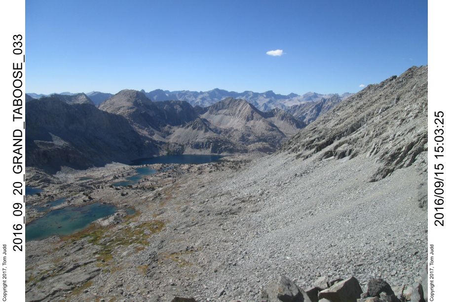
Day 5, Observation Peak Pass
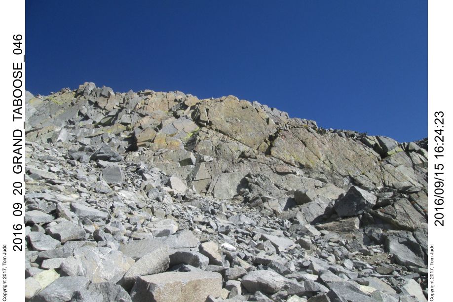
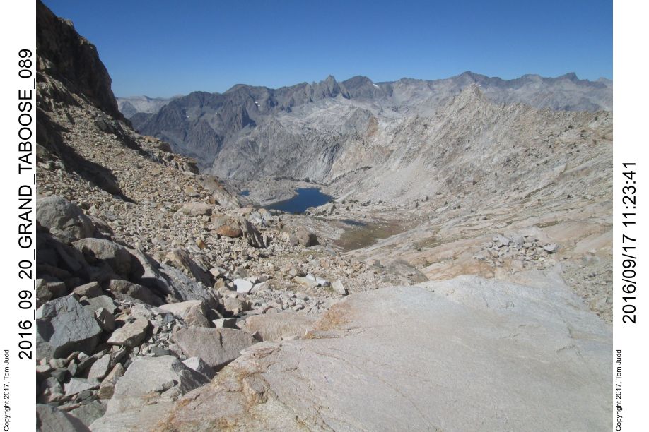
17.Sept.2016 Overnight low of 28 degrees (-2C). This is the third new pass for me in just as many days. Started out at 8:30. There were two willow thickets to get through. On the first I got lucky. A small creek created a crack in the brush that I slipped through. I then circled to the left and missed most of the next barrier brush. The hardest part was a 3 foot rock topped by a willow that had a thorn bush growing through it. Once past that I was in a small valley, easy walking uphill to the rocks (10:00). I then continued on up to the pass, arriving at about 11:15 (11600 feet, 3530 m). So, an easy three hours from camp to pass. There were some places to lay out a sleeping bag, and water in the slot lake in the rocks. So, I could have continued yesterday afternoon and still found an overnight spot.
Day 5 Continued, Lake 10565
There is a wonderful view of the ominous devil's crags from the pass. The rock is black, part of the black divide, black giant, 13.3K feet is to the right at the end of the black line of peaks. Getting down was slow and laborious. I finally got off the rocks and reached a flat area with a small lake at about 1:15. Two hours. I searched all along the cliff until I spotted the slot and grassy slope that I had read about. Once I found the path it was easy going down. It looks steep in the picture, but all the footsteps were firm.
Day 5 Hard Part
The hardest part was still ahead, for I had to make it by lake 10565 to reach my next campsite. It appeared that a lake-level traverse of the north-east shorline would be easiest -- except for the field of huge boulders near the end.
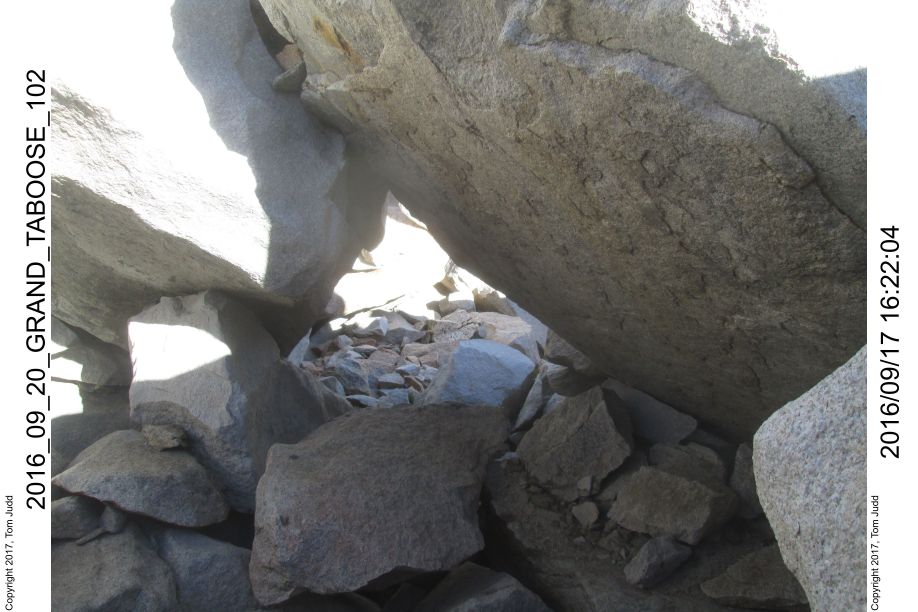
As expected, it was the final boulder field that gave me the most problem. It took about an hour to get to the start of the boulders and another hour to get through them. I had to climb way up over and down. The last 20 feet was frustrating; I tried three different ways, all too steep, too far, or too dangerous. I finally circled back and found a rock tunnel that I got through.
Day 5 Satisfaction
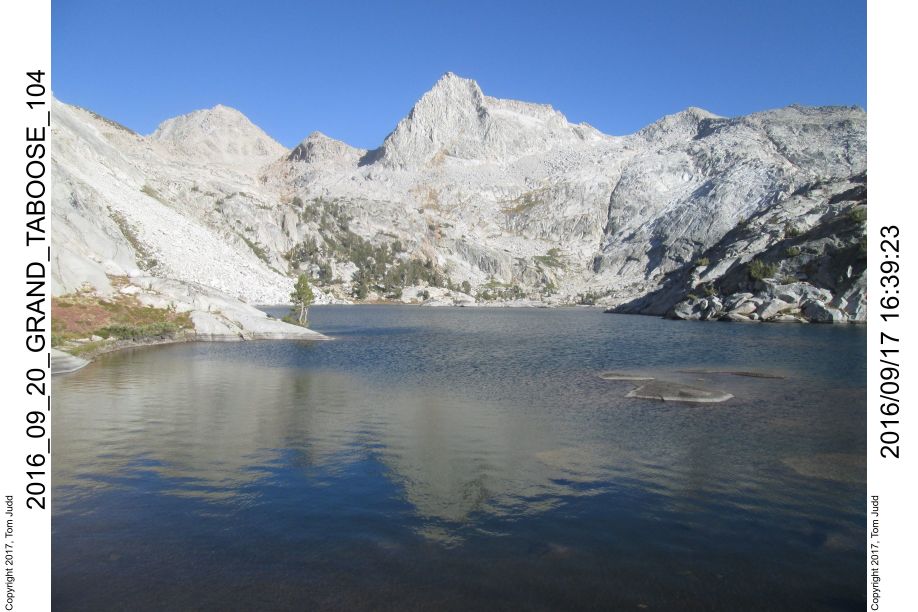
I got to the north end of the lake at about 4:30, about 5 hours from the pass. I was very satisfied, since I had stood in the same spot a year earlier approaching from Bishop pass. It meant that an interesting back-country path was doable from Taboose to Bishop pass. It took another hour to get to the night 5 campsite, at the lake just below Adventurer Pass.
After I had gotten settled I noticed a length of thin white rope about 20 feet away. I took it with me. I had accidentally dropped it last year when I had camped in the same spot. Satellite phone to Kay. I do it regularly when I am off-trail to reassure her. Besides, I get lonesome.
Day 6, Approach to Sea Gull Island
Western Shakspere-Observation Drainage
18.Sept.2016 6:15AM Temperature: 32.4 (0C). I boiled two liters of water. I had retrieved a gallon but when I went to sterilize it I saw that there was a lot of debris in the water. I usually use water pills and a steri-pen. Started out about 8:15 to descend to the valley below via the rock chute all the way to the right.
I generally hugged the wall on the left going down. There was more dirt (hence fewer rocks) than the center which was all talus. Got to a level spot at 9500 feet (2900 m) at about 10:40. I circled to the right and followed a game trail through the willows. Got into the trees. It took an hour to get to the valley floor at about 9200 feet (2800 m). I got really stuck coming down. I had remembered a creek with black rocks from my visit here last year. I had followed it on the way up and I thought I could now follow it down. I got stuck in a blind with 5 foot boulders on three sides with very dense willows on top and between them all. Spent about 15 minutes moving 20 feet. Evidently, I had cut over to the black creek a bit too soon. It was terrible. I got to the Valley Rock camp site at about 11:45. I will use this site on the way back up.
Day 6 II
12:50 I loaded up on water not knowing if I would find a source on my way up to Sea Gull Island. A bear was making noises tugging at bark on the other side of the creek. I made noise so I wouldnt surprise him. I could see the brush shake around where he was working, but I didnt actually see him. There was a lot of grass that had been matted down all around this section of the valley. I was thinking 'bear'.
Day 6 III
3:31. I struggled up through the brush on the hill; it didnt get easier until I was just in talus. I never thought that I would say that talus was easy. It took a long time, but I finally found a campsite and flowing water at about 3:00. Much of the water travels under the rocks so I was fortunate to find a 2 inch gusher near the campsite. It was very nice, soft, but seemed to be somewhat sappy. I stopped since I was unsure of campsites further up. I figgured I could do a daypack up to the lake tomorrow. Called K on the sat phone at 6:30. My camera stopped working so the rest of the photos are from my iPhone. Hot climb up through the brush, trying to hydrate.
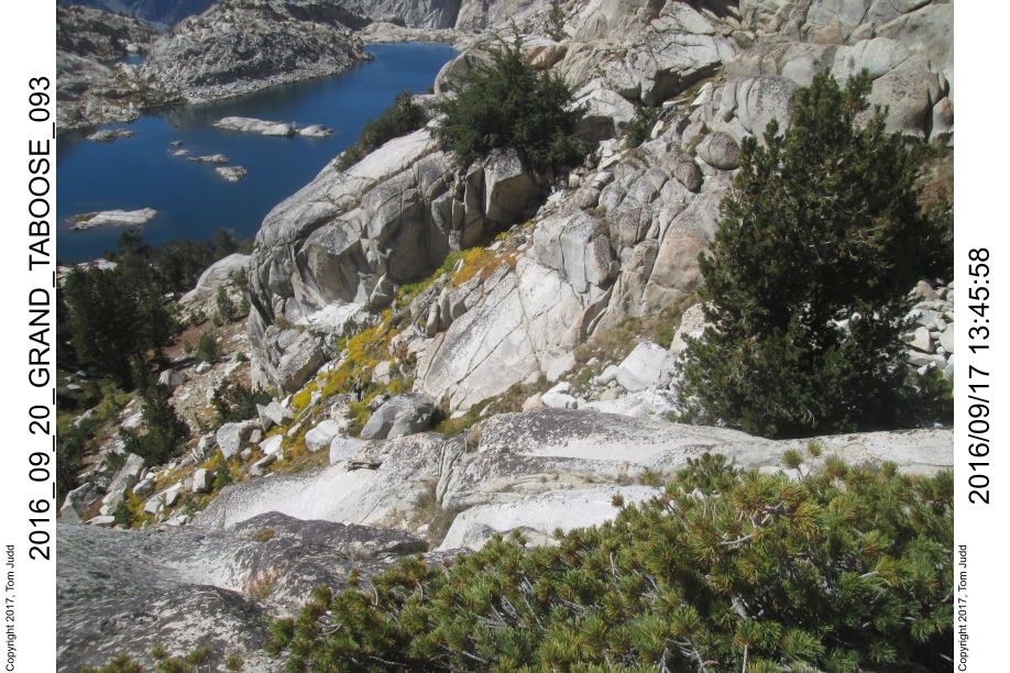
Day 7, Sea Gull Island
19.Sept.2016 I woke early, at 5:15 it was 45 degrees (7.2C). Plan to go up to the island with with a partial pack. Left bear barrel etc behind. Started up a little after 8:00AM. I tried going up a short-cut gulley. Right at the top, with about 10 feet to go I came across a section that looked like it had some exposure. I turned around and got back to the apex where the trail divided. I proceeded up the next gulley and made it. I put up ducks along the way once I had crested (I removed them all on the way down)
10:00 view of seagull island and lake. About two hours to go up 800 feet (240m). Not bad over talus, and considering I had turned around in a false gully.
I did not see any obvious campsites on the way up, nor did it look like there would be a good spot on the island. Best seemed to be on sloped rock hill. Made my way down to a spot nearest the island and verrry carefully waded across. Water at its deepest came up to my crotch. I was thrilled to be on the island. I had seen it on a topo about 24 years ago and was intrigued by its shape. It looked like a flying sea gull. I call the tiny speck above the gull 'apostrophe island'. I walked around clockwise, and on the way back, found a helium baloon that had popped and landed on the island.
At first I was shocked to think that someone had been on MY island and had left some trash. But after inspection, I realized that the colored wire I saw was actually a ribbon from the balloon. I was on the island for about an hour: 10:30-11:30.
11:56 Started back. There is an obvious notch that you go through to get to the lake, so I followed it and then picked out my ducks. 1:37 back at camp. All items collected. I had place them where I thought the shade might be but the bear barrel ended up in full sun. 2:33 setting off. On the way down I was mulling over the descent into Simpson valley. From a bluff I could see that it was extremely steep. Tried to stay in the talus on the way down. Wading through brush is bad.
4:18 valley rock campsite about 9100 feet (2774m). This is where I had camped last year. On my way to get water I found another balloon! I think this was the one of which I found a piece last year. This one had the UPC code on it so I could concievably track the age.
Day 8, John Muir Trail
Return to Civilization
20.Sept.2016, 6:13AM 38-39 degrees (3.5C). It was a full moon on the 15th. Now it is rising later and is overhead in the morning. It is still more than half full. Started out just before 8:00AM. Got up to campsite 5 just before noon. It was a 1380 foot (420m) climb. It is another hundred feet up to the pass.
 12:25 Adventurer Pass, about 10600 feet (3230m) . The last time down I
took the slot all the way to the left. It was quite steep. This time I
started in the middle and slanted down to the right. No difficulty,
except when I got off the steep part and started through the Boulder Bowl.
1:29 Over the lip of the boulder bowl. About an hour to go 1/8 of a
mile.
Horrible boulders.
12:25 Adventurer Pass, about 10600 feet (3230m) . The last time down I
took the slot all the way to the left. It was quite steep. This time I
started in the middle and slanted down to the right. No difficulty,
except when I got off the steep part and started through the Boulder Bowl.
1:29 Over the lip of the boulder bowl. About an hour to go 1/8 of a
mile.
Horrible boulders.
Day 8 II
2:02 Once past the boulders and a rim of rocks you can find two grassy areas on the right going down, then duck into the trees on the left when the canyon gets steep. I did this last year. Going down through the rocky duff is relatively easy.
2:54 I passed a campsite on the way down from Adventurer Pass. I had seen it last year. It had a weak flow of water now, but enough to boil. Recall in 2014 I walked all along the face of the canyon entrance but couldn't find any water. That suggests the flow could shrink further in a dry year. If you wanted to hike up from the JMT on a dry year, you would have to make it all the way over the pass to get water. It's a 2000 ft (600m) climb from the JMT. 3:42 Within sight of the river, cannot pick out the trail though. I remember from last year that it seemed to take a long time from here. You can see the goal, but it still takes a while to get there. An old forest fire left many trees down, so you have to negotiate through the pick-up sticks.
Day 8 III
4:18 river 4:21 JMT. I was able to just walk across the river on stones and high gravel. Last year I had gone a month earlier, there was more water in the river, so I had to use my sandals; there was more water in the creeks too. 4:36 Found the campsite that Rick and I had used last month. I was staring at my pack thinking of putting up the tent because it looked like rain when the first drop fell. I used the pink raincoat, put the clear one over my pack, and got the tent up with bag and bivy and miscelaneous inside. I boiled two liters of water while it was raining. In my tent while raining at 6:11, outside while it had stopped at 6:40. The rain stopped and the sky was clear and starry by the time I got up to pee at 12:30. The difficulty with this poncho-tent is that it saggs. That dramatically reduces the volume.
Day 9, Palisades Lakes
6:44 21.Sept.2016, 8600 feet (2620m) Spaghetti for breakfast. That and the wetness made it a slow start. 9:16 Start. Kay had been texting me the weather via the satellite phone. There was a forecast of high winds (gusts 50-60 mph, 88kph ) tonight with rain. So, I was anxious to find a campsite once I got to the palisades lakes. Stopped early 3:20. It was too far to get over Mather pass with the storm coming. Supposed to be high wind and rain. I put the tent up with heavy rocks at each corner. I then thought the tent might fare better in strong winds if the pole were down. Took it down, and to control the flapping, I tied my shoelaces to the peak and put a water bottle in the boot to hold it all down. The support loop from the bivy kept the tent out of my face. Rain from 5 to 7PM. There was some puddle in the tent because a low sandy spot took time to drain; but nothing got wet. Some hail.
Day 10, Mather Pass
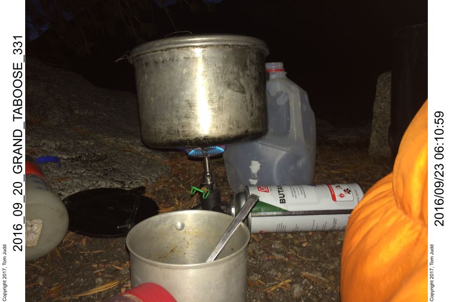
22.sept.2016 6:30 Wind dried the tent off, now condensation inside the bivy. Buried the remainder of the spaghetti under a rock that look like it had toilet paper. That is the problem with going along popular trails 8:00 start. Cold, so I was wearing both my coats. 10:21 Mather pass. It is so cold that the water in the bottle is slushy. 11:17 Down off mountain. Stop for snickers in boulder field. good trail. 11:34 First lake camp site. It would have been 3.5 hours more to get to a campsite if I had continued last night. Probably more because I was tired and I would have been hiking in weather. The wind was strong from the right rear so the right side of my face was cold. I hiked for awhile with my hand over the right side of my face. There was no cover to break the wind, no trees yet. 1:42 Nice rest area above the trail in trees for lunch. 2:38 Muro Blanco. 3:48 Taboose trail 4:30 Campsite about 100m below Taboose Pass. Got all setup, It is going to be a cold night. Elevation 11020 feet (3560m)
Day 11, Taboose Pass, Home
23.sept.2016 7:52 Hot coffee and oatmeal for breakfast. It was a hard freeze last night. The water in my jug froze solid. I was mostly warm. There are a number of other campsites here on the uphill side of the trail. Very nice, and tree-sheltered. Start about 8 Taboose Pass at 9. 10:03 found a water bottle going down a steep section. Some water was frozen in it. 10:38 Met will_jrob user name for high sierra topix. 11:26 snack at crossing. 12:04 half-way campsite. Doing about a thousand feet (300m) an hour downhill. 12:32 At the river crossing below the campsite I met Bruce, an IT person from Berkeley. He grew up in Vista, so he knew where I was from 1:19 Lower campsite, Snickers. 2:36 At the car. There was a group of young campers getting ready, so I had one of them snap my ending picture. 3:08 leaving trailhead. I knew from before that it takes about an hour to get through all the boulders, so I was patient. Bumpy ride. 3:57 reached highway 395. 9:38 Home. I had stopped in the McDonnalds for a hamburger, and ate it on the way. My return weight was 158.6 lbs. (72kg)! That is the first time below 160 in a couple of years.
©2016, 2017 Tom Judd.
www.juddzone.com
Carlsbad, CA
USA