2018 Aug Sierra Hike
Cottonwood to Kersarge
This is a work in progress
Intro
I had never been on JMT west of Mt. Whitney. Rick and I were planning a hike somewhere along the JMT; but being late, we had no permit. At the time, a very smokey forest fire was shutting down hiking through Yosemite. So, we decided to get up early to the Lone Pine ranger station and get a walk-up permit. We wanted to avoid smokey hikes for health and safety reasons, so southern trails were preferred.
This trip was a bit unusual for me since I usually spend some portion of the hike in the backcountry. This hike was completely on trail.
Day 1, 9.August.2018 Thursday
Rick was up early at the Lone Pine Visitor center. But when they opened, they put everyone in a lottery. So, he got bumped down a few places. Instead of New Army, we got Cottonwood pass. No problem. We drove up to the Kersarge trailhead to drop off his car. Parking was tight. The forest fire was pushing a lot of hikers south.
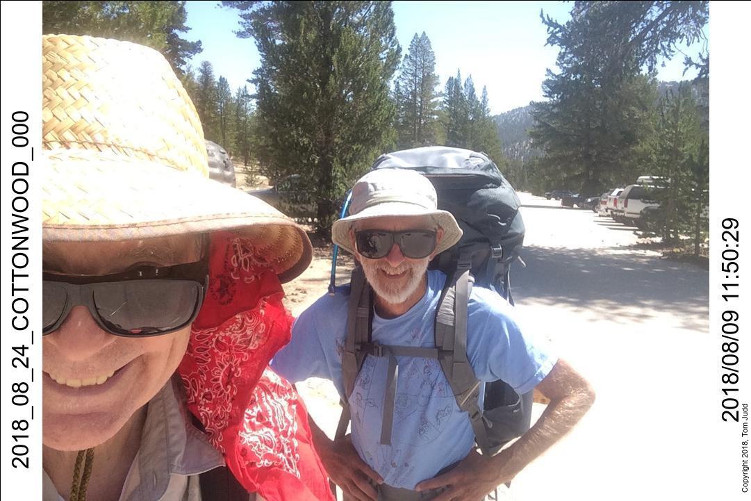
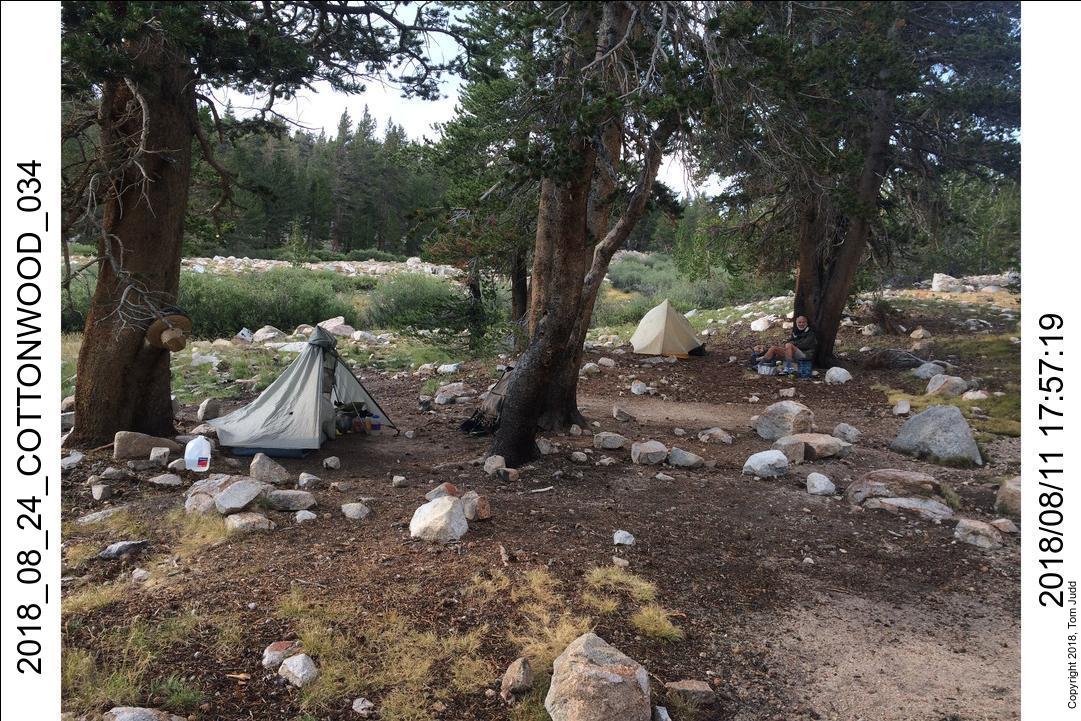
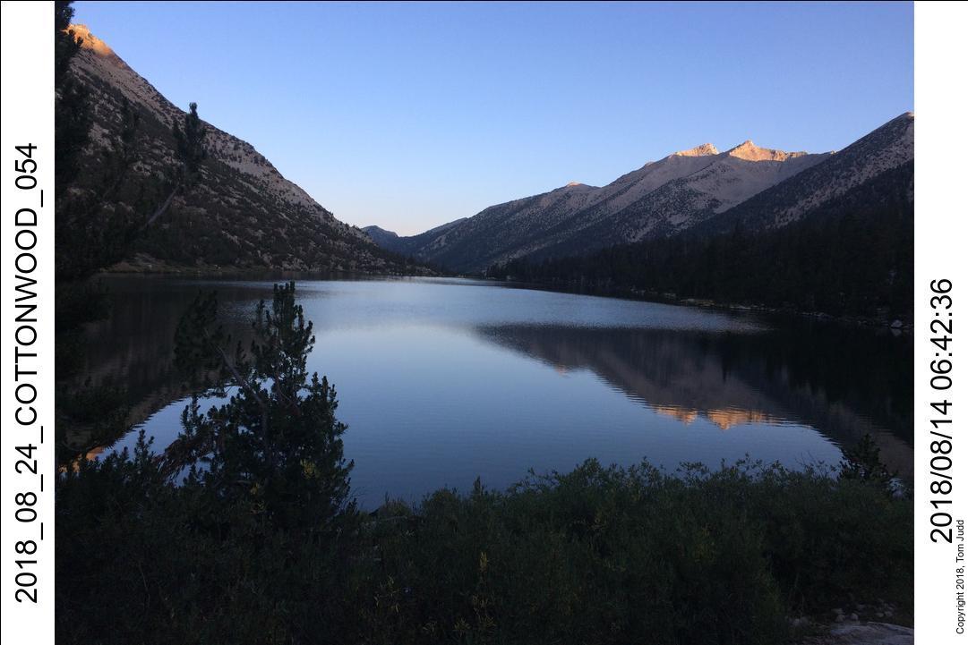
We drove back to Cottonwood and started on the trail just before noon. I was tired from getting up early, so the hike got quite hard for me after passing Chicken Springs lake at about 4:00PM. The switchbacks after the lake kept promising to end; and finally did. We went on for about a mile till we found a flat spot above the trail. No water, but we were tired. Camped at 5:30, lights out before eight.
Day 2, 10.August.2018 Friday
We were both quite tired all day. The altitde and the long first day left us both dragging. The hike itself was relatively mild. We made our way over to Rock Creek and then had a fairly delightful walk down along the creek.
Rick took a dip in the creek before we started UP the trail past the Mt. Guyot saddle. We got to the Crabtree Meadow campsite at about 5:30, snuggled in our sleeping bags by eight. Many hikers go through this campground since it is within striking distance of Mt. Whitney, the crown of jewel of the JMT experience. So, the trail got busier from here.
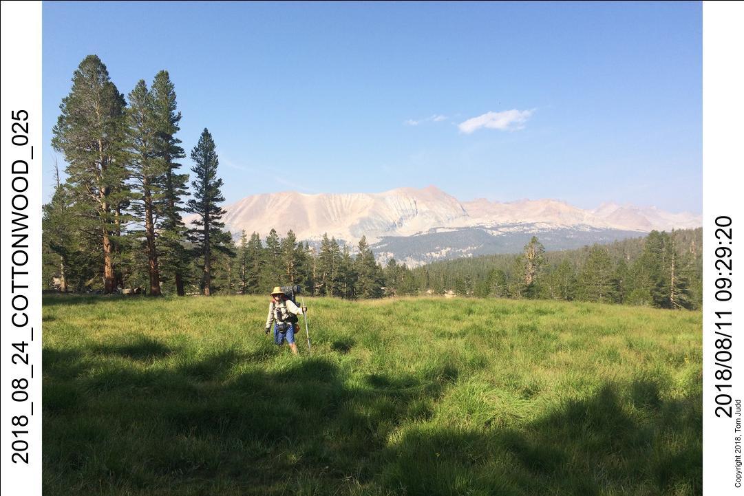
Day 3, 11.August.2018 Saturday
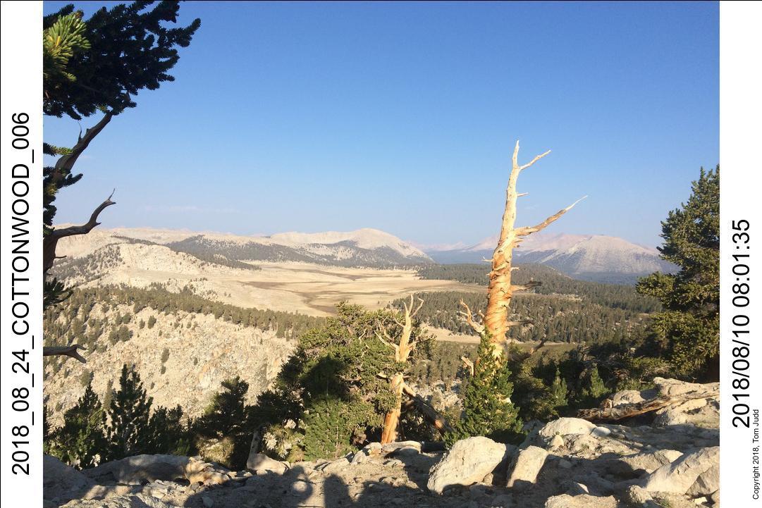
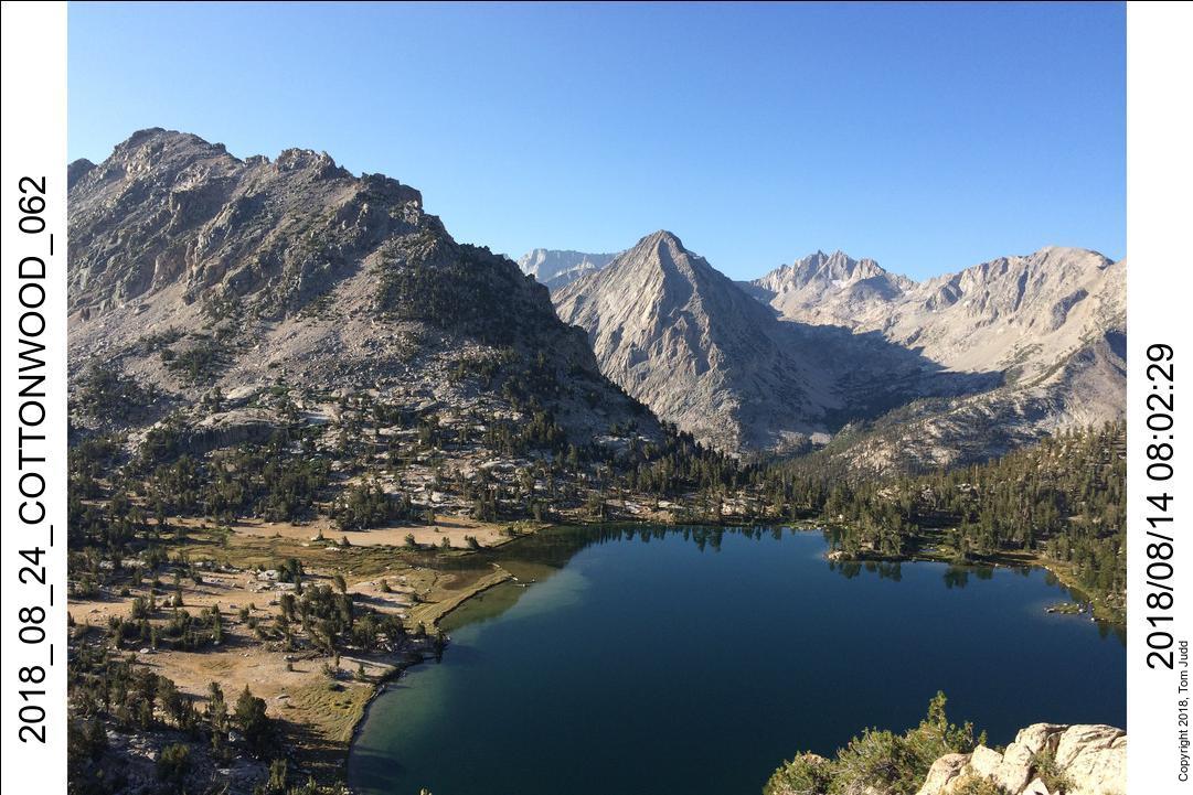
We were both feeling better in the morning. The 600 foot climb over the ridge and into Sandy Meadow went smoothly..
I was interested in the view of the Red Spur since I was planning to hike over the spur next month. Last year (2017 Sept) I climbed up the spur from the other side. A light colored gulley similar to the one I used last year can be seen in the picture above, straight up from my hiking pole. So, it looked like it would be technically feasible. Rick was a bit more skeptical. We'll see.
We got to Wallace Creek just before noon. This is where the High Sierra Trail (HST) meets the John Muir Trail (JMT). We started getting sprinkles here. They were off and on and they had an impact on our hiking plans. We originally had planned to take a lazy hike up to lake South America and the surroundings.
After we got to Tyndal creek (about 4) we talked to ranger Laura Pilewski about the weather. She indicated there would be more rain tomorrow. We thought it would be better to hurry over Forester Pass (13.2K feet, 4025m). So, we set up camp early with the plan to push on over tomorrow come rain or shine.
Day 4, 12.August.2018 Sunday
Our task for this day was to hurry over Forester pass without suffering from the weather. This is the highest pass on the JMT/PCT, so 'hurry' has to be read in context.
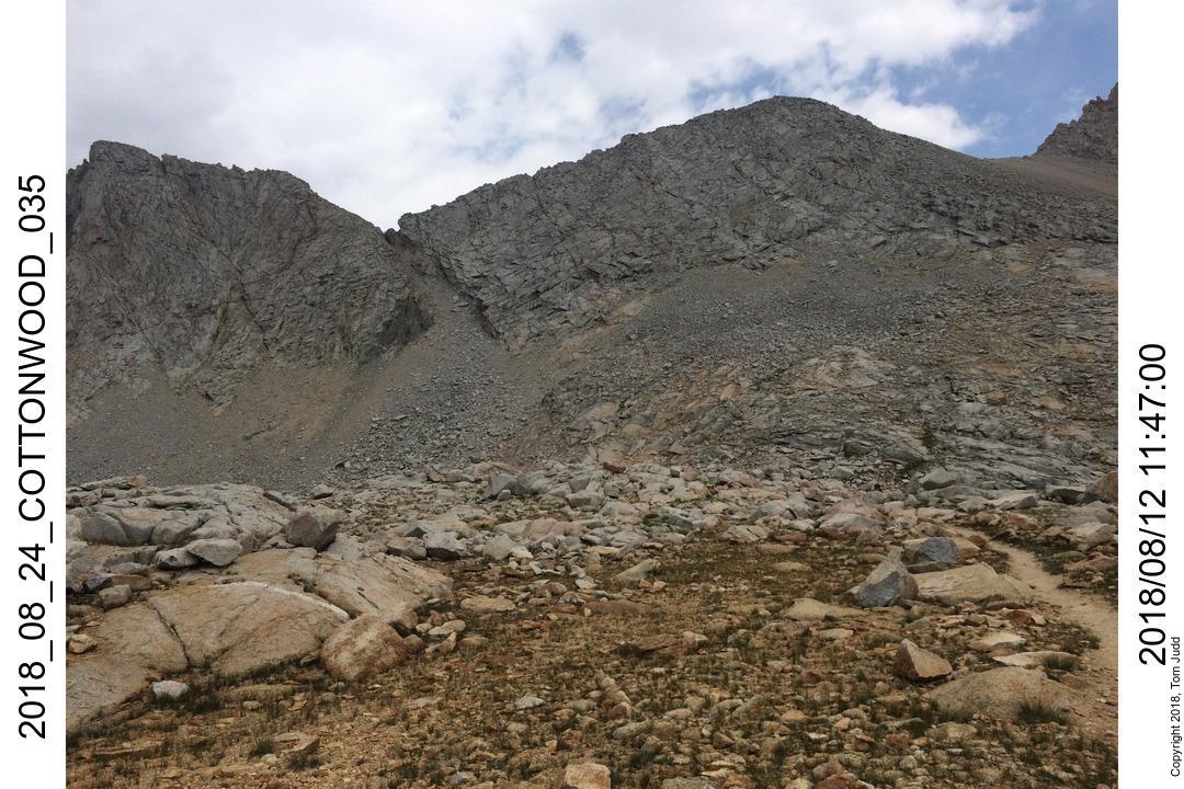
When planning hikes I allow for 500ft/hour climbing; so, a 2000 foot climb (600m) should take about four hours. That's about what it was from our Tyndal creek campsite to Forester pass. We started at about 8:30 and were there by 12:30. It was sprinkling a bit so I put on my poncho. From the pass we could see the rain squals quite clearly. We left immediately after our snack. We ignored the begging marmot.
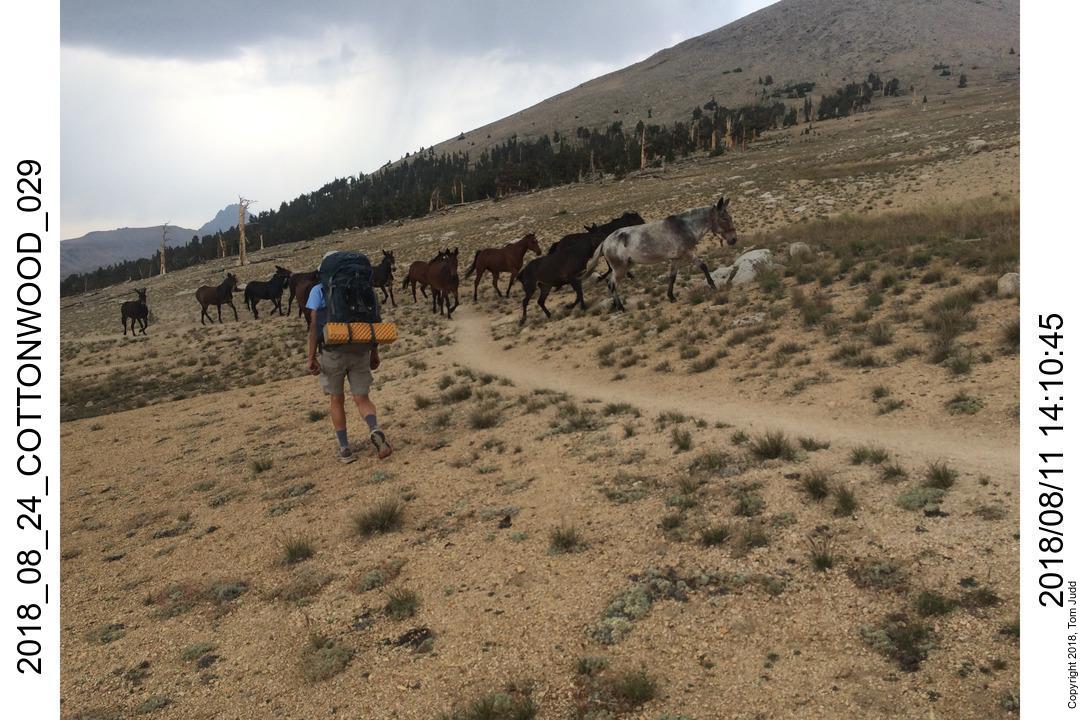
Going down I had spectacular views down into the valley. At one point in the descent the trail passes along the broad crest of a mountain. I wanted to get a picture of Rick walking ahead on the ridge with the valley ahead spread before him. A thunderclap made me think of how well my aluminum hiking pole would act as a lightning rod. So, I jogged down, with my backpack to a place where I was not the highest feature. No picture, so just imagine. There is only one area of campsites along the way, just after the steepest part and the trail turns to point down the valley. We stopped early at 3 to put my tent up in the sprinkles and wind. By 3:20 it had calmed down.
Day 5, 13.August.2018 Monday
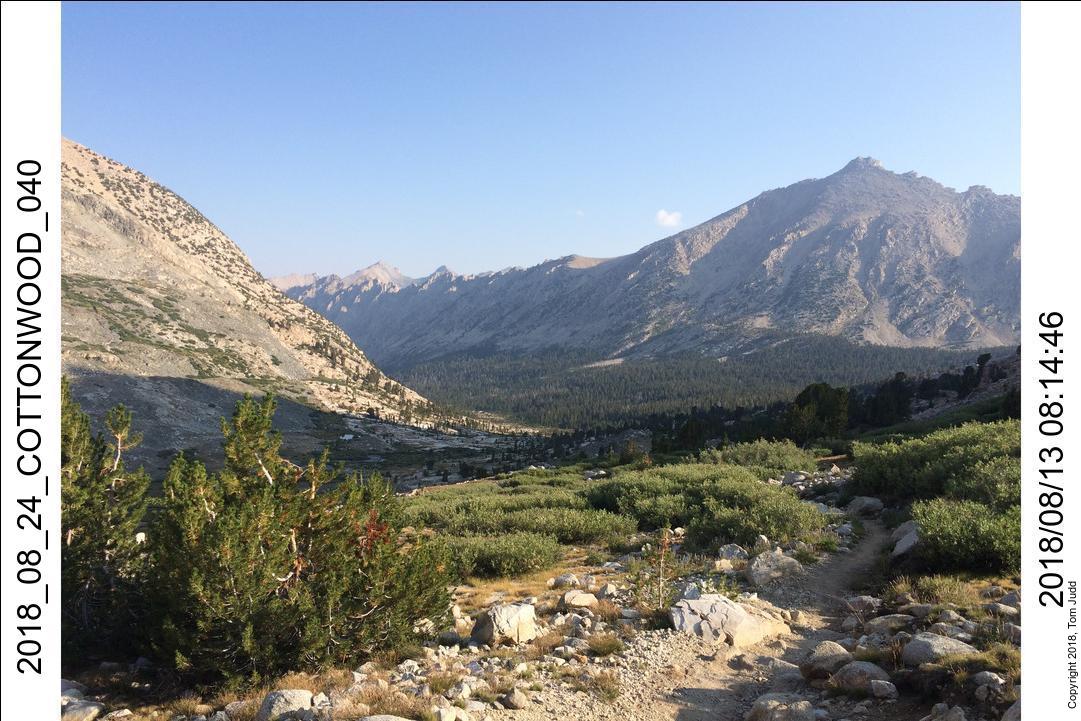
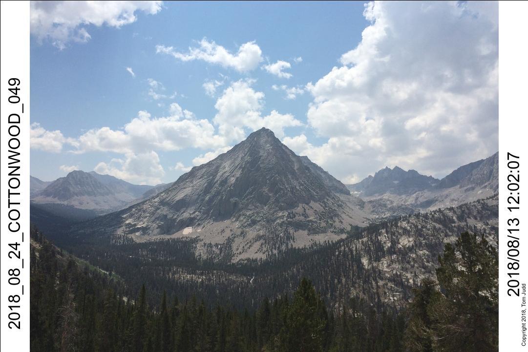
We arrived at Charlotte Lake early. We had allowed some time to explore off-trail, but our concern for the weather caused us to eliminate that portion of the trip. We had time to spare.
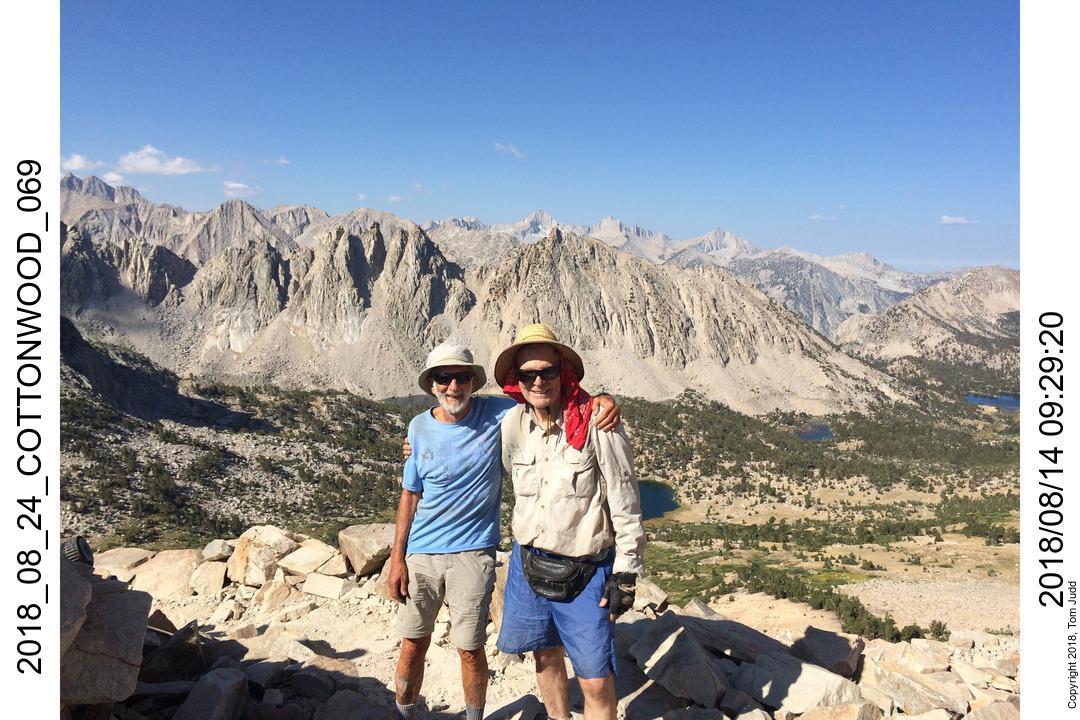
Day 6, 14.August.2018 Tuesday
We left Charlotte Lake early. There is an annoying 350 foot (100m) climb out of the lake to the trail, but since the total climb to Kersarge pass is only 1000 feet (300m), it didn't bother me as much as it had in the past. Once we got above Bullfrog Lake, the views became astounding. I could mostly keep up with Rick except for the last few switchbacks. It was a pretty day with a number of hikers all enjoying the view from the pass.
You can see the parking lot down the hill for quite a ways. So, it seems to take a long time to finish up the hike. It actually took us about 90 minutes. We lunched in Lone Pine and picked up my car. Left Lone Pine about 4PM and was home by 9PM.
© 2018 Tom Judd.
www.juddzone.com
Carlsbad, CA
USA