Four Sierra Hikes in 2022
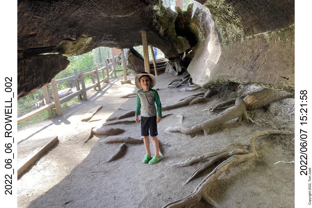
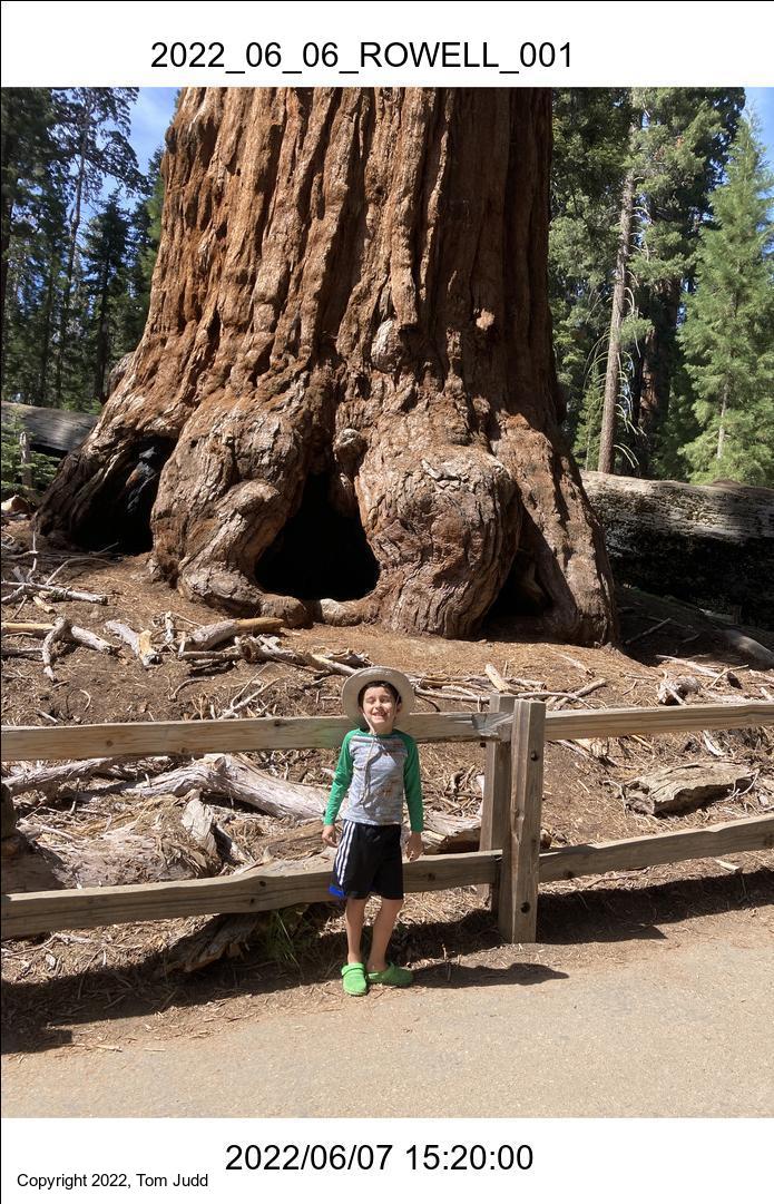
Rowell Meadow with Rafa and Wally
Taboose Pass and Upper Basin Crossing
Copper Creek, Cartridge Pass, Arrow Pass
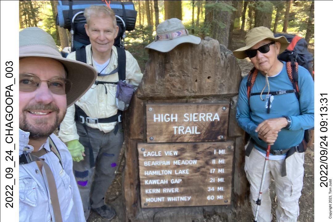
Chagoopa Plateau with Wally and Dave
A number of life events took place this year. My mother died at 97 years soon after I returned from my August trip in the sierras. I texted everyone to wish her a happy birthday in late August while I was still out in the back country. I am glad everyone got a chance to reach out to her.
I also went hiking with my grandson Rafael. My three other grandkids have already gone on Sierra hikes with me. So, when Rafa was born in 2015 I was already planning this trip with my fourth. He is my last grandchild; it has been eighteen years since I went out with Jon, my first grandson. I have done it with all four when they were seven years old.
I was a bit concerned in the meantime whether my health whould allow me to complete the challenge. I have seen my other hiking buddies scale back or stop as age took its just payment. Dale stopped in 2015 and Rick stopped in 2018. I was waiting for the third shoe to drop when I broke my ankle while hiking in 2019.
Recovery was prompt, thanks for the genes, Mom. I am glad that I can still hike at 74.
Other natural causes made hiking difficult. COVID closed the parks for a while in 2020, and serious fires in 2021 and 2022 limited access to the Sierras. At my age, cancellation of any adventure takes a big chunk out of the number of hikes I have left in me. But, things seem to have worked out OK. I was able to hike with Rafa and more!
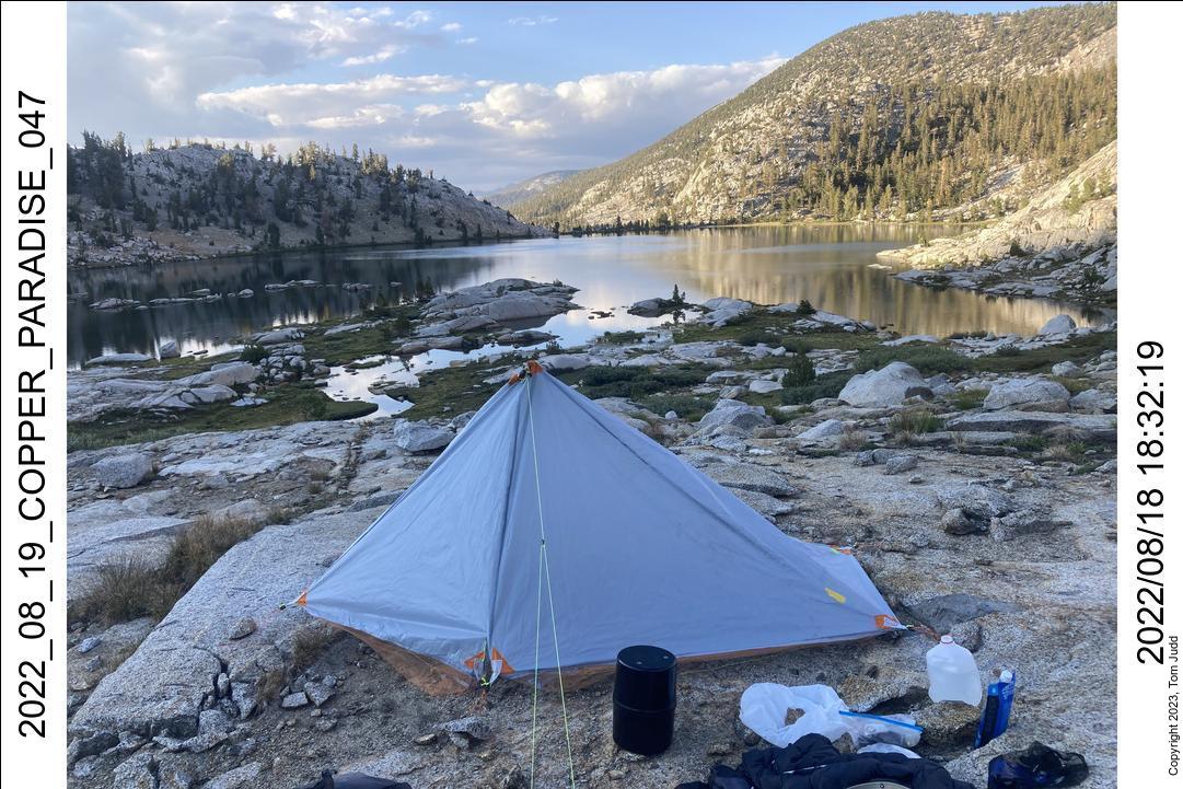
This year I also got to use my new Gray tent. I sewed it up this year using the experience I had gained from the White tent
My first hike of the year was with Rafa in June. He and his mother flew up from Panama for a short vacation. We took the opportunity to take a hike. He is such a positive child, it is fun going out with him. Wally came too. The July trip was shorter than I had planned: I missed the pass; but I met some interesting people. The August trip was the longest, and lots of fun. It could have gone on longer but I got tired. The September trip was the first one hiking with Dave, my son in law. He's a great hiker. Wally came too; and they were both amazed at Precipice lake.
OK. Read on.
August 2022 Copper Creek
Sept 2022 Chagoopa Plateau
Rowell Meadow with Rafa and Wally
7-June 2022
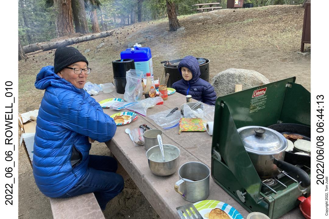
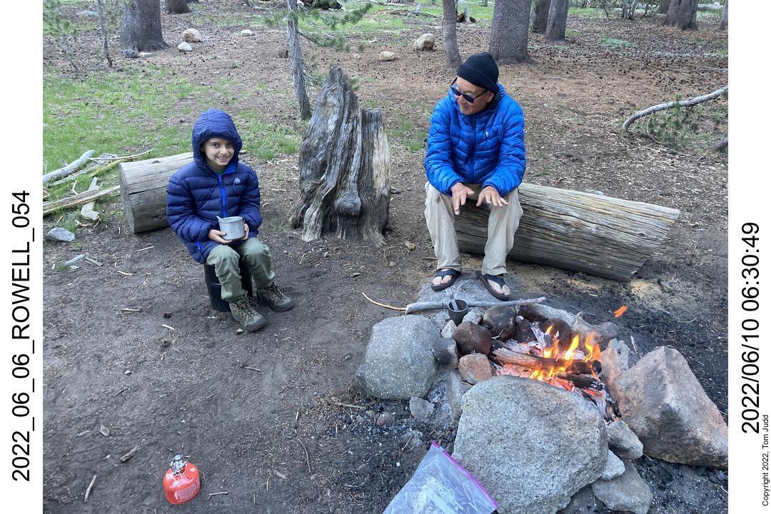
Rafa and I drove up to the Grant Grove visitor center, arriving at about 2 in the afternoon. We picked up our hiking permit and got our campsite in the nearby Sunset campground. Wally had not yet arrived so we set out to explore the sites. Went to the Grant Grove and walked the trails. When we got back to the campground Wally was just arriving. We had pot pies for dinner with Smores for dessert. Played a modified version of 'War' card game in which the looser by one could challenge the results by putting extra cards up for grabs. In bed at 8:30. Long drive and I was tired.
8-June 2022
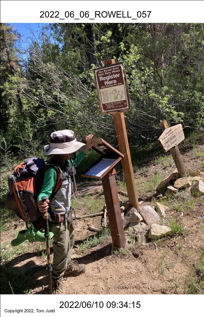
This was a day for hiking. After a pancake breakfast we drove up to the trailhead and started out.
Rafa lives in Panama where sandals predominate over shoes and down coats are unheard of. So, with the help of Marin, who has had three hiker kids to train, we outfitted Rafa with a kid-size backpack and down jacket. We had also gone to Big 5 sporting goods store to get a pair of hiking boots. Appropriately equipped, he took off from the trailhead like he'd been doing it all his life.
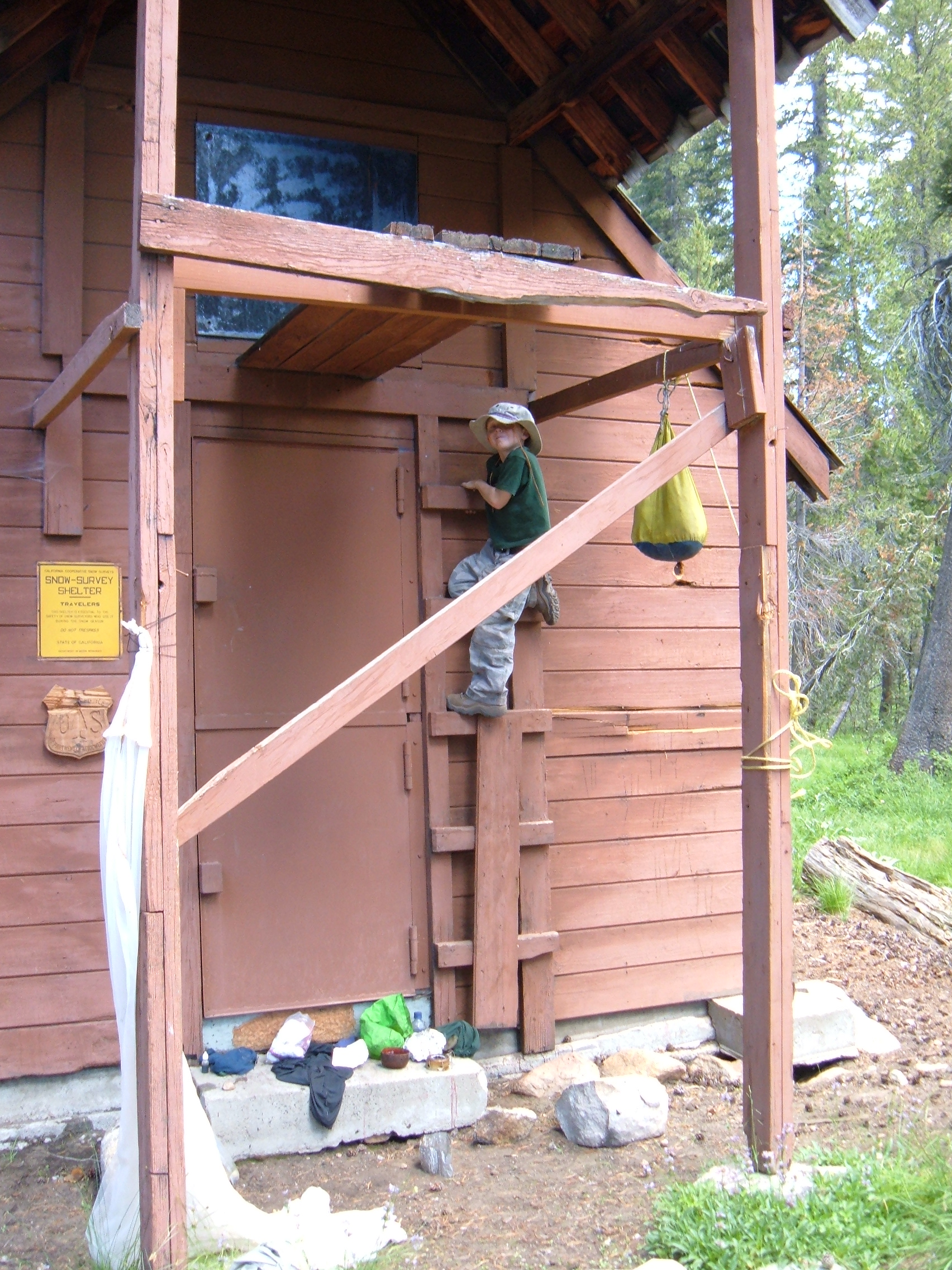
It has been a very dry year, so there was some concern about finding a campsite with water. About a quarter mile past the ranger hut we found a nice isolated campsite with plenty of water. Well, it was isolated until a group of 15-20 young men arrived. They were a Mormon group from Encinitas, CA who could not get over Elizabeth Pass and so turned back, and camped with us. They behaved.
After setting up camp and a delicious dinner, we again treated ourselves to smores before bedtime. It was a pleasant 62 degrees. Rafa's heartrate and SpO2 was 97/93%, mine was 68/90%. At an altitude of 8800 feet (2700 m) one expects the lower sats.
9-June 2022
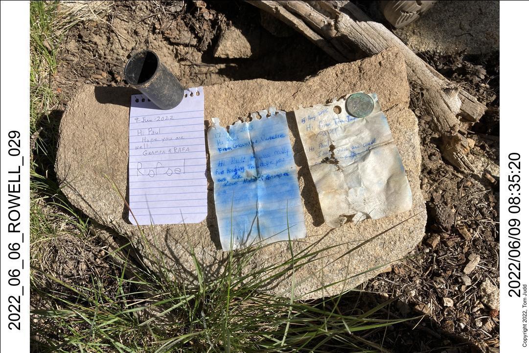
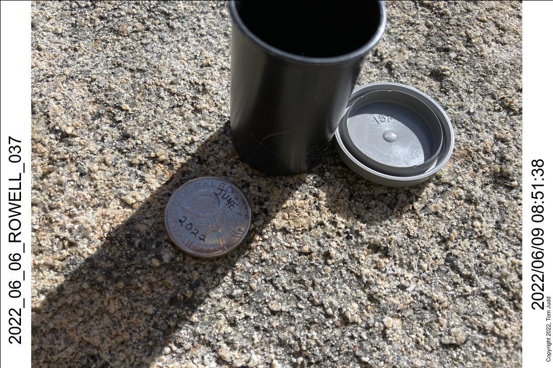
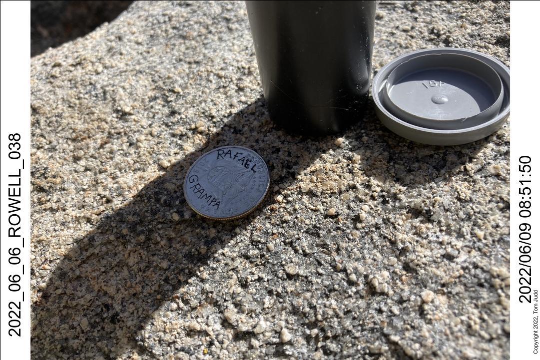
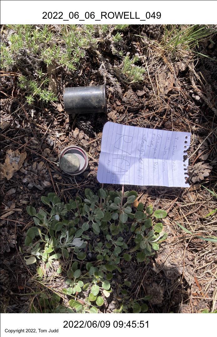
This was a day for hiking. My three other grandkids have been here and buried medallions which they promised to visit with their grandkids. So we hiked for buried treasure. Using the GPS coordinates we located sites for Jon and Paul. We did not have time to get to Nat's. One difference is that Rafa's medallion was made out of a Panamian quarter Balboa, while the others used quarter Dollars.
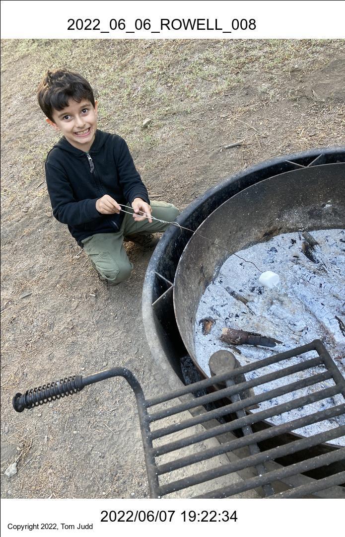
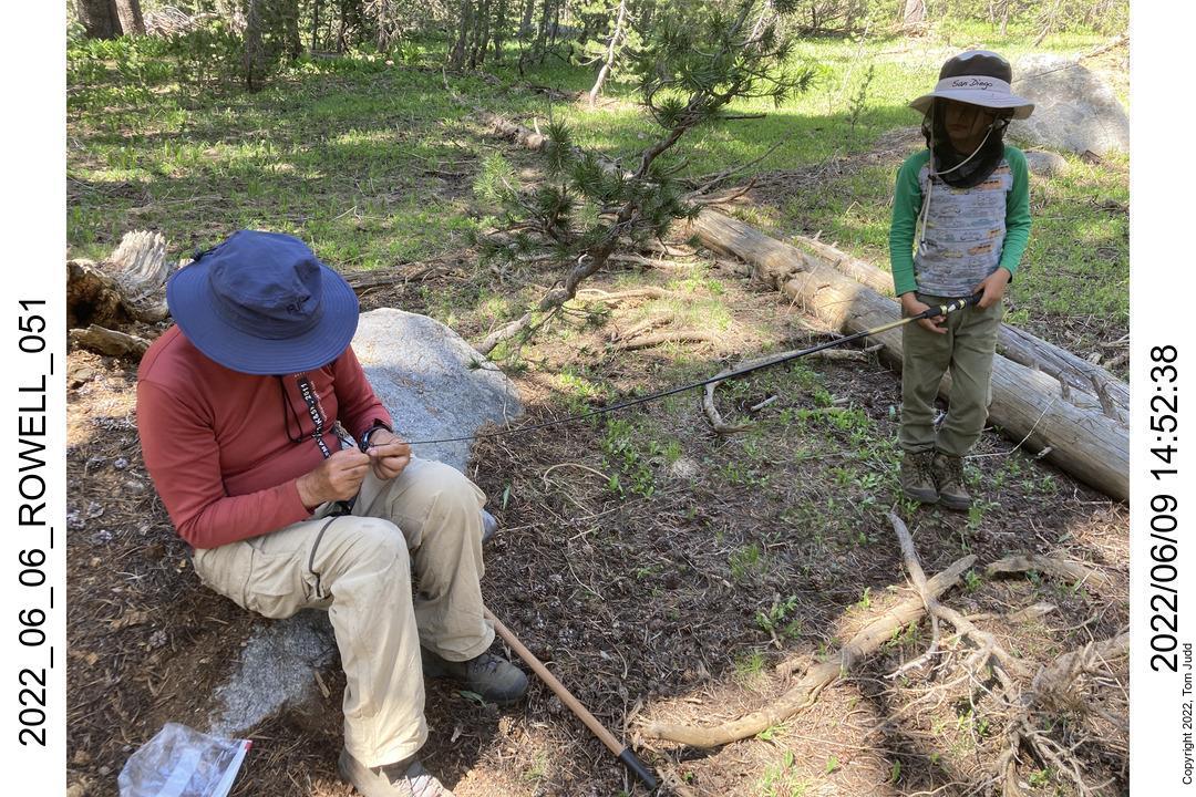
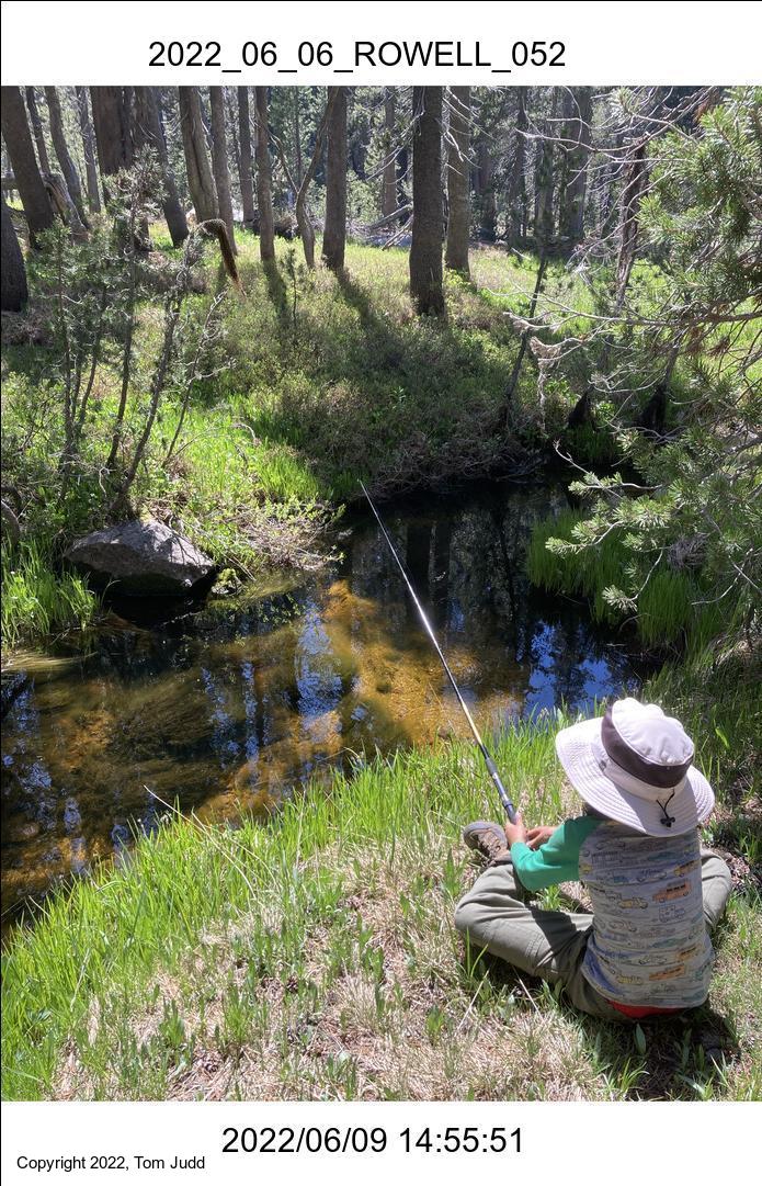
After the treasure hunt we tried our hand at fishing. The streams were way down, so we had to hike a bit to find a prospective fishing spot. Wally helped with tying the hook and Rafa did the fishing. No luck. Next year.
10-June 2022
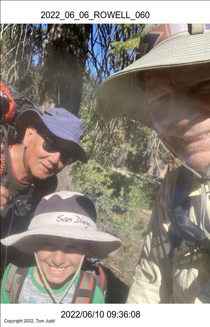
Today we leave. Started hiking out a little before 8 AM. We got to the trailhead and started driving out at about 10. Wally and I split up here. He went back north while Rafa and I went to see the sights along the way south.
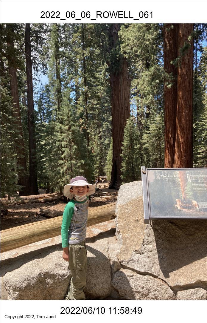
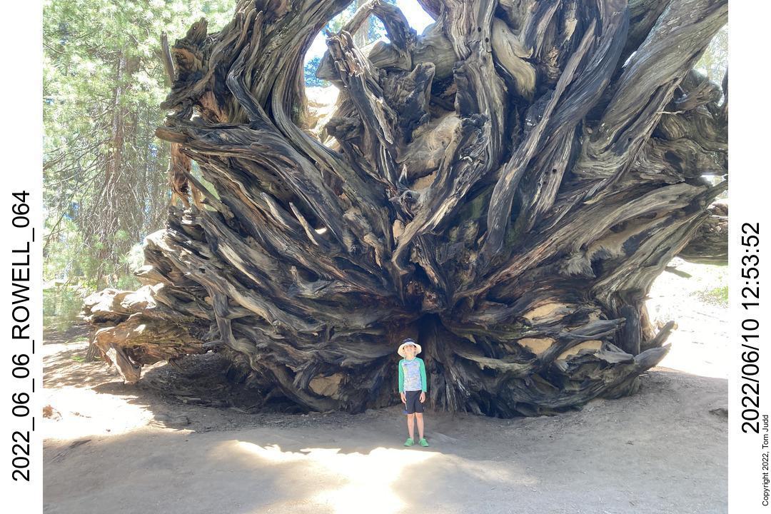
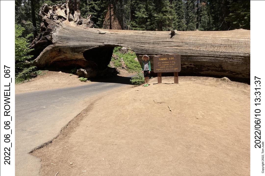
The Sherman tree is a tourist trap. They blocked off the visitor parking lot that we used with Jon and Paul, and reserved it for the Handicapped. Healthy people have to walk a half mile up and down a hill, or fight for a place on a packed COVID shuttle bus. Rafa and I walked down for a bit till we could peek through the trees. Then we walked back UP. It was not a pleasant experience.
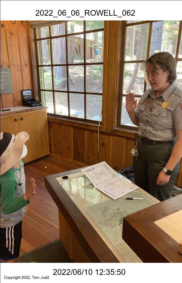
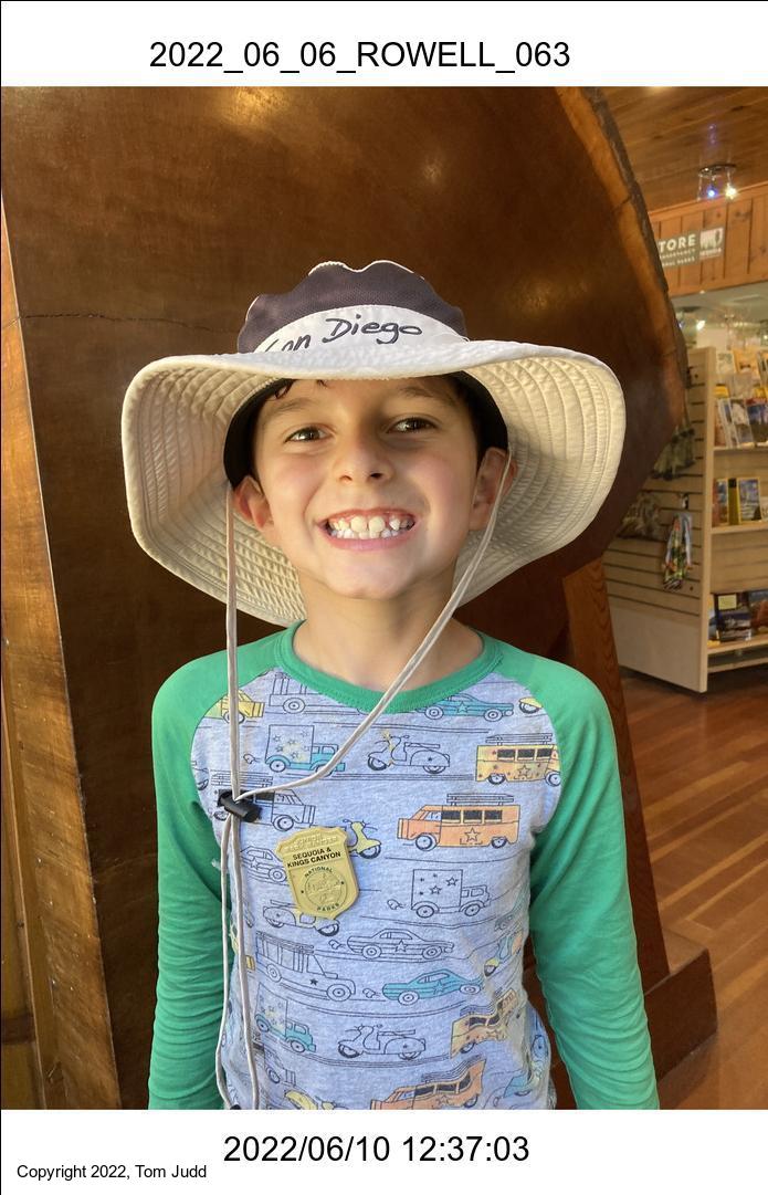
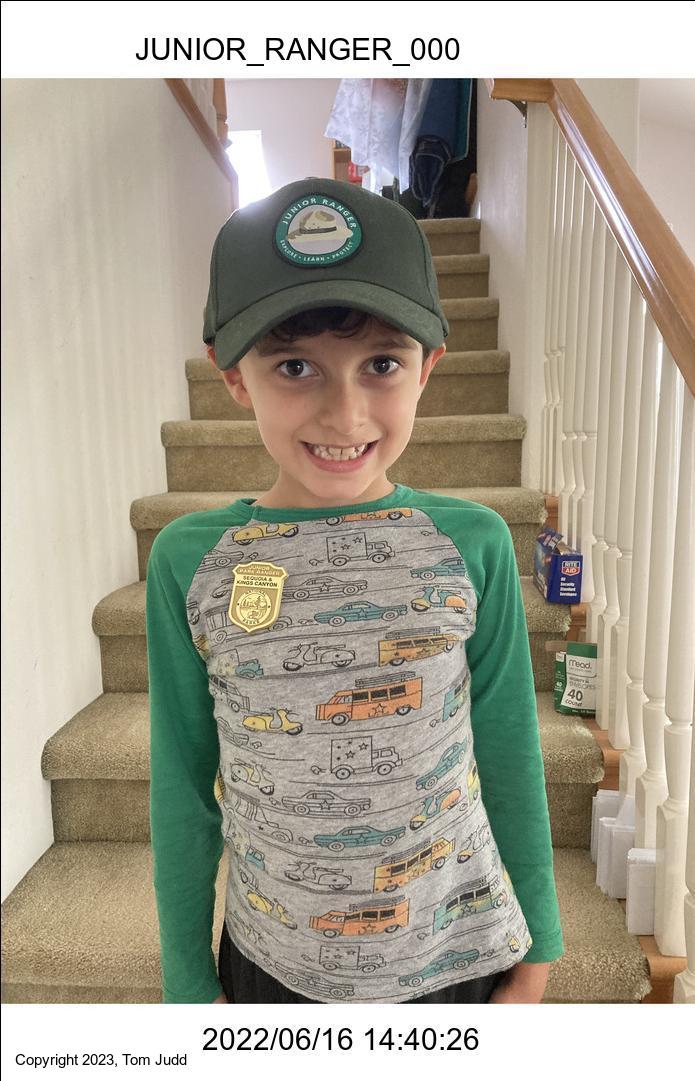
We then went to the Visitor Center. That was really good. Rafa was jumping up and down with excitement. The ranger there quizzed Rafa about the Junior Ranger workbook he had filled out while we were camping. She then pinned on his Junior Range badge and swore him in.
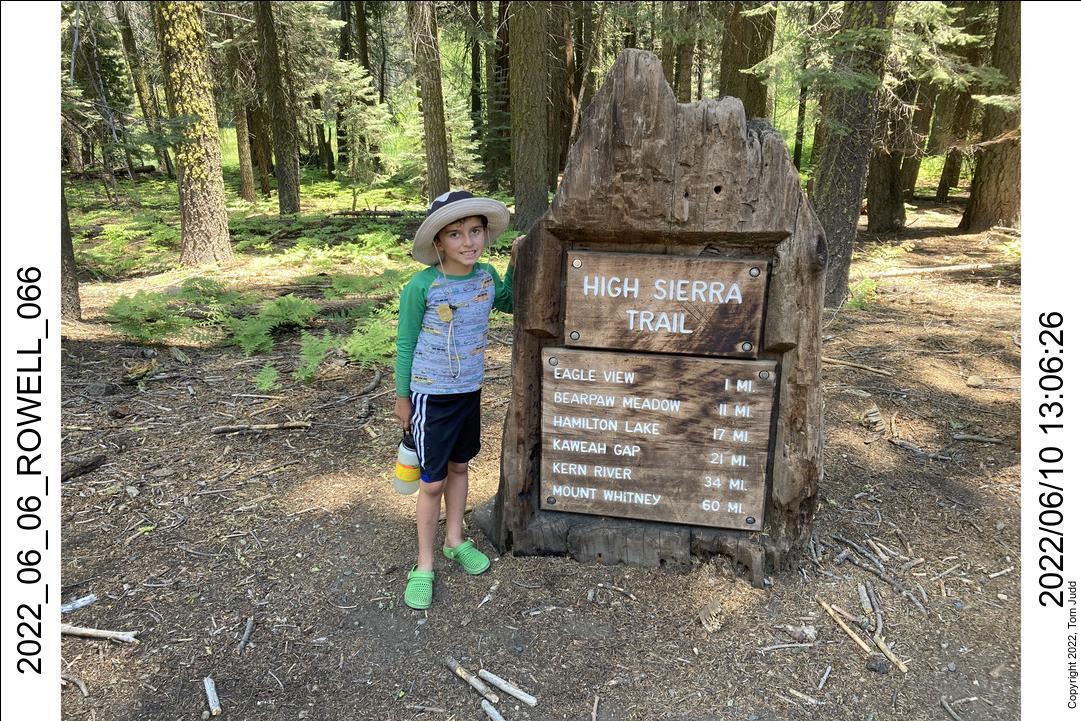
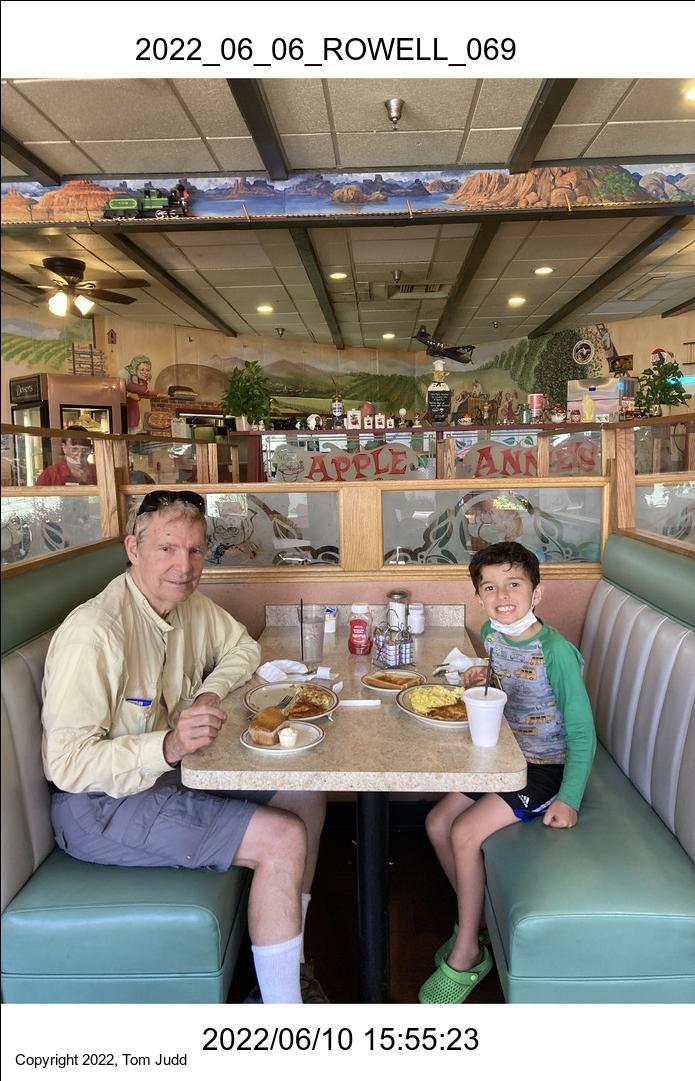
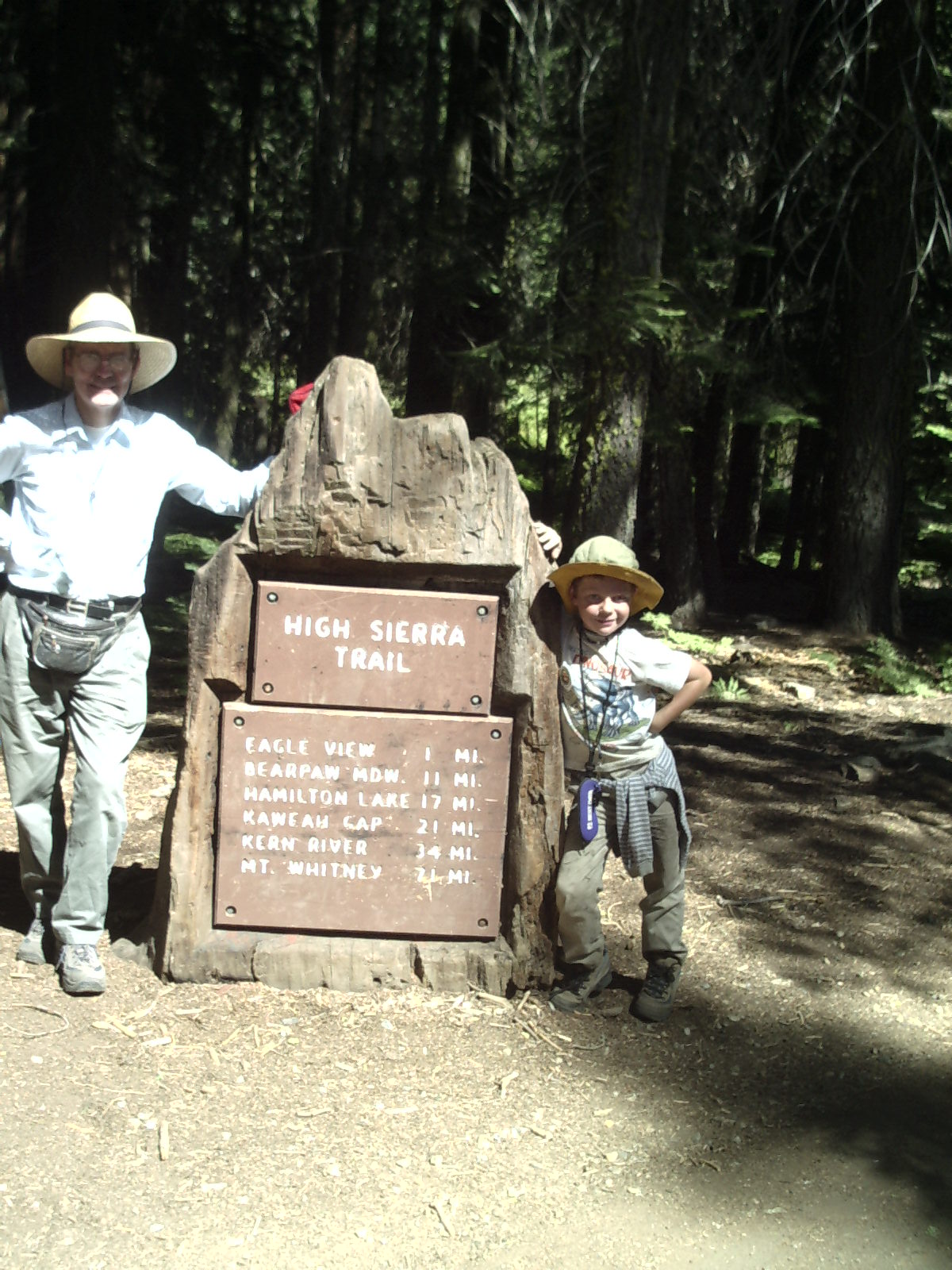
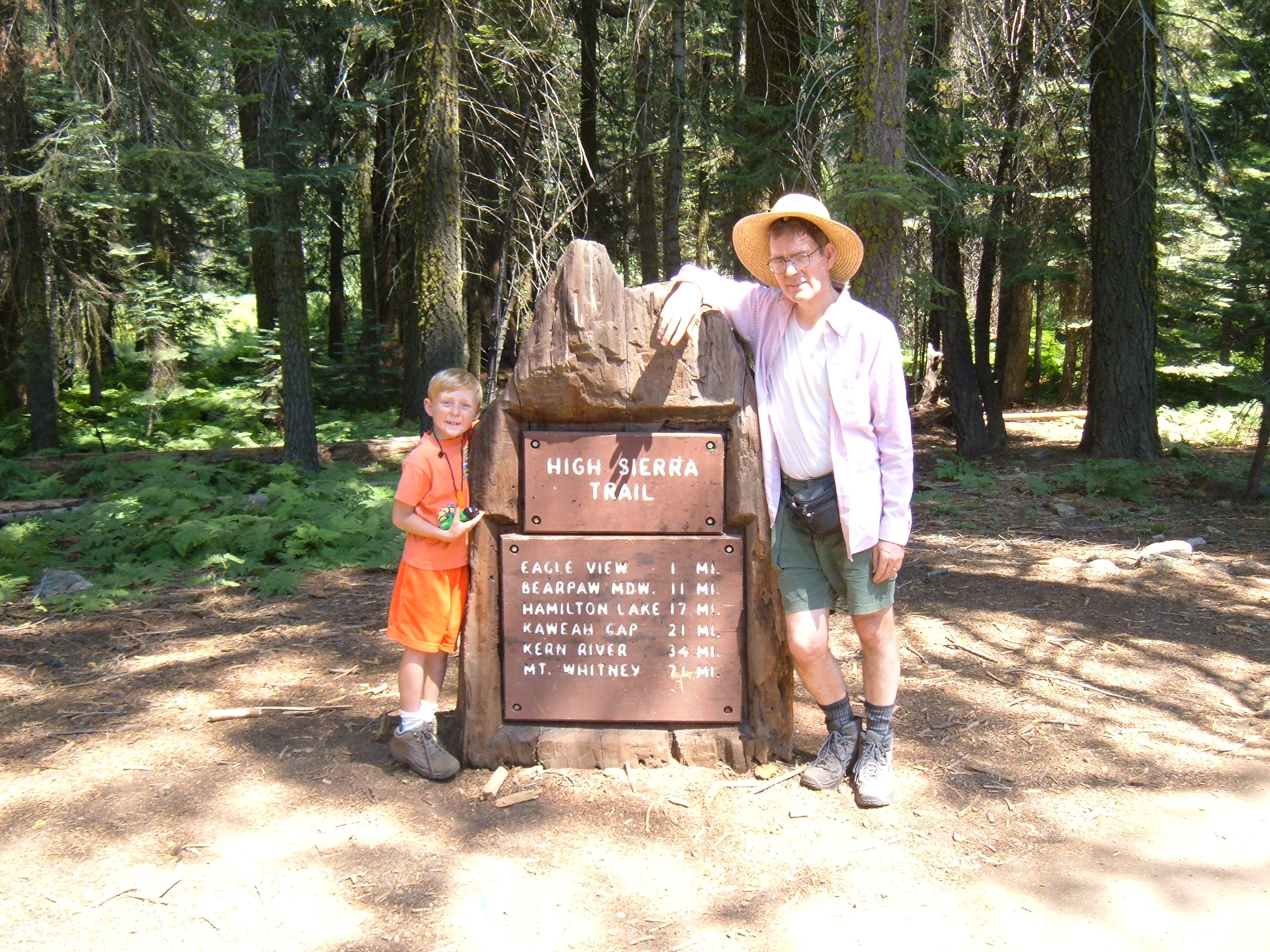
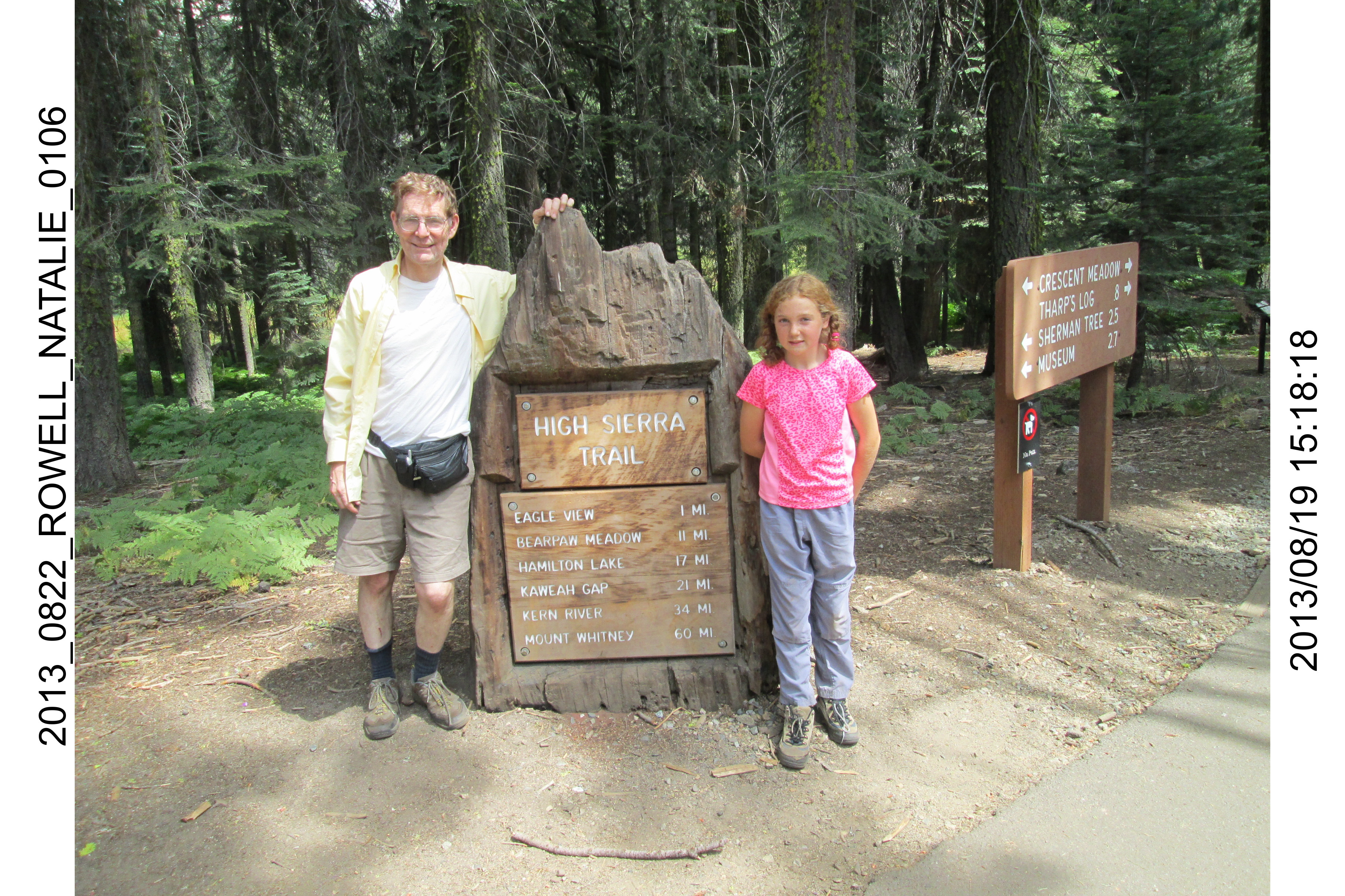
After that excitement, we toured the Big trees along the way to Crescent Meadow. We snapped the obligatory picture at the High Sierra Trail sign. Then we left the park. On the drive back home we ran into a brush fire on the road up the grapevine. So we spent the night in Bakersfield, then drove home the next day.
A week later, Rafa was quite pleased to receive a surprise Sequoia Ranger Hat in the mail. Wally had picked one out for him. Thanks Wally.
Four Grandkids in the Sierras
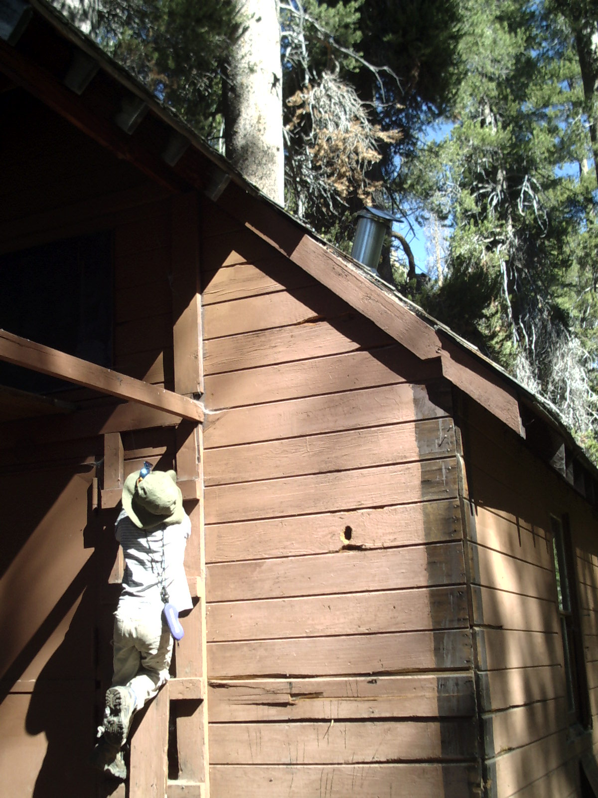
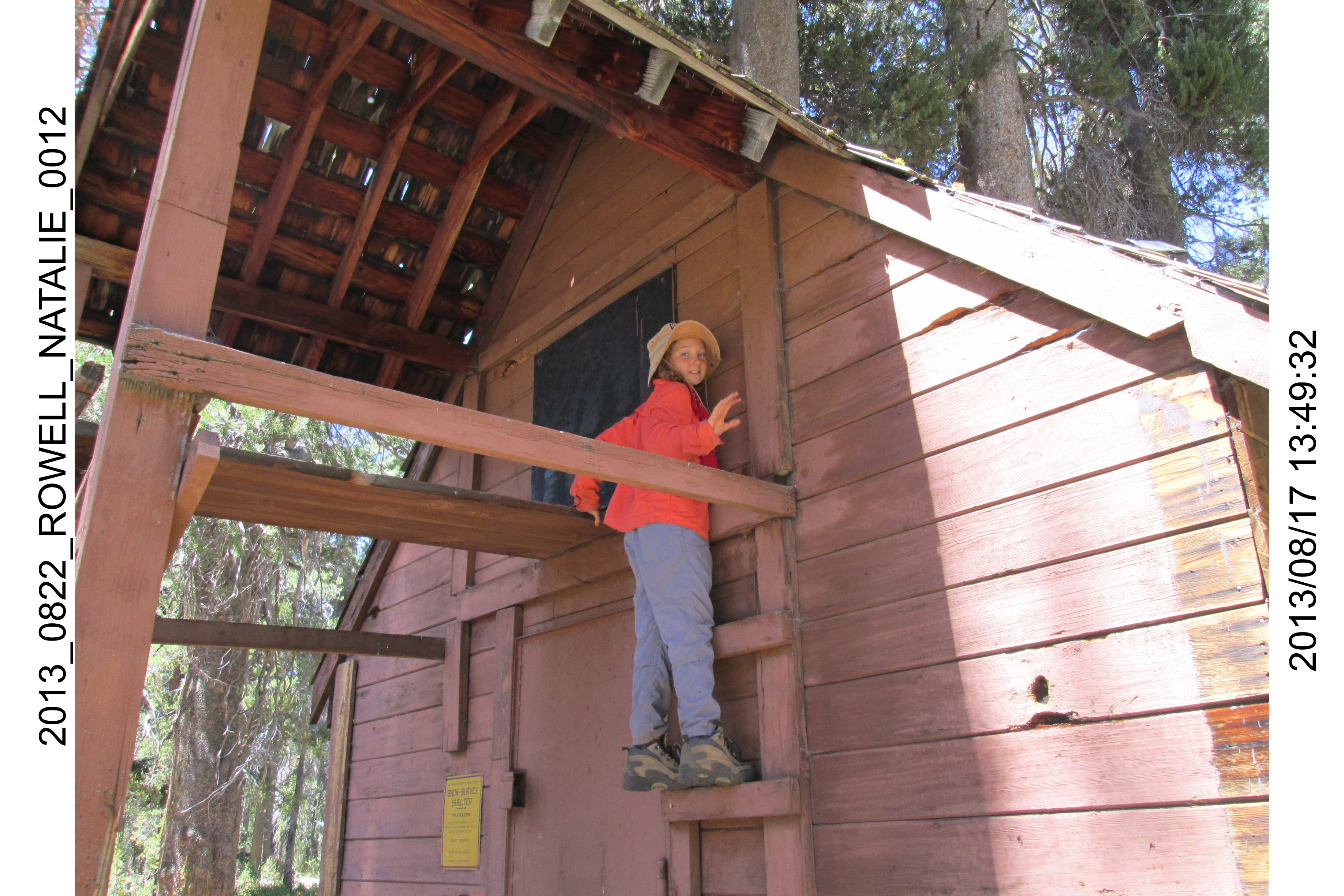
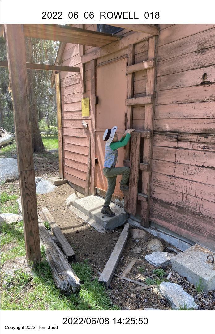
Ranger Hut in Rowell Meadow
Crescent Meadow start of High Sierra Trail
Taboose Pass to Upper Basin Crossing
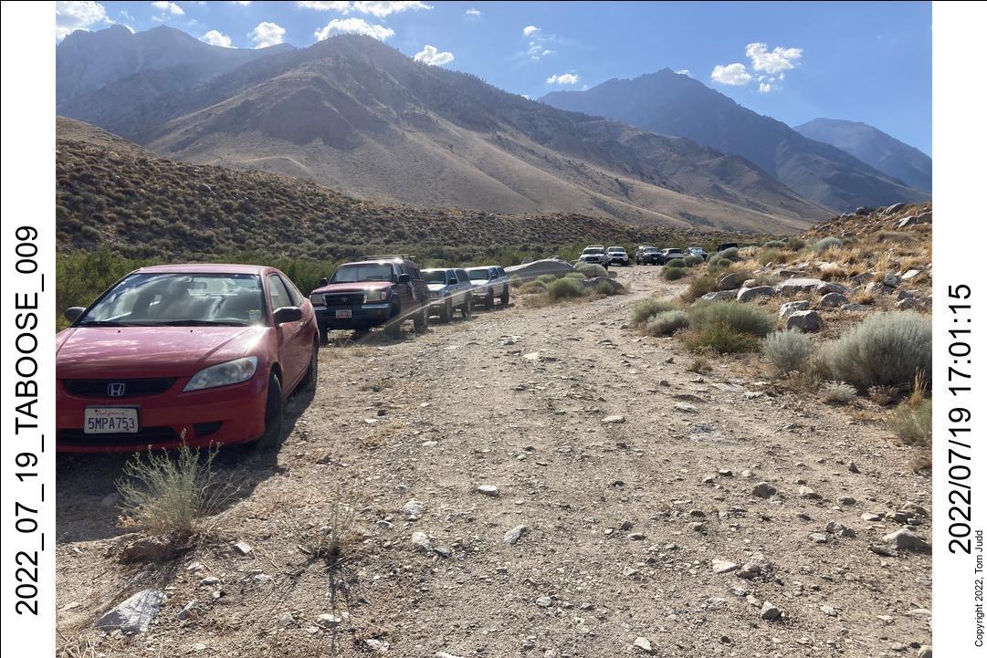
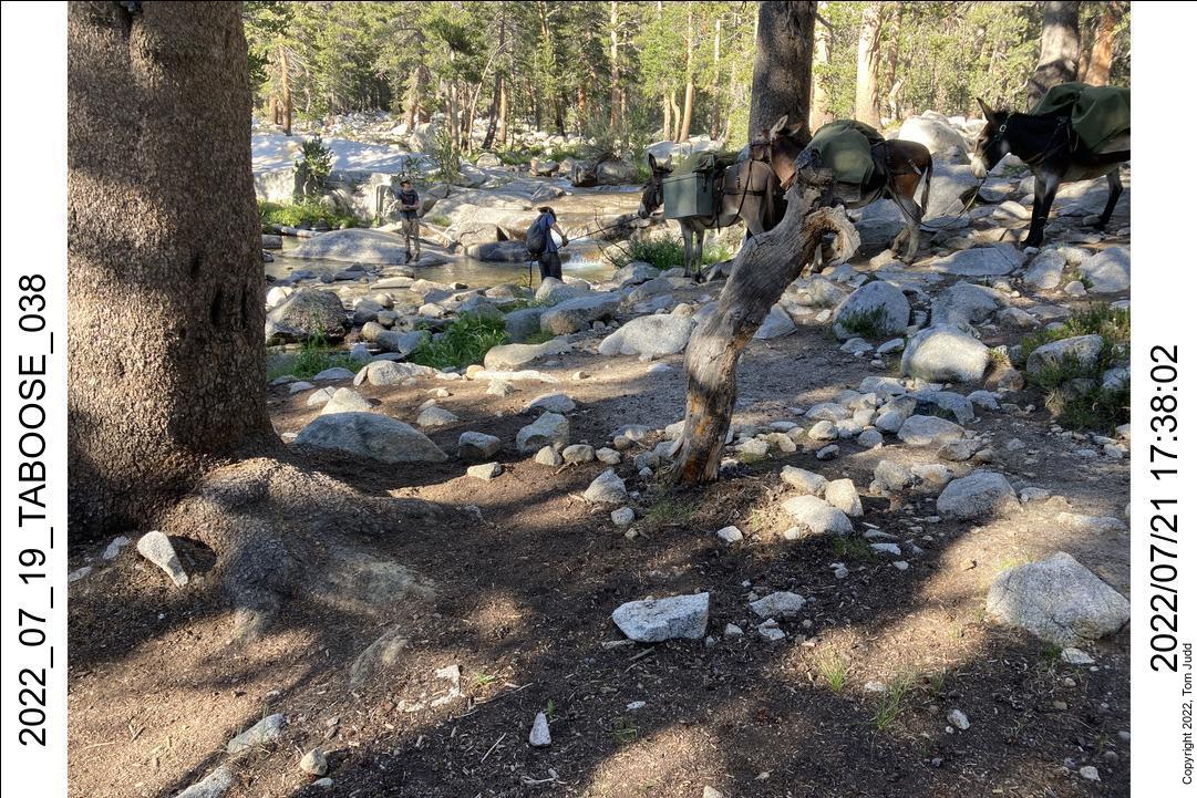
19-July 2022
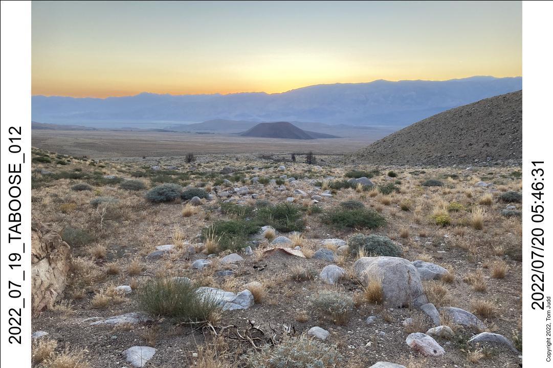
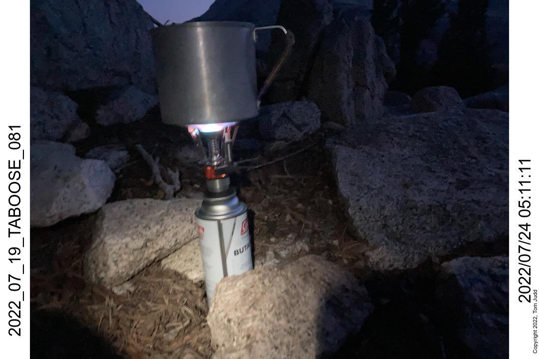
It gets really hot driving up highway 395 during the summer. Worse, you have to hike in the heat until you attain some altitude. That usually means that the first day is miserable. I decided to drive up and stay in my Air Conditioned car till evening. I stopped in the Adelanto Walmart to cool off and eat some lunch. Got to the Taboose Creek campground at about 3:00 PM. I piddled around in the shade and then drove on up to the trail head. I slept in the car there. A bit warm at first but it gradually got comfortable.
20-July 2022
I set my alarm for 4AM to have some hiking time before the sun rose. Started hiking at 4:45. I had forgotten my hiking pole, so I picked up a straight stick by the creek. Trimmed it. It worked quite well for the whole trip. At one point in the morning a hummingbird hovered around me. I was wearing a new bright red shirt and I wondered if it thought I was just a big red flower. This happened more than once this summer with this shirt, so maybe there is something to it.
Got to the first camp at about 2:00 PM. I was quite tired. So, even though it was early, I set up camp there right by the creek. After an hour rest my energy picked up. I had thoughts of continuing, but decided I would try that the next time.
21-July 2022
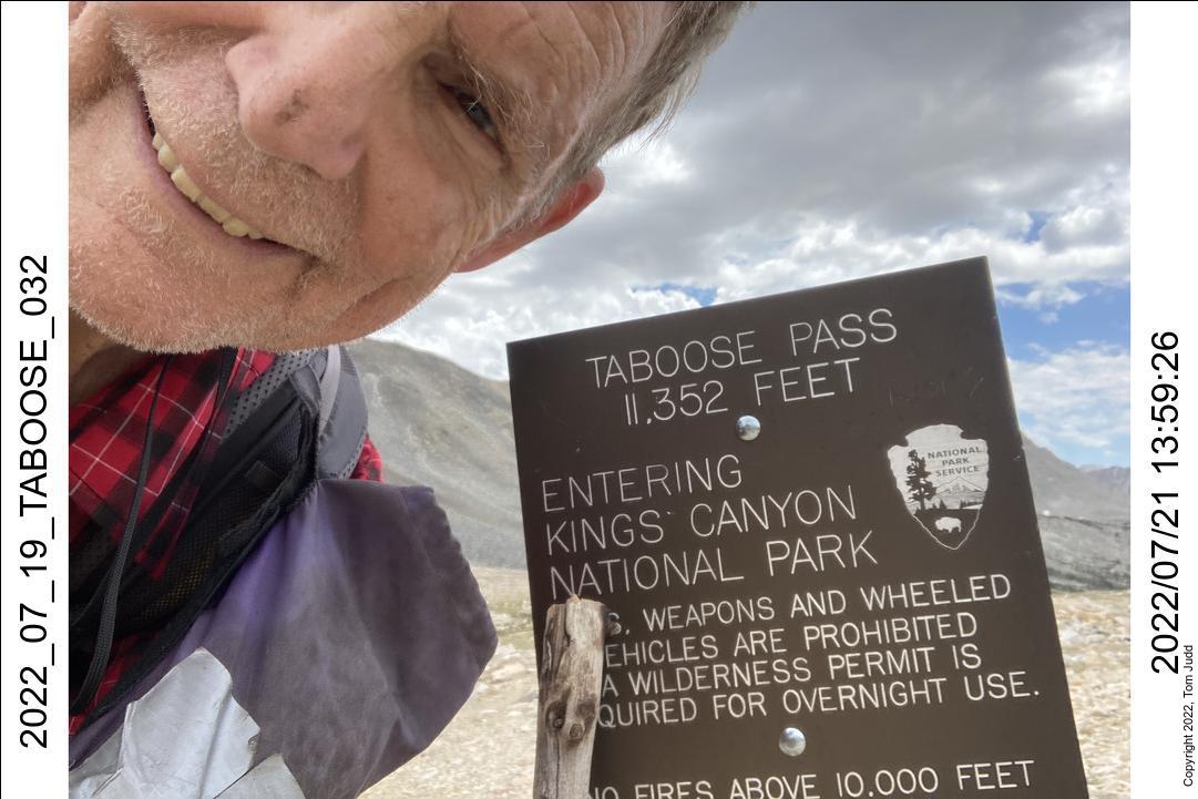
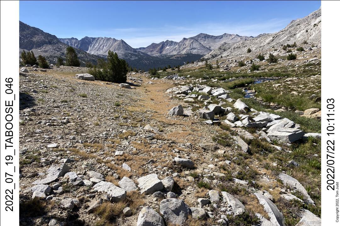
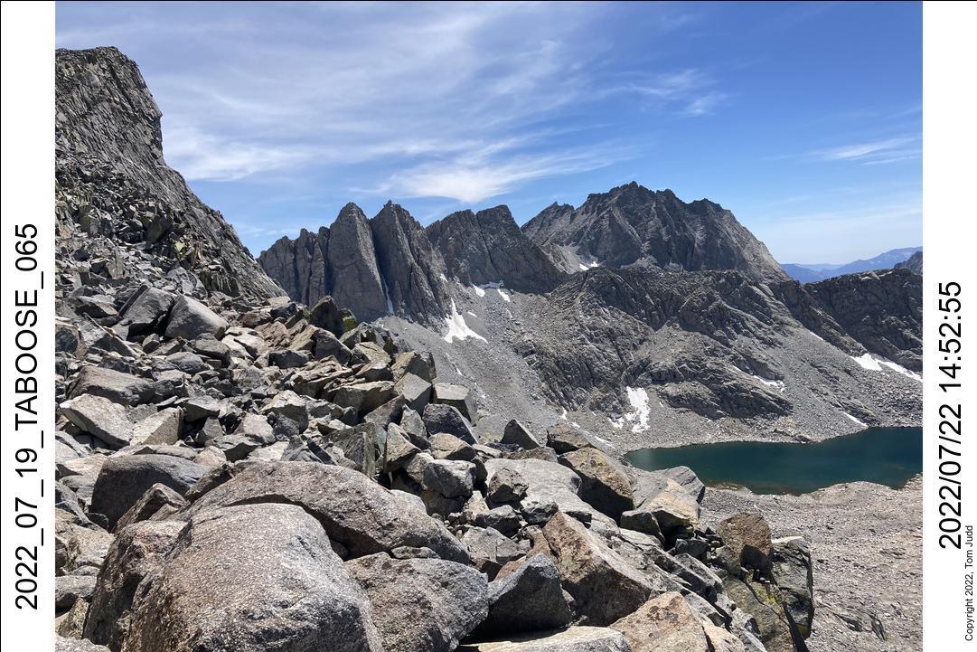
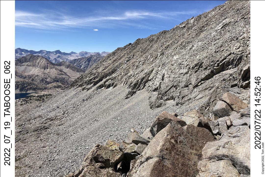
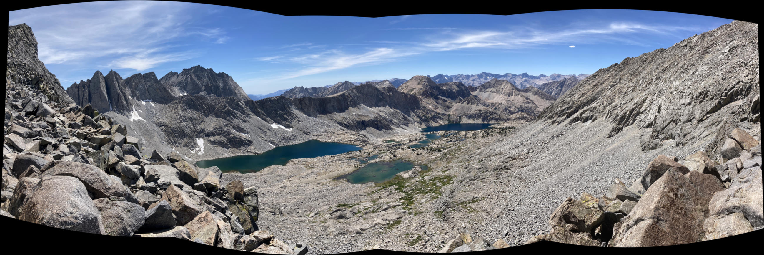
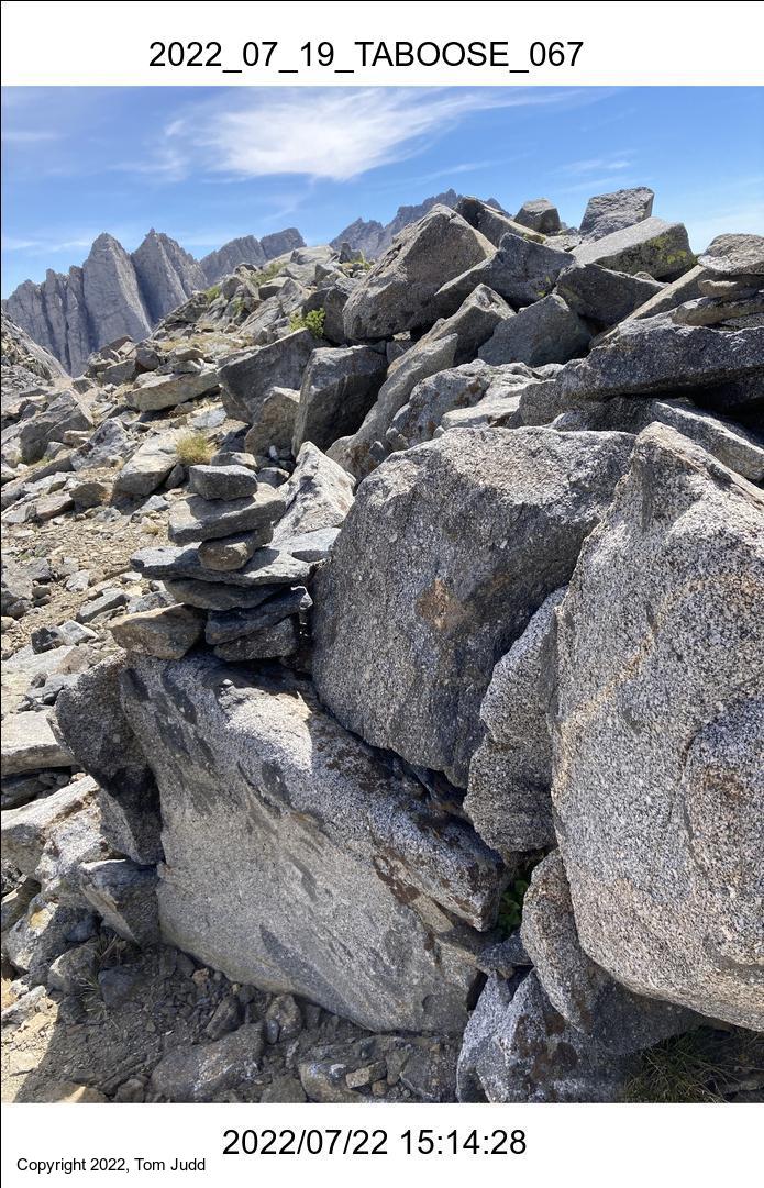
A bunch of steep climbing to the pass for today. I got there about 2PM. The last half hour was spent on the winding trail through the rocks at the pass. It seems to backtrack on itself at times. I have missed it entirely on trips where the snow at the pass covers the trail. Seems like it could be easier.
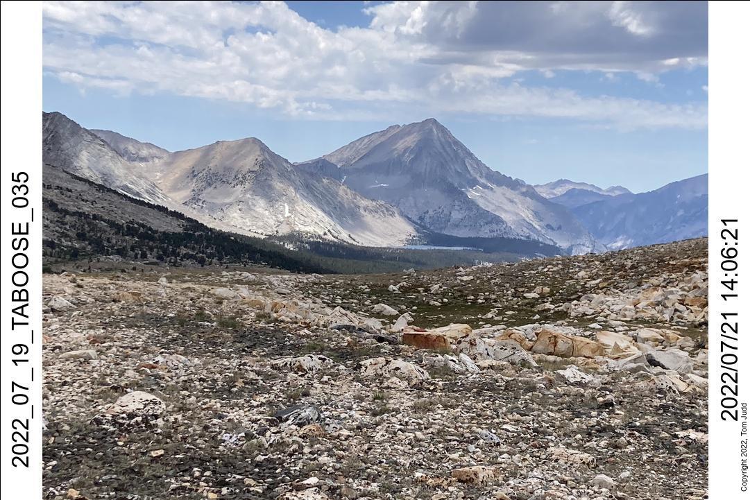
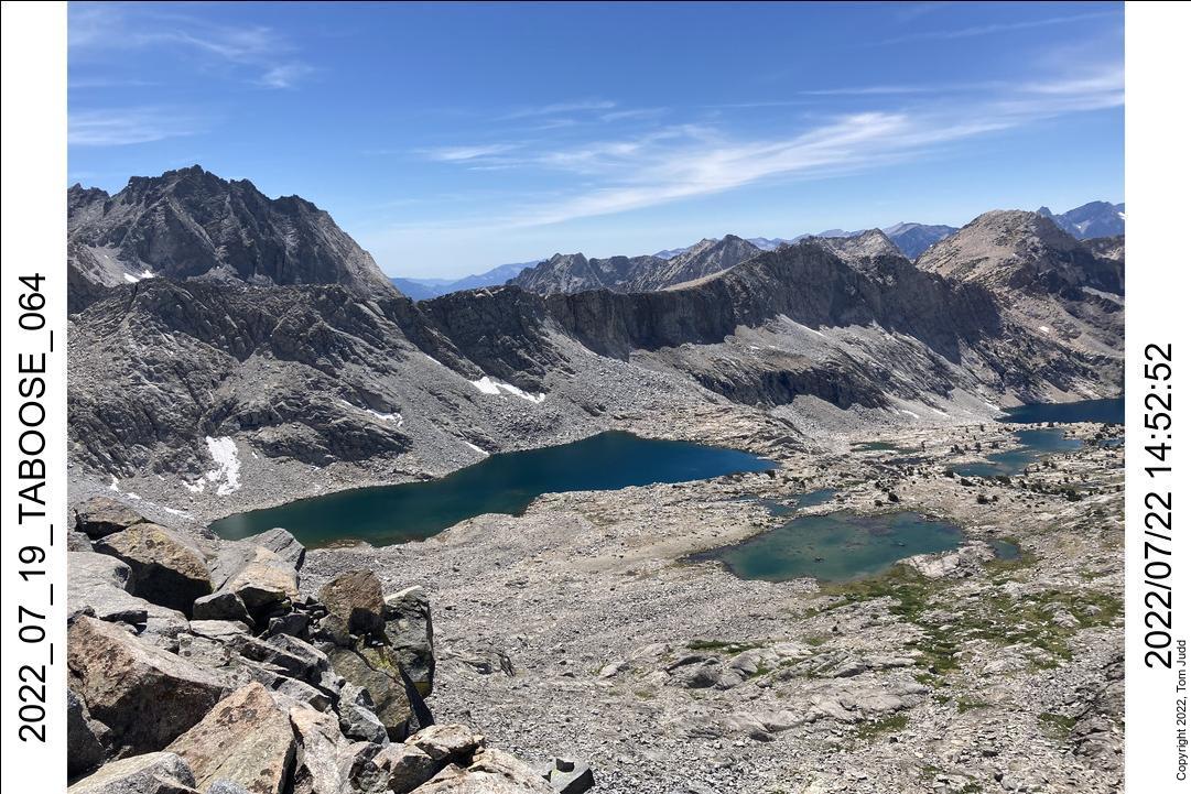
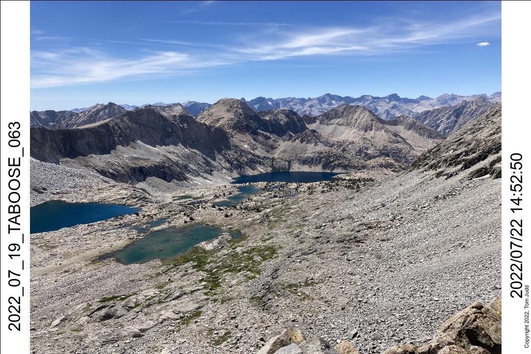
I have always enjoyed the view from here. About a hundred yards down from the sign you can see Arrow peak, Bench Lake, Muro Blanco, and the sloping way up to Cartridge pass. I think it is pretty
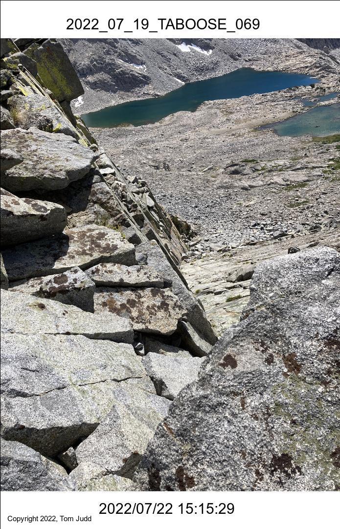
I had planned to take the northern branch, as I had done with Marin last year. But I missed the cutoff. I had it marked on my GPS, which was in my pocket until I was way past it. Oh well, I just went down to the campground at the bottom.
I camped closer to the trail this time. Marin and I ran into a bear when we camped about 200 meters down the hill. I explored down there after I had set up camp, and encountered a large friendly group of campers. I again looked for the campsite I had seen in 2013, this time with my GPS. But the GPS kept jumping around. I was never able to find it
22-July 2022
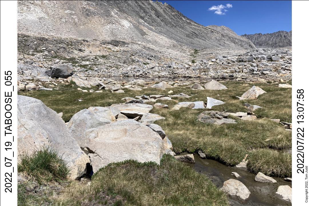
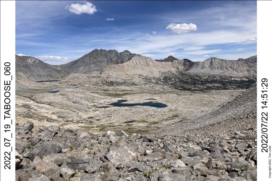
This was the critical hiking day. The plan was to go North off-trail to the Upper Basin Crossing; just as I had done in 2016. The hiking times were similar, and I got to the pass within a few minutes of the time I achieved it in 2016. Then I ran into trouble.
I was hiking from memory. I had written a detailed description with pictures of the way down from the pass in my 2016 trip report. Quoting from that report:
I found the cairn, but I was stunned when I looked down the gully. It was treacherous! It is not what I remembered! This was a hundred foot slippery slide. In retrospect, and after rereading my account and that of High Sierra Topix cgundersen, I realized that there must be TWO cairns. One has to scramble up over rocks near the pass to see the actual gully and the second cairn.
I have since read accounts of the slide: not an easy route. I realized that I was NOT going to take a chance negotiating down that tricky chute. So, I turned around.
I should mention that there was another group of hikers climbing up to the pass from the left. One of them came over and offered to watch over me as I went down. Well, that would help with a rescue, but it wouldn't help me get down. I stayed up at the pass for a while wondering what to do. I could peer back and see the other hikers make their way down, then sit in a large circle at the bottom. As I started back down I could see them file off like a herd of mountain goats looking for greener pastures.
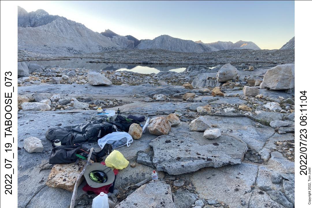
I worked my way down to the large lake at the bottom of the pass and stayed there for the night.
22,23-July 2022
It was an easy hike to the next campsite on my return to Taboose Pass. It was uphill once I passed Muro Blanco but I was meeting some interesting people.
One of the more interesting was at the junction of the John Muir Trail and the Taboose Pass trail. I rested there with a diverse group of JMT hikers. As the conversation progressed I found out that a pair of them had been in the Peace Corps, just like my daughter. Then I found out they were stationed in Panama, just like my daughter. Then I found out that they worked in Guabal, a tiny villiage just north of Santa Fe, Veraguas, where my daughter has a B&B. Then I found out that they actually stayed at the B&B. Then I found out that they actually talked to her about the Peace Corps! What a chance meeting!
But then I had another meeting. I hiked up the Taboose trail to where the campsites are along a creek. I didnt want to stay next to the trail, so I hiked up a bit and plopped down in a nice isolated campsite at about 3:20PM.
At about 5PM I heard some other hikers coming along the trail and making their way uphill to my spot: a man and woman, heavily laden for some serious hiking. They were headed off-trail to the lake about 300 feet (100m) in elevation further up. The woman mentioned that she hikes a lot during summer vacations. That rung a bell. I asked for her name. She replied "Talley".
"Talley Kayser!" I exclaimed. I had met her off trail two years ago at the Pass between Grouse Lake and Granite Basin It was an unusual meeting then for I rarely met anyone in the back country. And it was unusual this time too. We were not on a trail.
The next day I hiked out. Drove away from the trailhead at 2PM, Back home at 9:21. Delayed a bit by LA traffic.

Copper Creek, Arrow Pass
16-25 August 2022
16-Aug-2022
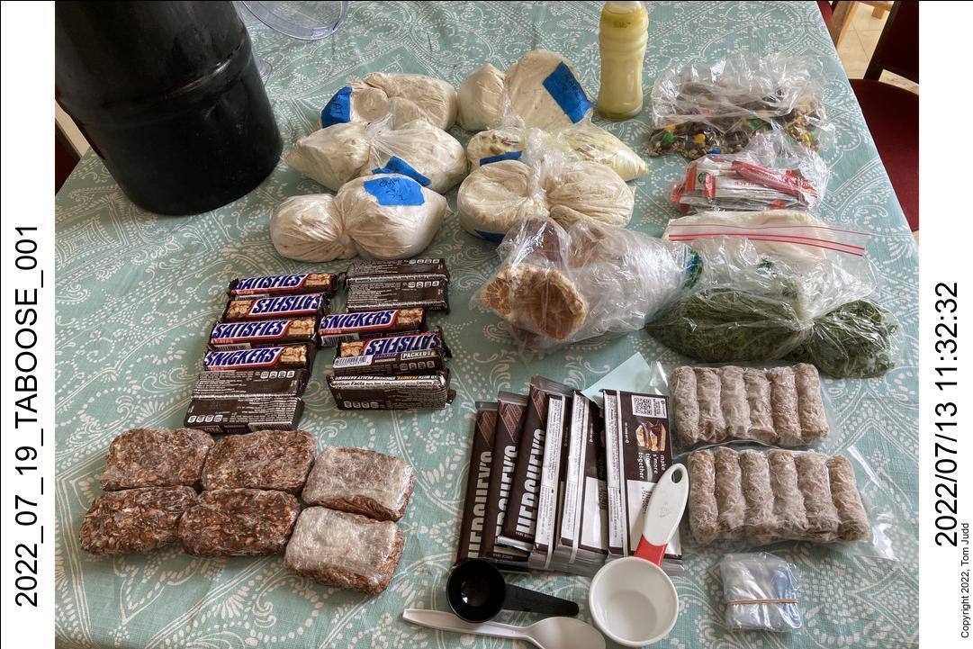
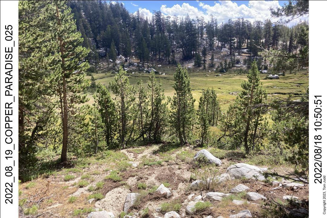
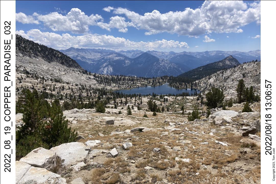
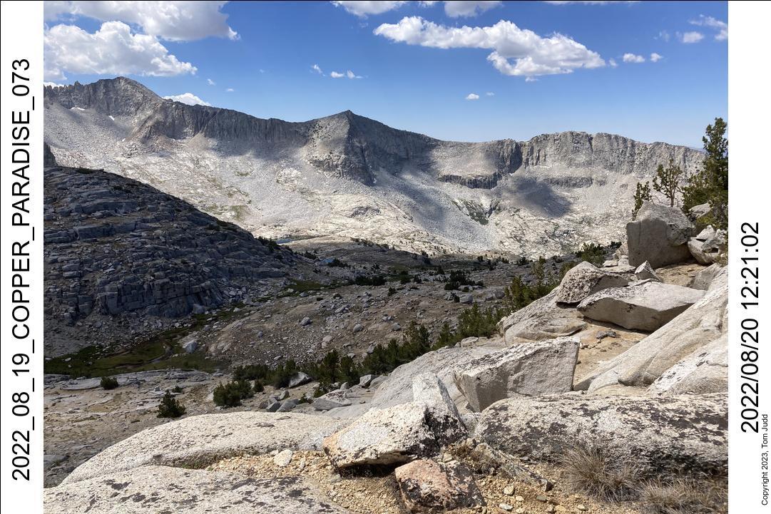
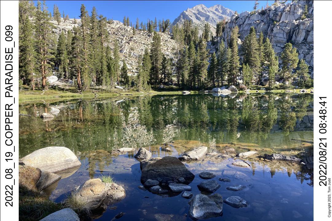
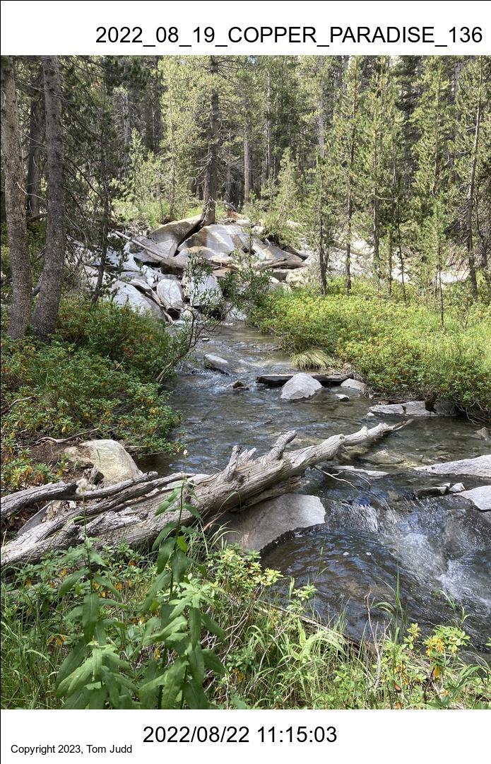
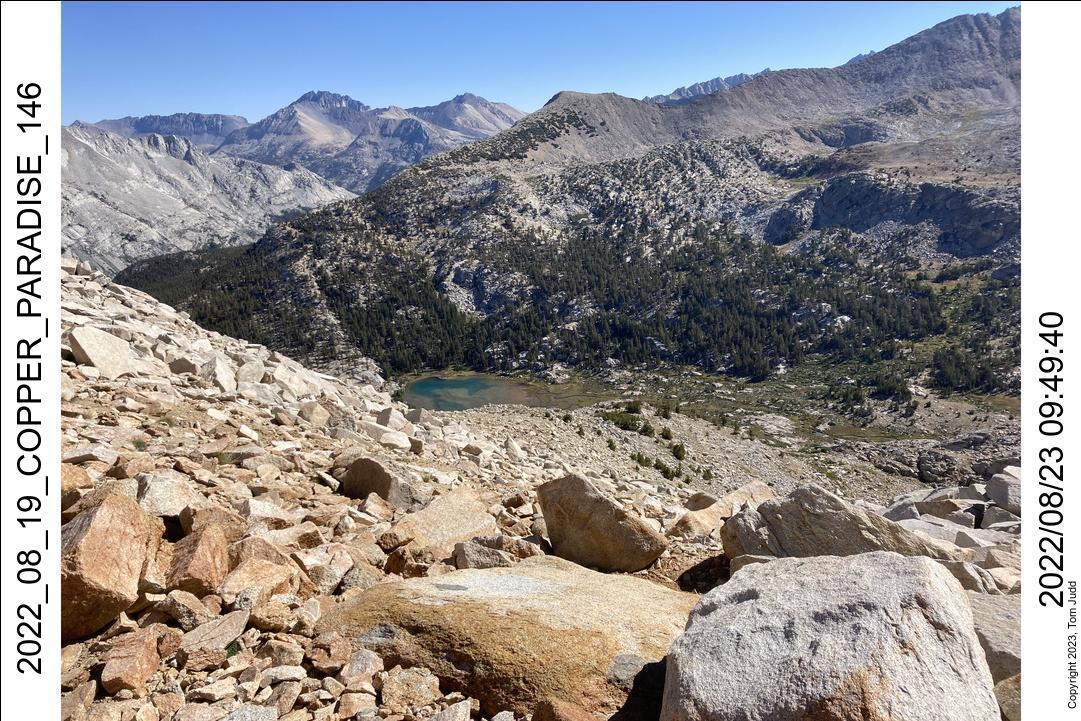
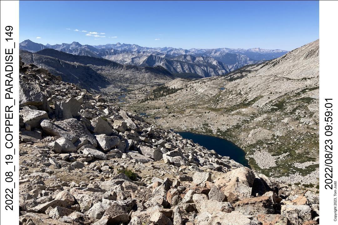
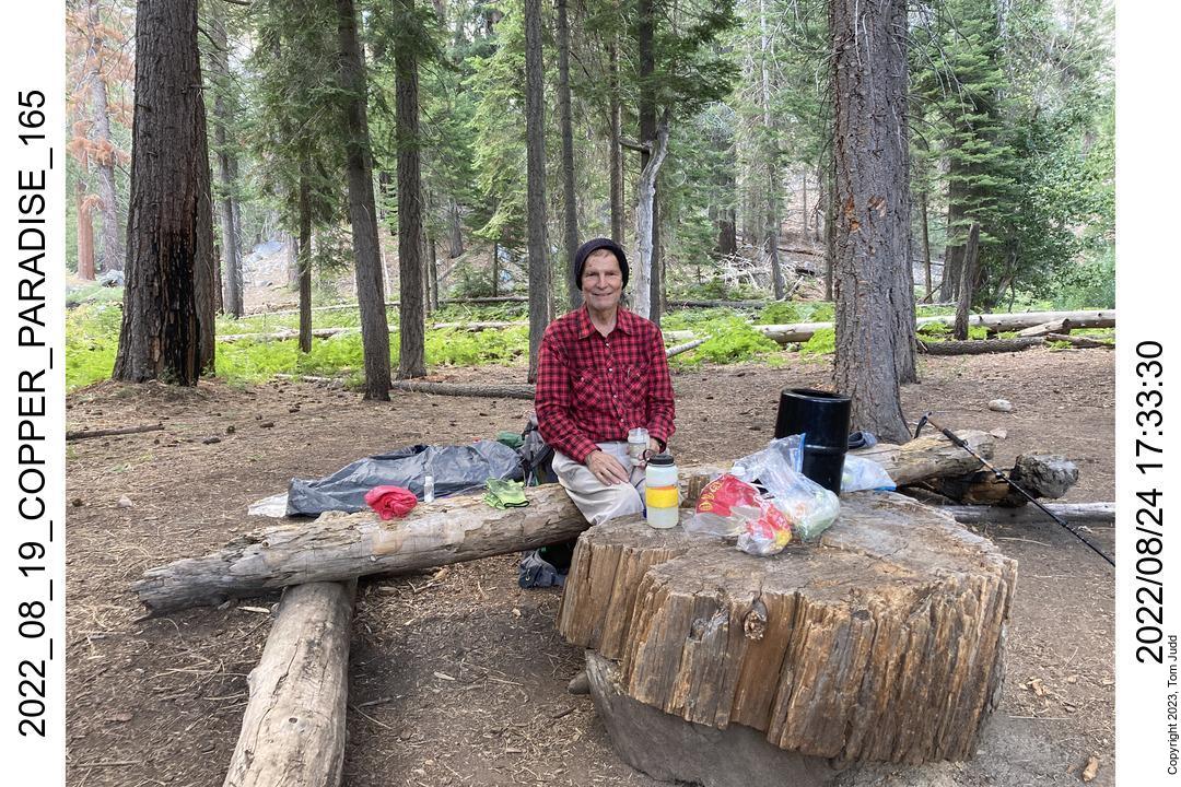
This was a great trip! It is quite similar to my August 2020 hike. I have been trying to do my trip for several years. I did not quite finish the loop this year, but I had a lot of fun trying. I began at the Copper Creek trailhead at Roads End. I follow the Sierra High Route to the Lakes Basin, then over Cartridge Pass and into Muro Blanco. I then go up to Arrow Pass, then down to Arrow creek, over the hump to Window Creek, then down to Paradise Valley and home.
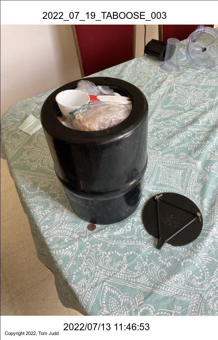
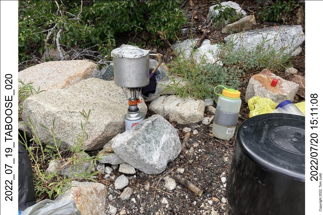
I drove up from Carlsbad, CA. I stopped at Apple Annie's in Tulare to get my traditional California Omelette. I ate it for dinner. I got to my campsite early. I picked up my hiking permit from a pencil-necked ranger who demanded to see my bear barrel before issuing it. He made me walk all the way back to my car to get it. Since this was a long hike, the barrel was quite heavy. He's the only ranger in the past 20 years that did this. Doing his job, I guess.
17-Aug-2022
Copper Creek is a hot trail, so I got up early (4 AM) to get a jump on the sun. I started on the trail in the dark at 5 AM. I used my headlamp for the first hour or so until it got light enough to see. I got to my first campsite at Upper Tent Meadow quite early. I considered a bit continuing on, but it was too far to the next reasonable campsite.
As I was setting up my tent here I came across the most disgusting sight I have seen on the trail. Someone had done their business right in camp and covered the toilet paper with a rock. And not just once. Since I used rocks instead of stakes for many of the tent corners, I uncovered quite a few toilet paper surprises. Disgusting flatlander!
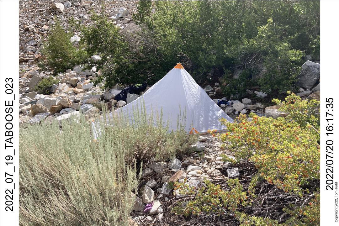
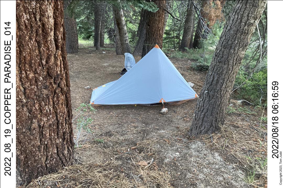
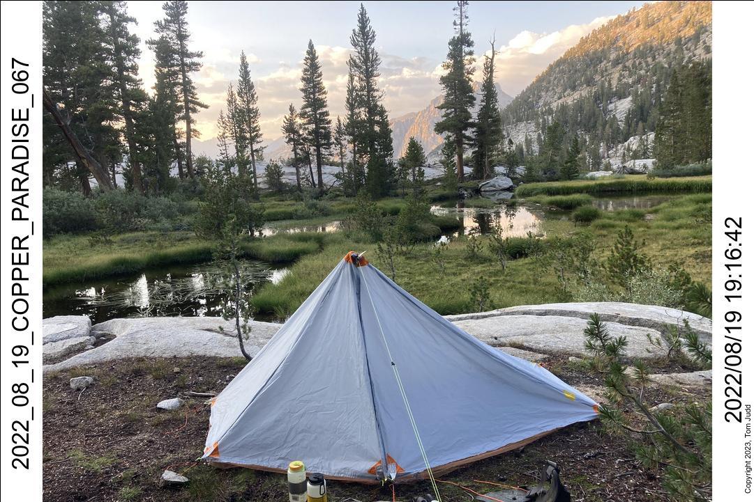
Nevertheless, this was the first time I put up my new homemade tent on the trail. It looked beautiful. AND it sprinkled lightly. So, I got to huddle for a few drops under my design and sewing project. Heh Heh.
18-Aug-2022
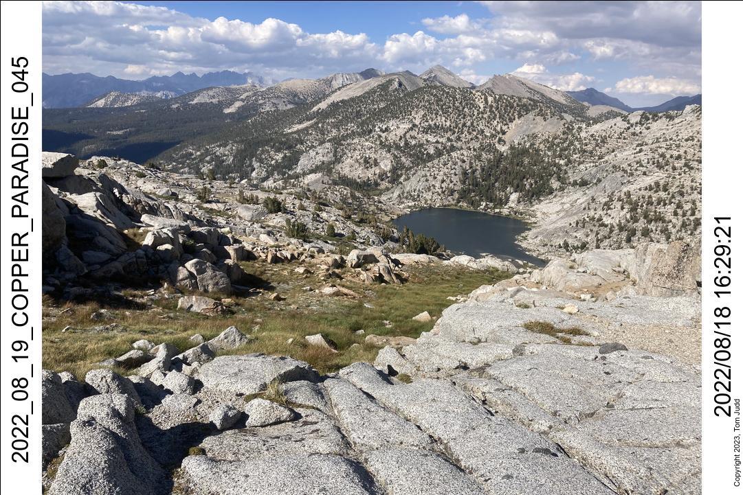
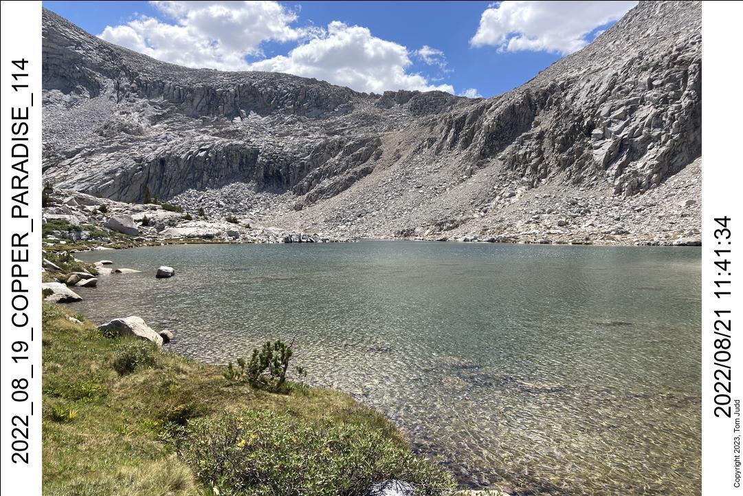
Started at about 7 AM to continue on up to Grouse Lake. The first time I came up here in 2002 was uneventful. But every time since, I had turned off the trail too soon. That always results in an uncomfortable climb over talus. I finally put a waypoint in my GPS at the spot I expected and headed for it. It worked. In case you are wondering, the turnoff from the trail is at 36.847503,-118.595971 (lat,lon). Got there at about 10 AM. I was up at the crest of the pass to the Granite Lake basin at about 1. I was very careful at this point, since I broke my ankle here in 2019.
I continued down into the valley then up to the pass to Glacier Lake. Got there at about 4:20 PM. After a snack and rest it took about an hour to get down to a campsite by the lake.
19 to 21 Aug, 2022
The morning sky was quite interesting. I was up in the dark before 5 AM. The bright half moon was next to the Pleiades, but you couldn't see them unless you blocked the moon with your thumb. You could see mars, looking like a bright red star just next to the moon. Orion's belt was standing straight up on the ridgeline pointing to the celestial bodies.
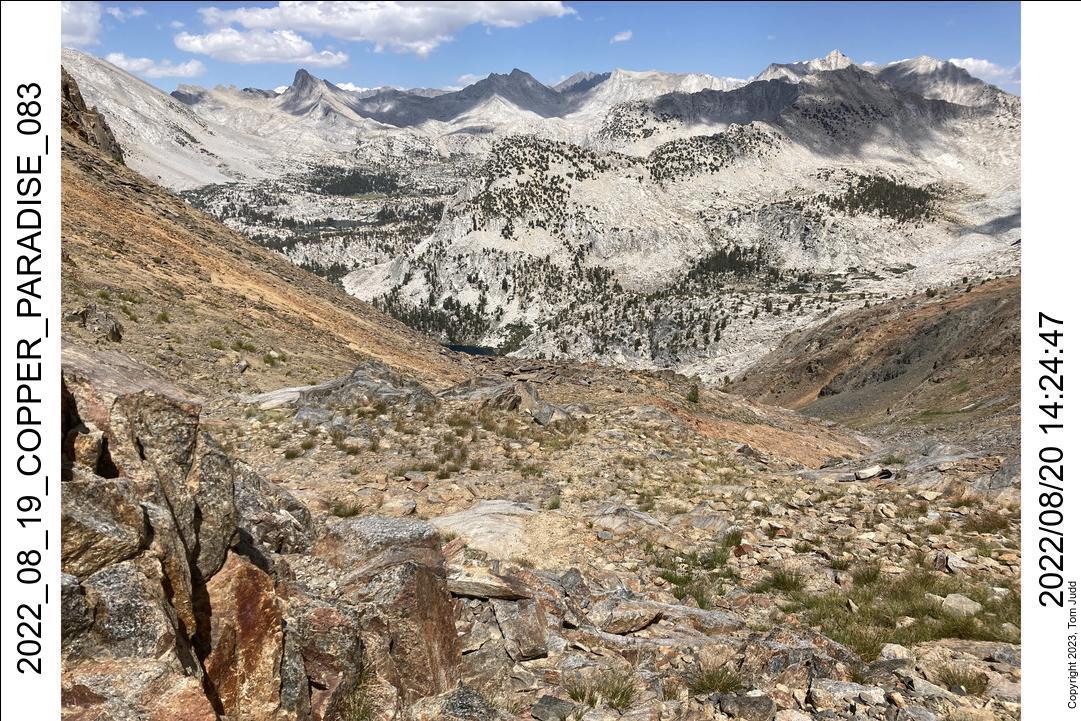
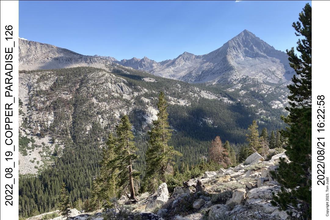
The next three days I traveled from Glacier Lake to my familiar campsite in Muro Blanco. In 2020 I got just as far in the same number of days. I was hoping to get a bit further. And, indeed, at first I did. But I had trouble finding a suitable campsite on the second day, and that slowed me down a bit.
I made it past Gray Pass this year and camped at a beautiful spot in the valley (South fork of Cartridge Creek) The trick is when going down Gray pass, hug the slope on the right so you don't go down all the way into the valley. The campsite is at 36.96258 ,-118.55292.
The next day I was up and over White Pass. It was a bit smoother than in 2020: I took my backpack off only once. It was then on over Red Pass. I lost a couple of hours here in 2020 trying for the wrong col. On the way down to Marion Lake I could travel on use trail for a surprising percentage of the way. It probably goes all the way down. Hiking with a buddy would certainly help here in finding the trail.
Past Marion lake I slowed down considerably. I was looking for both a trail and a campsite at the same time. Neither worked out. I ended up in a flat spot which I later saw was a very old trail. It was rock-lined, but had old fallen trees over it that had old trees fallen on them.
I had a lot of problems with Sierra ants around here. It was so bad that I tied paracord around my pants at the ankles to keep the ants from crawling up my legs.
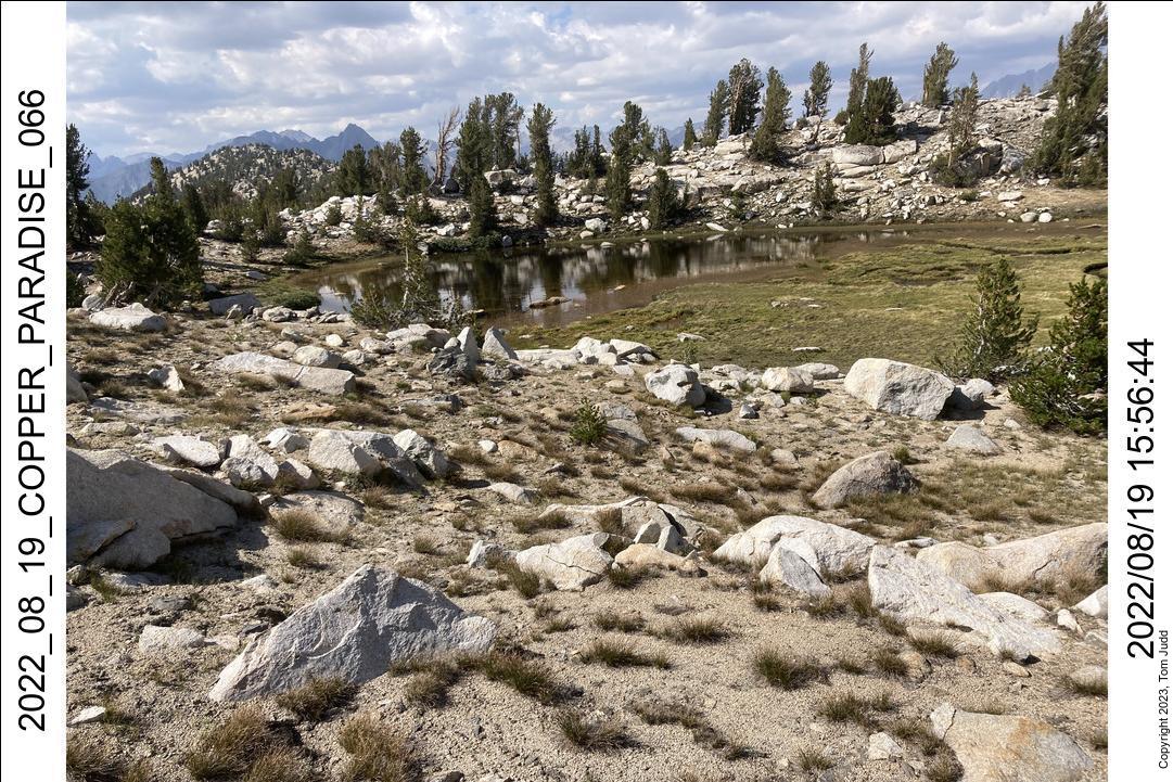
The next day I split the lakes to the north east of Marion lake, then took the chute to the left. Once above that I hiked leaning towards the thumb of 'L' lake. Once up on the level area you just pick your way around to the left of the lakes until you get to the base of Cartridge Pass. Over the pass you take a big loop counter clockwise, over the creek, then down to the lowest lake.
I always have trouble at this lake because I try for short-cuts. This time I remembered to stay high all the way. It was a lot easier.
From here, there is a trail all the way down to the bottom in Muro Blanco. The problem is trying to find the trail. You have to pay close attention because there are plenty of places to go off. Again, a hiking buddy would help here.
I got to my campsite in Muro Blanco a little after 5 PM and decided not to push on. My mother's birthday was the next day, turned 97. So I sent texts out to everyone with my InReach to call her and wish her a happy birthday. Marin mentioned at her funeral a few weeks later that she had called her. That was nice.
22 to 25 Aug, 2022
Happy Birthday, Mom.
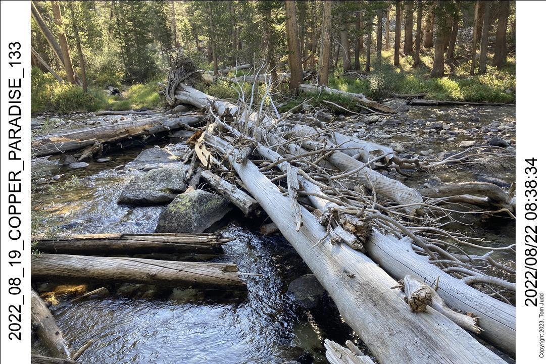
Started of at about 8 AM. I hugged the creek for awhile and came across several piles of human occupation and fire rings. I scooted across the creek on a small log jam; followed the creek a bit more; and then started up the valley I had come down last year.
It was much harder going up, mainly because of the talus field. Last year I barely broke stride hopping down through it. Going up I seemed to be running into all the hard parts. I was through the rockfield at about 10:30. Another two hours and I was up at the lake level. I was pooped.
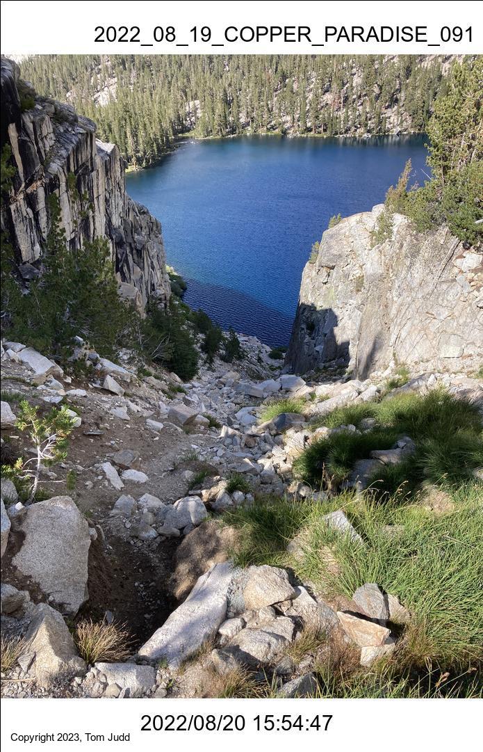
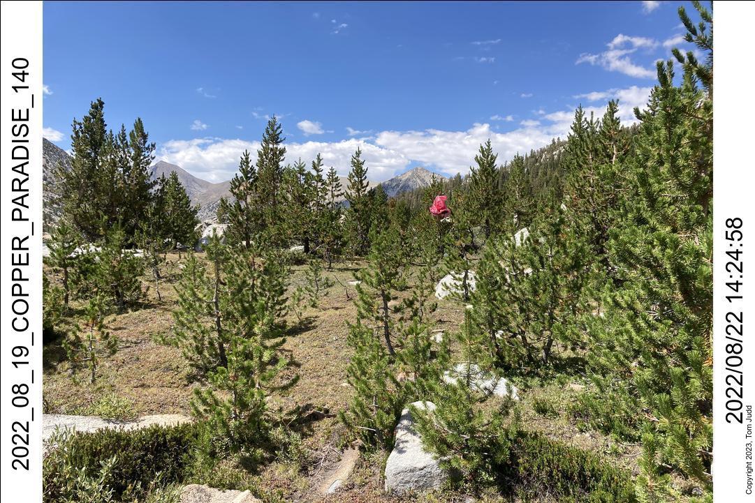
The lake is a pretty turquoise and rust red. Although pretty, I didn't want to drink it. Last year, coming down, I marveled at all the mineral deposits on the rocks. I thought it would be better to drink out of a clear creek. I walked clockwise around the lake until I found one. It was still quite early, but going over the Arrow pass might put me downhill in the dark. So, I found a flat spot amongst the short trees and scrub and stayed there for the night.
I had started tying a bright red plastic raincoat to a tree as a clear marker for my campsite. It worked splendidly here. It is very good for finding my way back to camp after getting water.
The next day, I started out at about 7, was up at the pass at about 10. I was down the other side near the outlet creek to the lake at 11:15. I hiked down Arrow creek to the campsite I had found last year with all the broken glass and old rusty cans.
It had been a dry year. Last year was dry too: there was no water in Window creek then. I was going over the hump from Arrow creek to Window creek so I sterilized a quart of water before leaving on the climb. I think it is only about a 300 foot (100m) climb, but I was quite tired by the time I got to the top at 4PM. Forty five minutes later I was down at Window creek. Water in the creek! I had actually expected it. All the creeks seem higher this year. But, you never know.
I both filter and treat my water with pills. I didn't want to wait for pills to sterilize, so I boiled a quick pint (500ml) and drank that.
The next day I started down the steep slope to Woods Creek and Paradise Valley. I again ran into some problems. Started down a big cliff but couldn't get down so I had to circle around. And I had to swap out the batteries in my GPS. I was down at the trail a little past noon.
Thoughts of home started dancing in my head, so I headed down the creek. Got to the Middle Paradise Campground. Spent the night at a nice large campsite shared with a number of other congenial hikers.
Next day I started hiking out at 6:20, got to Road's end , changed clothes, and left about 10. Lunch in Tulare, home at 6:50. Weight check a day later showed that I had lost 5 pounds over ten days of hiking.
High Sierra Trail to Chagoopa Plateau
A trip with Wally and Dave up to the Chagoopa Plateau and back.
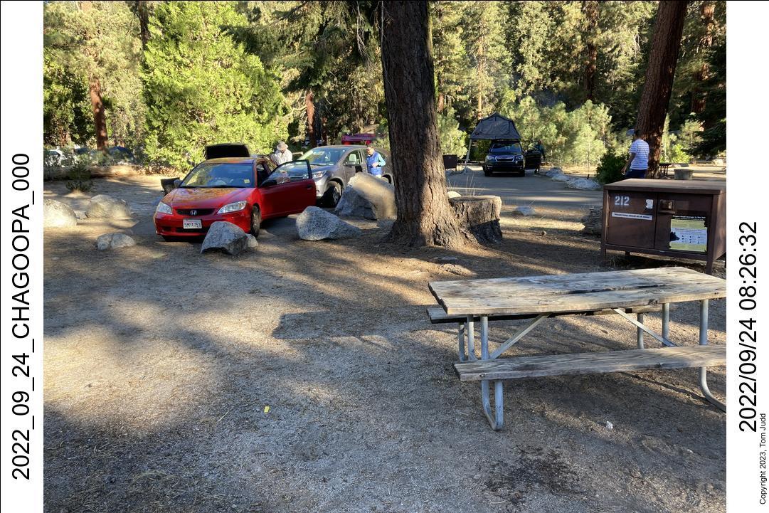
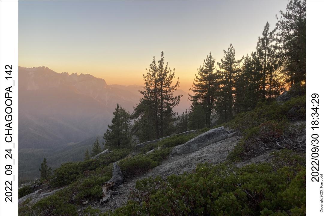
23-25 Sept, 2022
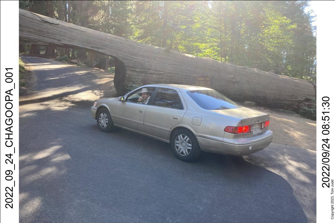
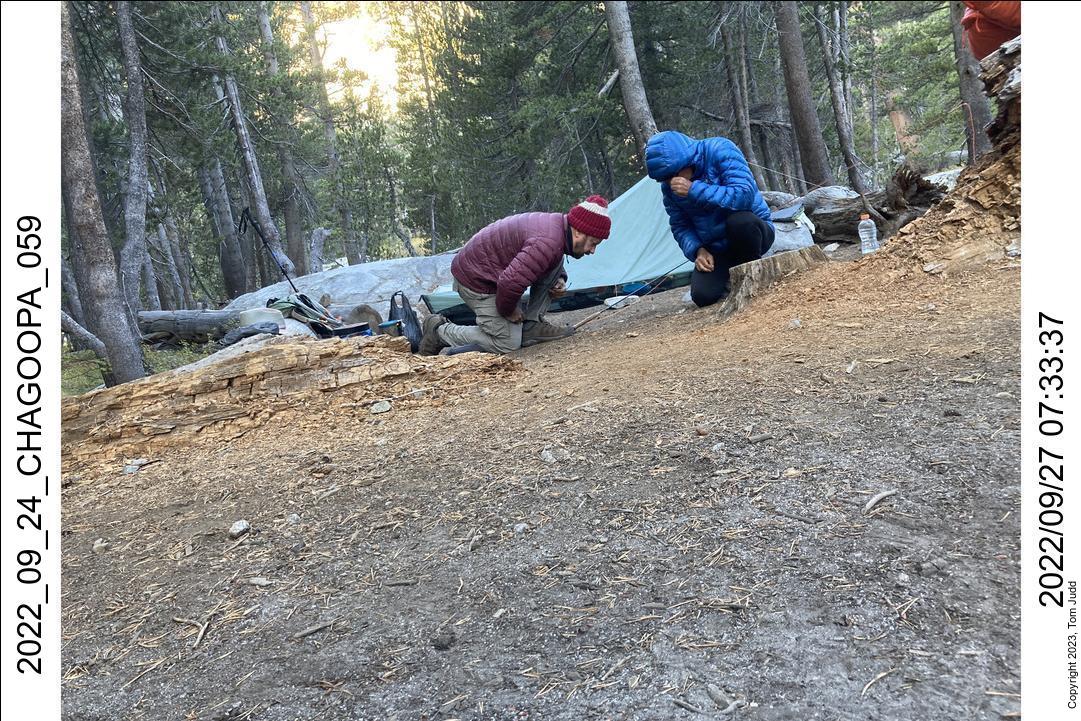
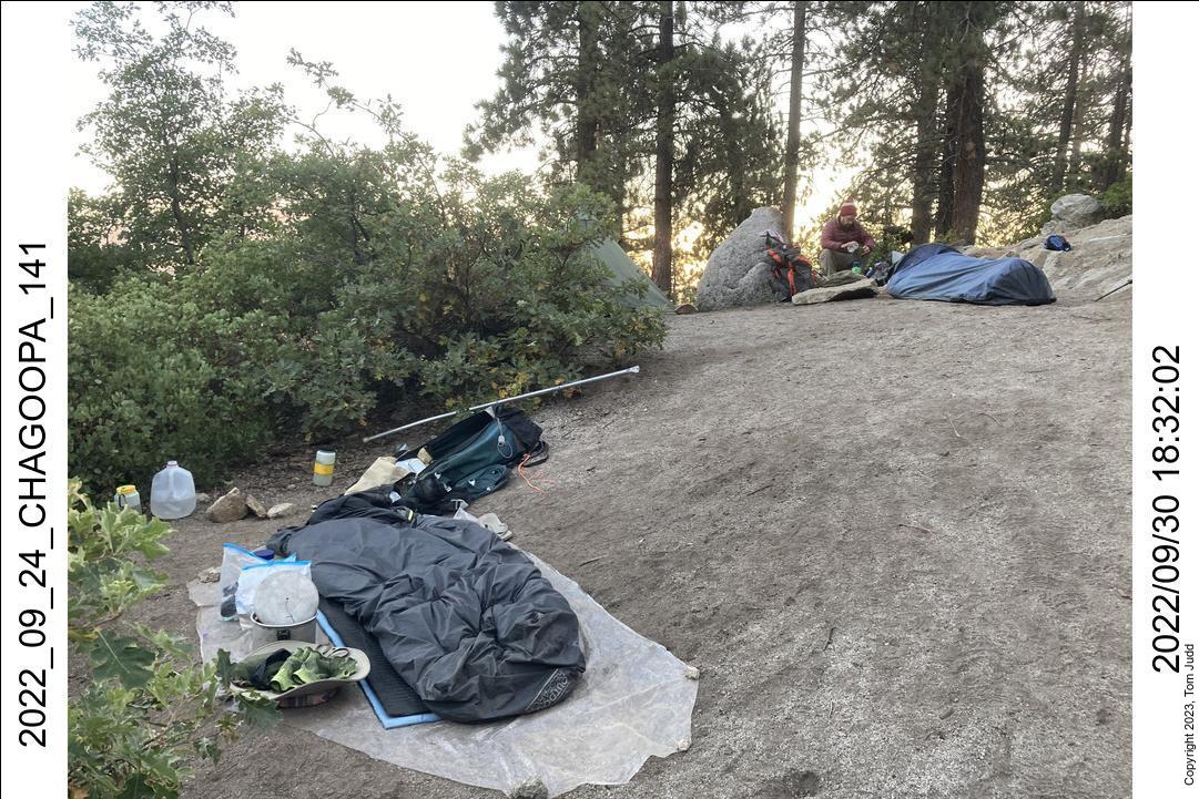
I use my larger sleeping bag in late September, so need my old frame pack to carry it. Nevertheless, total weight including 2.5 liters of water was 43 pounds (20kg). I drove up to the registration station at visitor center to fill out and deposit my wilderness permit. Drove over to the campsite in Lodgepole and waited for Dave and Wally. There was enough room for all our cars.
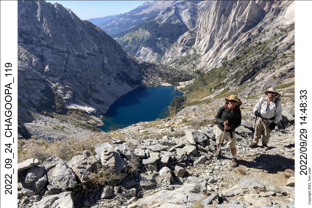
There was no hurry the next morning, so I did pancakes on my 40-year-old white-gas Coleman. We started hiking at the High Sierra Trailhead in Crescent Meadow at about 9:15. We got to Buck Creek at 5 PM. We heard that the water had been turned off for the winter at Bearpaw, so we decided not to press on. Camped at Buck Creek for the night.
We were up at 6 the next day, and on the trail by 8:15. This second day of hiking was a bit more difficut: a lot of uphill. Neither Dave nor Wally had been over this trail before, so I told them what to expect. One goal marker along the way up to Hamilton Falls is a squat pine tree at the corner of the trail. It is visible from many points. It marks the point at which the trail gets a lot easier (a downhill stretch before the falls).
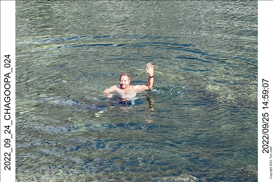
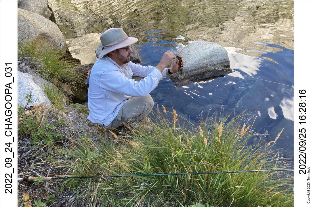
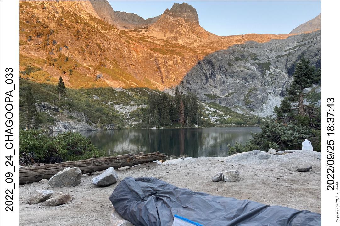
After a rest at the falls, we made it up to Hamilton lake quite early at 3PM. The next stretch is quite steep with no campsites until lower Precipice Lake. So we stayed at the lake for the night. Dave took the opportunity to take a swim in the cold water. Brave fellow. He also caught a fish on his first cast. Wally and I had found spots for our bivies up a bit from the lake. Dave got stuck in a crowd of noisy tents. He was a bit grumpy the next morning.
26 Sept, 2022
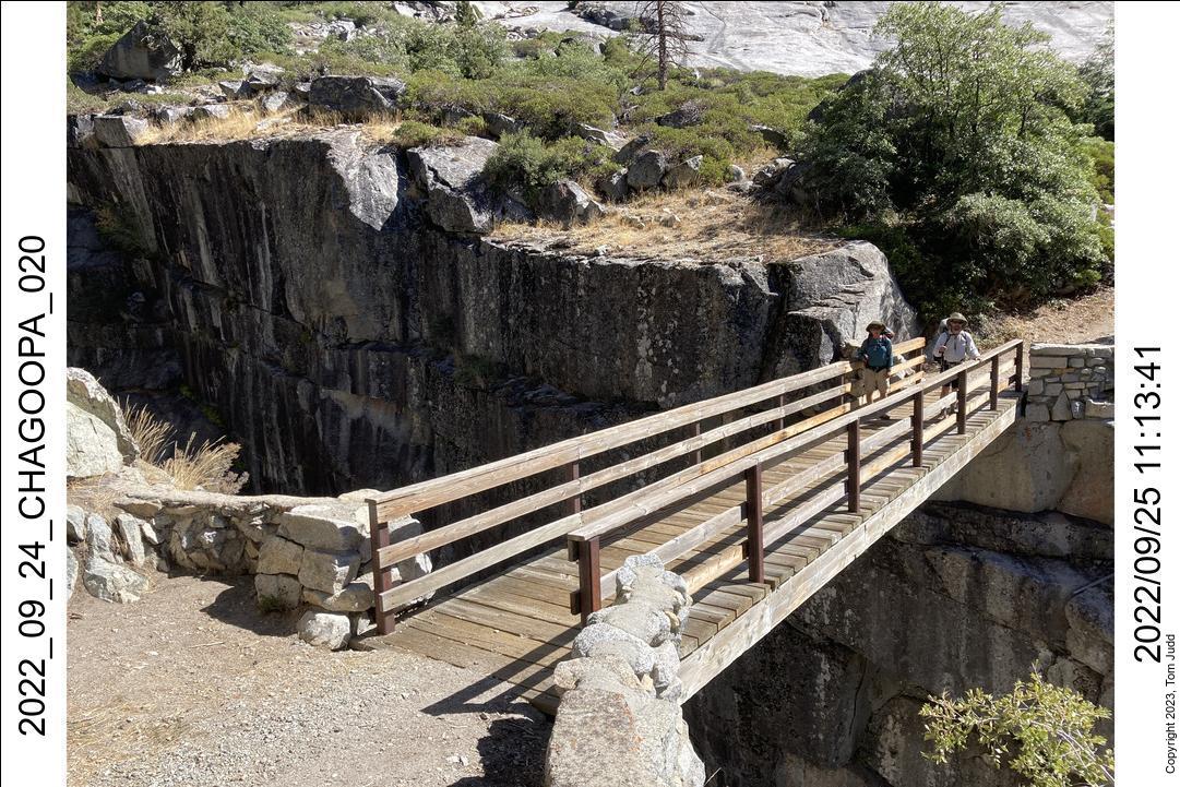
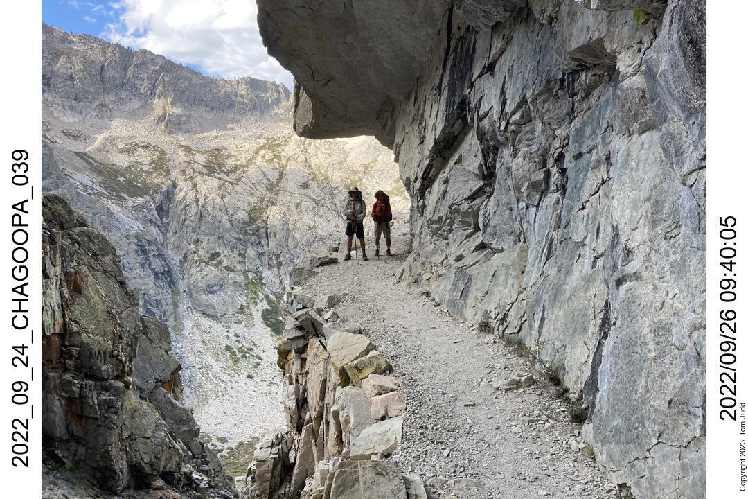
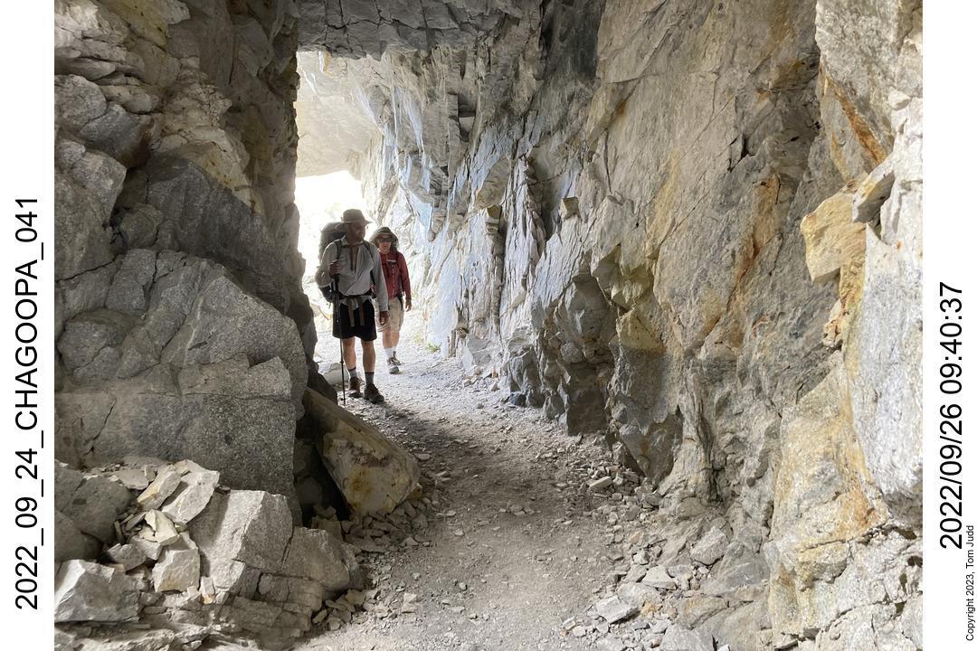
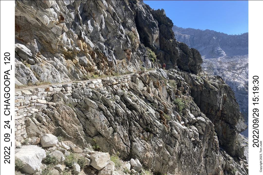
The hike up from Hamilton Lake over Kaweah Gap is quite steep. I allow about 5 hours to climb the 2500 feet (750m) from the lake to the pass.
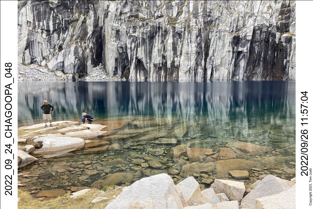
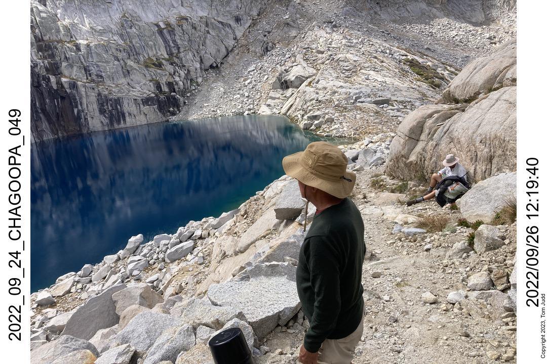
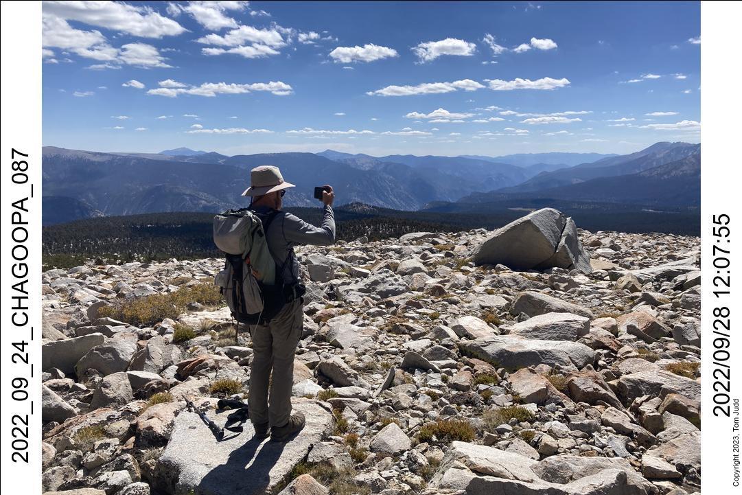
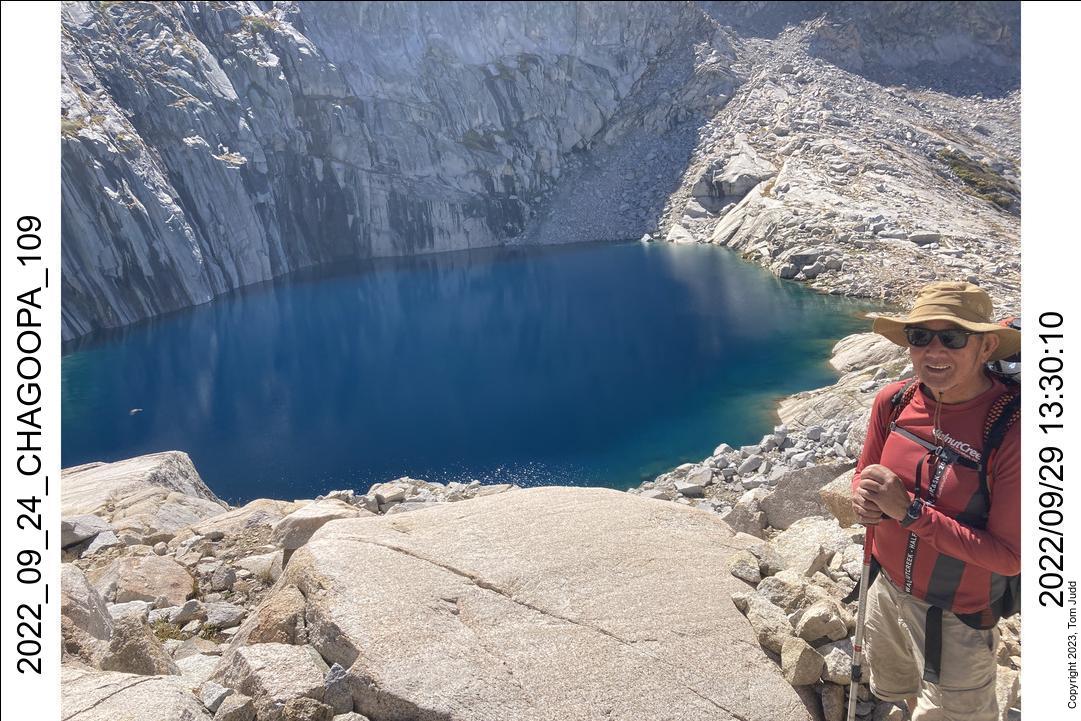
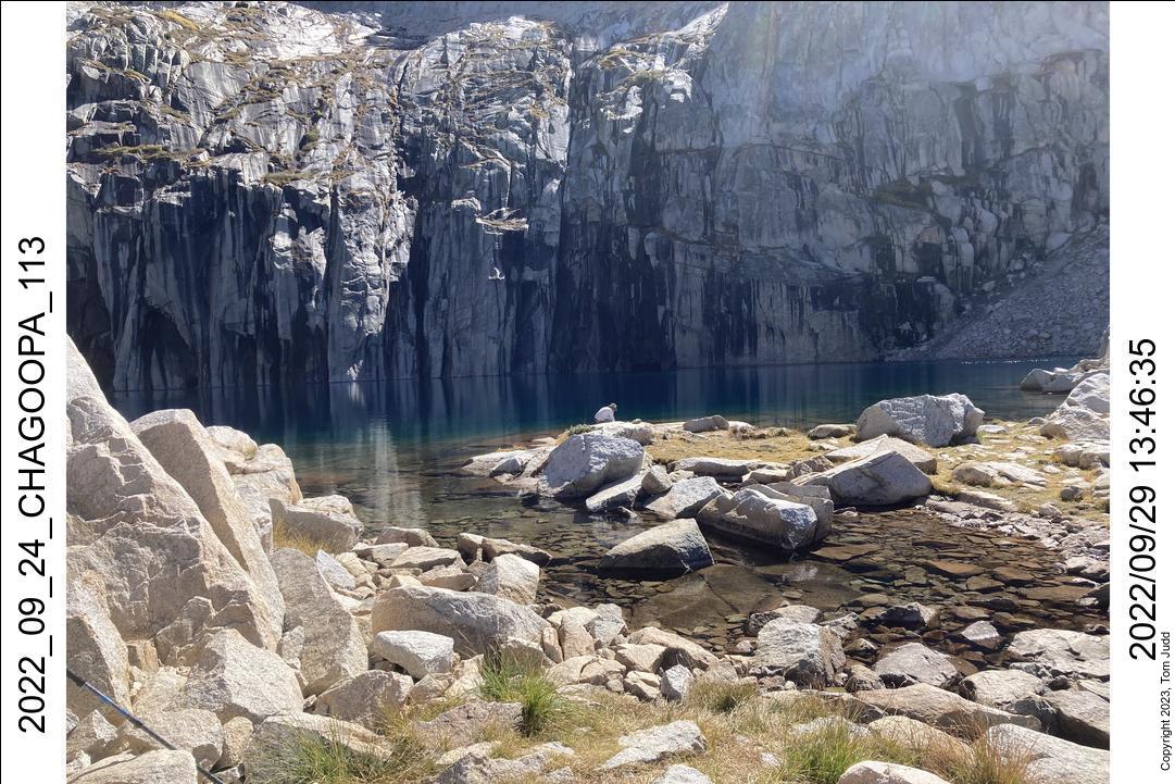
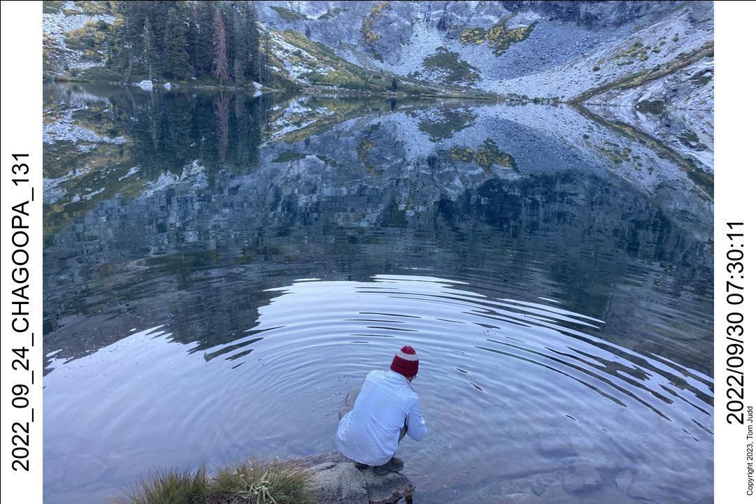
It is also one of the more spectacular sections of the High Sierra Trail. First there are the long switchbacks that take you higher and higher along the side of the lake. Then the trail gets to a steep gully where it goes through rocky overhangs, a tunnel, and a stretch blasted out of the side of a sheer rock face. Then on up to lower precipice lake with stunning views back down to Hamilton lake, and finally the crowning jewel: Precipice lake. My favourite time to see it is on a sunny day in late summer. The winter ice is gone and the sunlight enhances the brown to turquoise to blue progression of water color from shore to deep. But the vertically streaked walls surrounding the lake are its most unusual and curious feature. On a calm day, their uninterrupted reflection doubles the already precipitous apperance of the rock wall around the lake.
Dave and Wally were amazed. Yes, the hike was worth it!
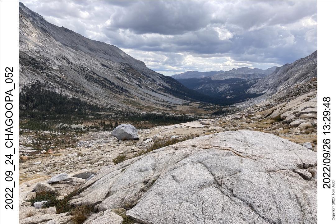
After a rest we continued on over the pass and all the way down to the cabin campsite in Big Arroyo by 4PM. Dave was consulting the Gaia map on his cell phone on the way. It showed some camping spots. But we were so close to the cabin there was no point in stopping.
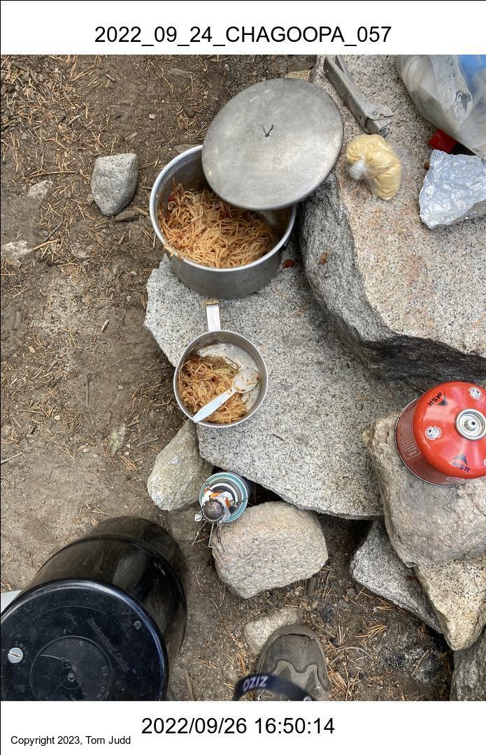
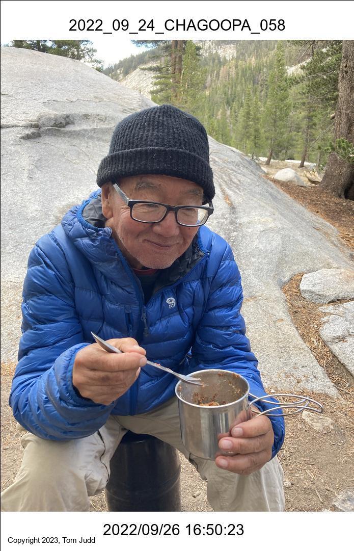
Dave and Wally took the spare time to do some fishing. Afterwared, it was my turn to provide a meal. I did spagetti. Everyone loved it.
27-28 Sept, 2022
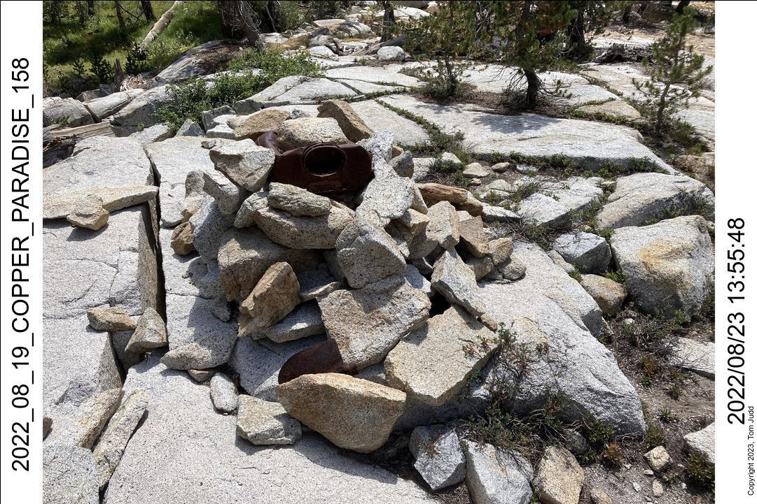
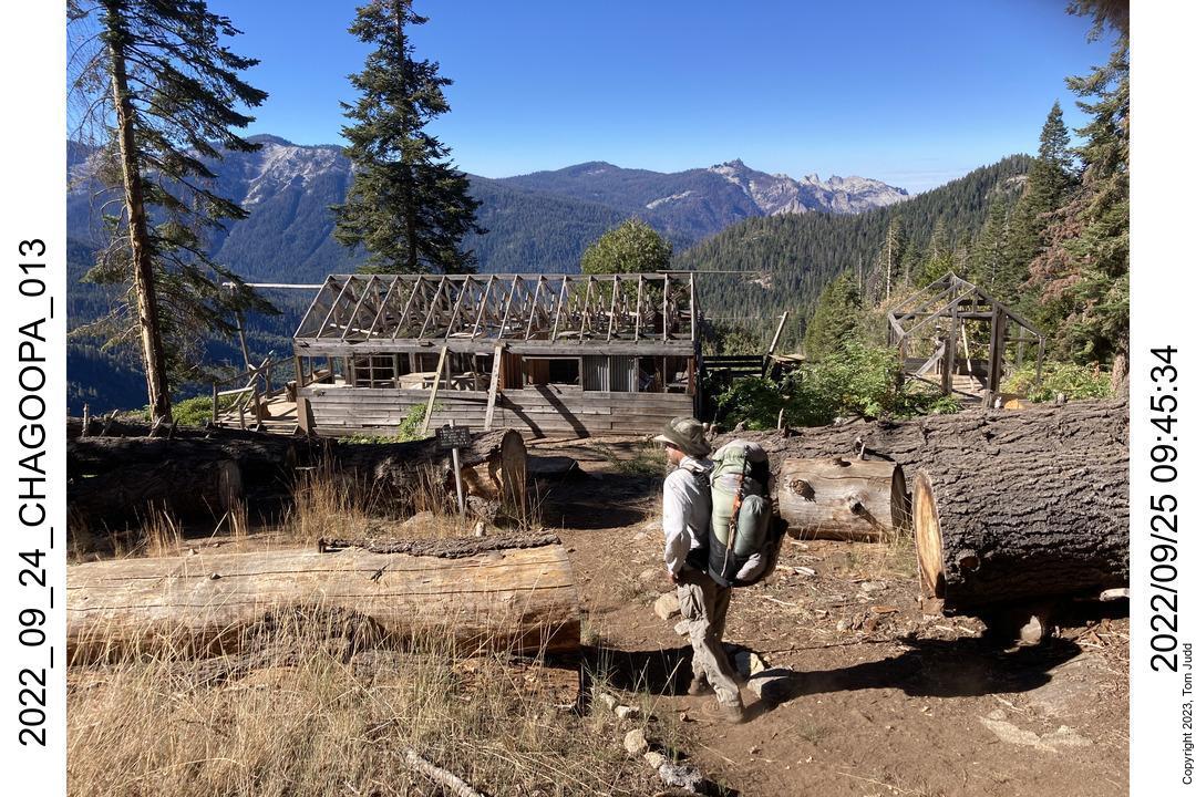
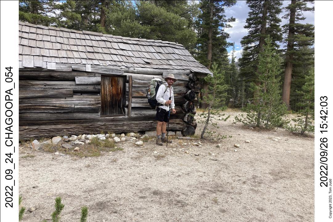
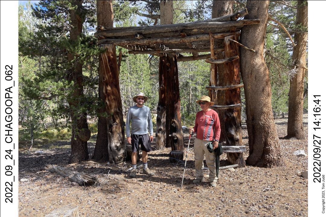
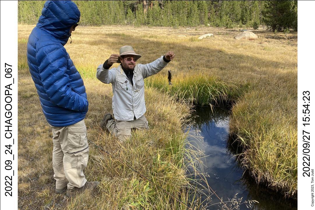
After a short period of fishing in the morning, we were off at about a quarter to 10AM. We went off-trail at the usual place in the meadow just after the High Sierra Trail splits. We went northeast through the rocks and trees until we came to the Lookout tower along 'Lookout' creek. We set up camp here. Dave and Wally were duly intrigued by the site and its mysterious history.
I had fished in the creek before (2011). Then, my fly had just touched the water surface when like and arrow a fish darted and struck it. After pulling it in and releasing it, I tried a second time in a different spot. The same results. That was two fish in a total fishing time of two seconds. I quit.
Dave and Wally got excited at the story and spent the rest of the afternoon fishing. They both are skilled fly fishermen. It was educational for me to see how easily they could place the fly in the narrow creek.
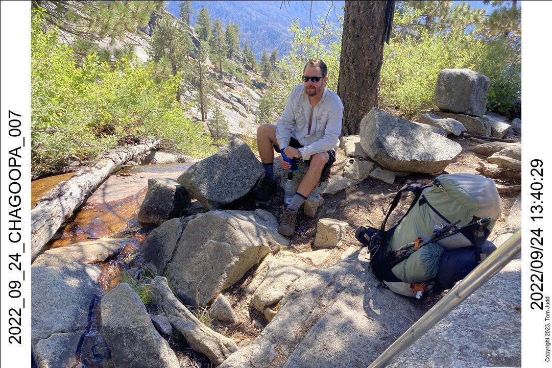
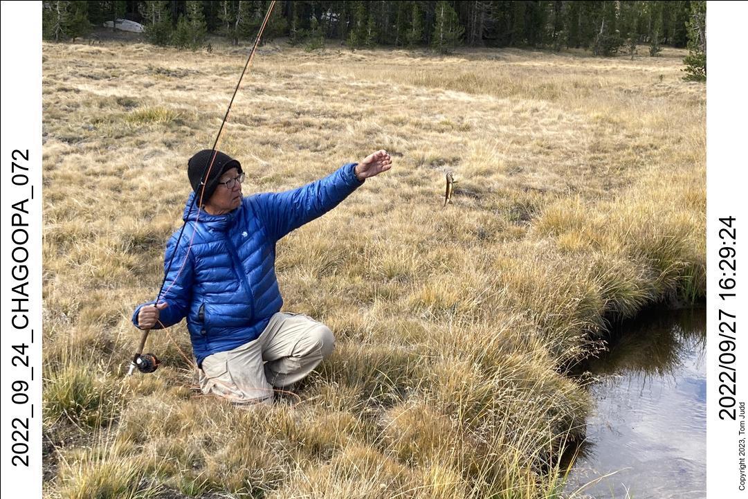
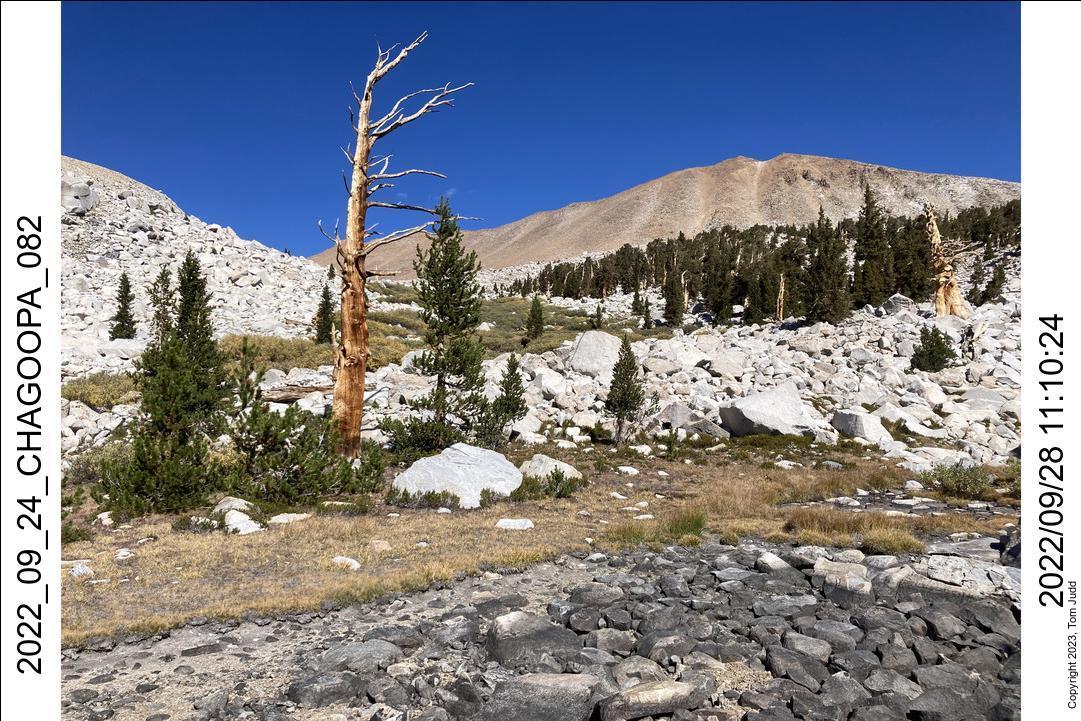
The next day Dave and I took a hike up the creek, while Wally stayed at camp and fished. I had come down the creek a couple of times from the Kaweah basin, but had never gone up. We hiked up 'Lookout' creek for awhile, then went over to Chagoopa creek. We went as far as the small lake in the talus about a mile down from the pass. Good views of the Kern river canyon.
When we returned from our hike we met a smiling Wally who claimed to have caught 30 fish while we were gone. We asked him if they were all different or the same one caught 30 times.
29 Sept - 1 Oct, 2022
Overnight low was 28.1 degrees F, lowest of the trip. I had kept my water filter in my sleeping bag, anticipating some cold temperatures.
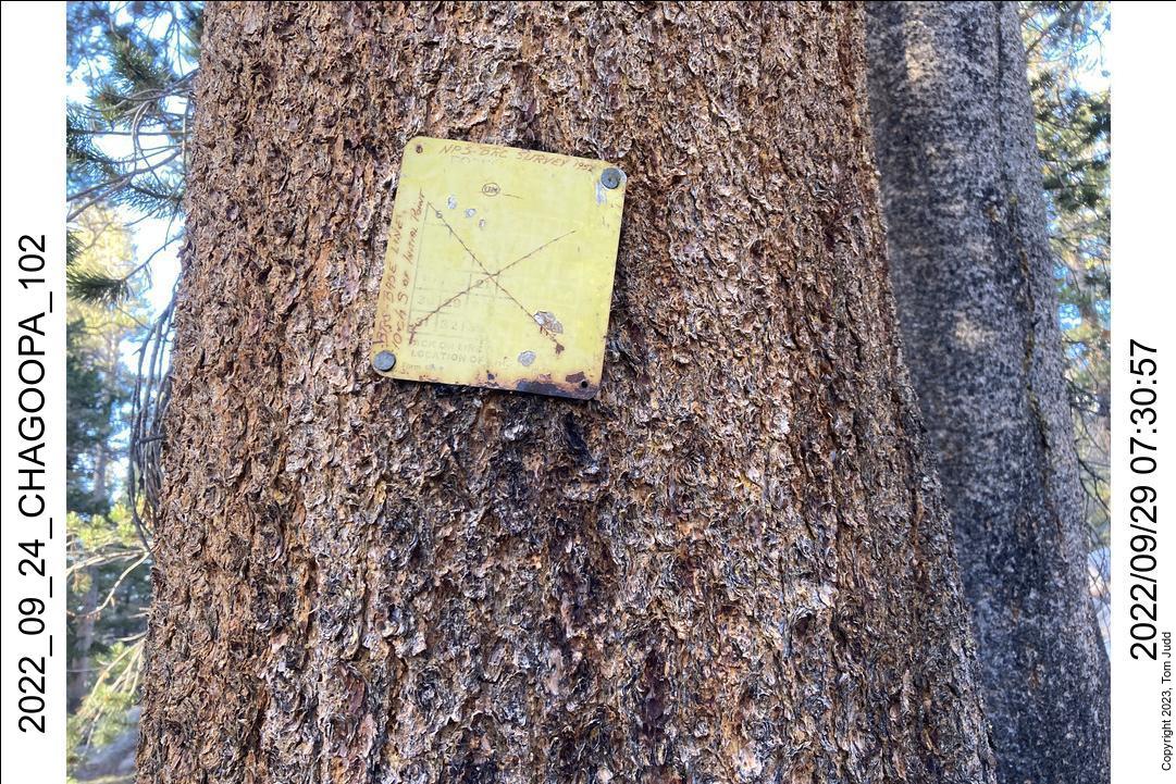
We hiked all the way back to Hamilton Lake for our next campsite. Just after we started, about half way to the trail, Dave spotted a yellow square sign nailed to a tree. 'NPS BRC Survey 1952' and 'BRC Base Line 10 ch south of initial point'. Wow! 1952! The sign has been on the tree for 70 years!
The 'BRC' stands for Blister Rust Control, an infestation that was killing pine trees. 'NPS' is national park service.
The 'ch' stands for chain. A chain is a unit of length equal to 22 yards. It is not a common household unit nowdays. But back when people were partitioning a new country into acres it was very important. And convenient. There are 80 chains per mile. An an acre is one chain by 10 chains.
I had recently looked up the history of the chain, furlong, rod, foot, and mile. I was motivated by the observation that 11 is one of the prime factors of 5280, the number of feet in a mile: 11*480 = 5280. Why eleven!?
Most English units have convenient factors of 2 or 3 in when stepping up or down to the next unit of measurment. A third of a foot is a convenient four inches. A third of a meter is something that ends in ...33333... Not very convenient.
A tablespoon, cup, gill, pint, quart, and gallon are related by powers of 2. Throw in a teaspoon to get a factor of three. So, why eleven? In 1593 England passed a law that shrunk the foot by an eleventh. To keep area measurements the same the number of feet in a chain (and hence, feet in a mile ) had to be increased by a factor of 11/10.
So there you go. But I digress.
It was sunnier than when we had hiked up, so Precipice Lake was a bit more colorful.
The next day we hiked from Hamilton Lake on down past Bearpaw and to the Mehrten Creek campsite. It is a miserable, steep campsite. But we wanted to be close to the car so we could get home at a reasonable hour the next day. The sunset was pretty.
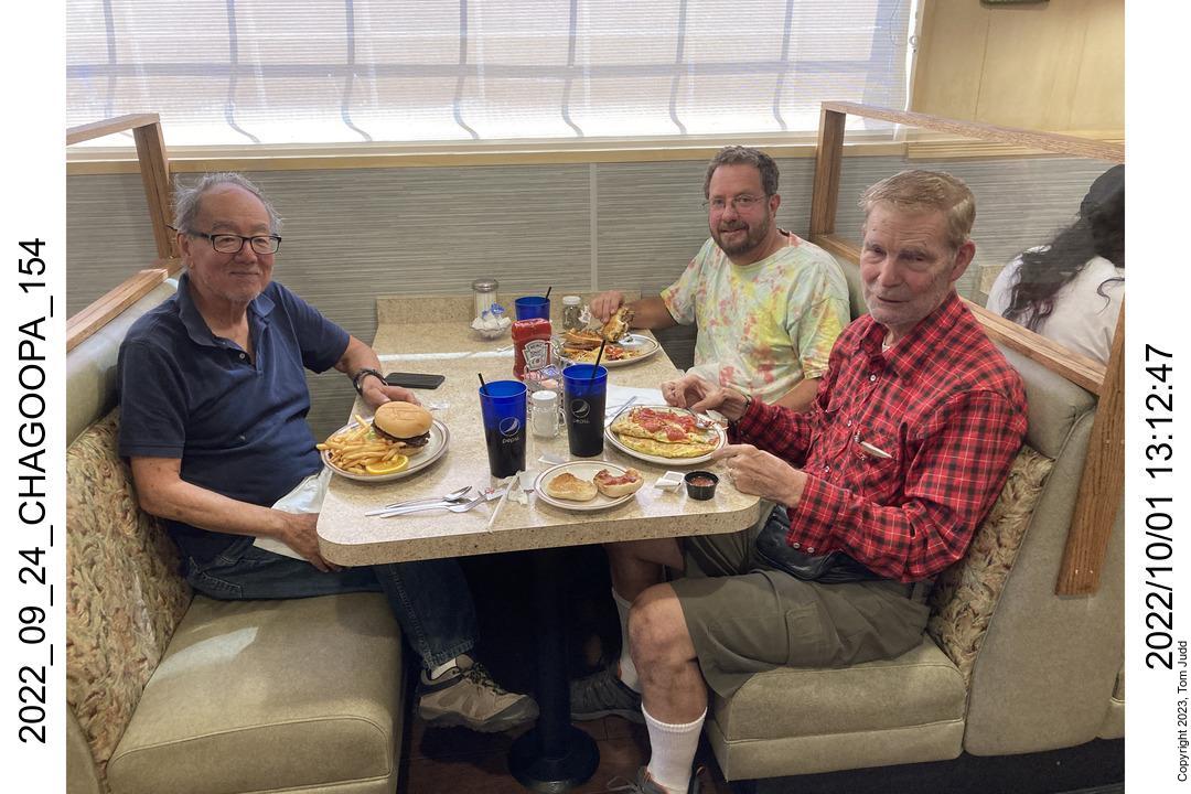
The last day, Oct 1, we made it from Mehrten to the car in Crescent Meadow in about three hours. We were at Apple Annies in Tulare for omelettes at 12:40. Home at 7:30.
©2023 Tom Judd
www.juddzone.com
Carlsbad, CA
USA